
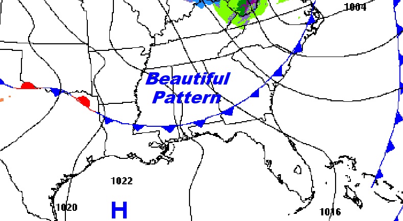
Good Morning! We have great weekend of weather ahead of us. Another fresh batch of cooler air is overspreading Alabama this morning. Your biggest complaint today could be the stiff wind later today, and the very chilly jacket weather nights. Other than that, the news is very good. Sunshine will be abundant.
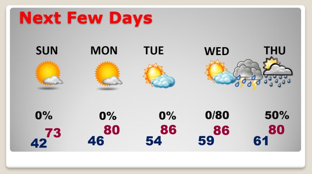
Our storm-free pattern continues beyond the weekend. In fact, we have a major warming trend ahead of us. By Monday we’ll be near 80. And, we’ll be well into the 80’s Tuesday & Wednesday.
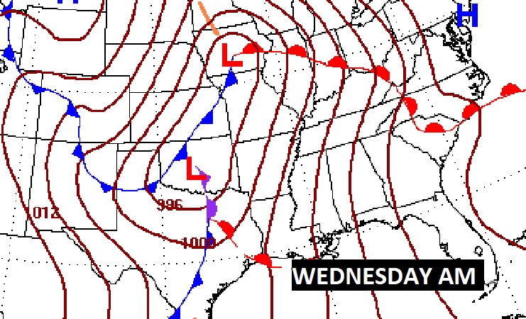
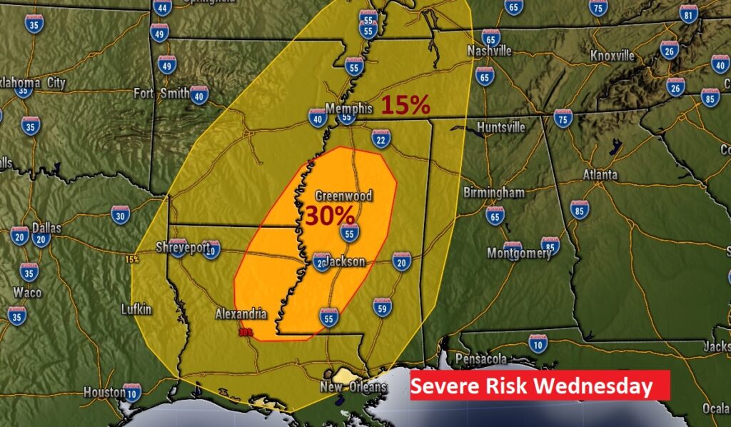
We’re keeping tabs on yet another concerning storm system, which will bring another severe weather threat to the state by Wednesday evening and through the overnight hours.
TODAY: Sunshine. High near 70. BREEZY. Northwest wind 10 to 15 gusting as high as 30 mph. Clear and chilly tonight. Low 42. (Normal high 76, low 47)
SUNDAY: More sunshine. Nice day. Chilly start. High 71. Northwest wind 6 to 12 mph. Mostly clear and chilly Sunday night. Low 46.
NEXT FEW DAYS: Much warmer Monday and Tuesday. Lots of sun. Near 80 Monday. Mid 80’s Tuesday & Wednesday. Showers and locally severe storms Wednesday night and into Thursday.
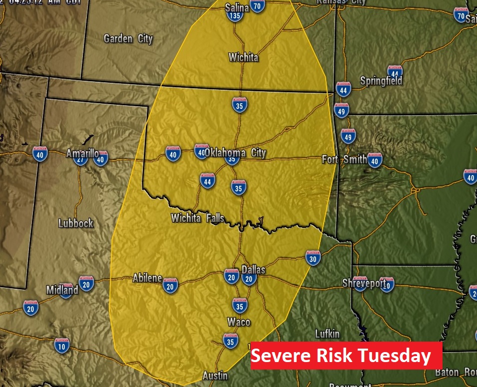
WEDNESDAY NIGHT SEVERE THREAT: Here we go again. Another potent, robust Spring Storm system will bring severe weather threat to the plains on Tuesday and spreading across the lower Mississippi valley Wednesday and into Alabama Wednesday night/Thursday morning.
SPC has outlooked much of the Plains states Tuesday, with an increasing threat eastward across the Gulf states on Wednesday. The greatest threat of severe weather in Alabama will be Wednesday night. All modes of severe weather are on the table, including tornadoes.
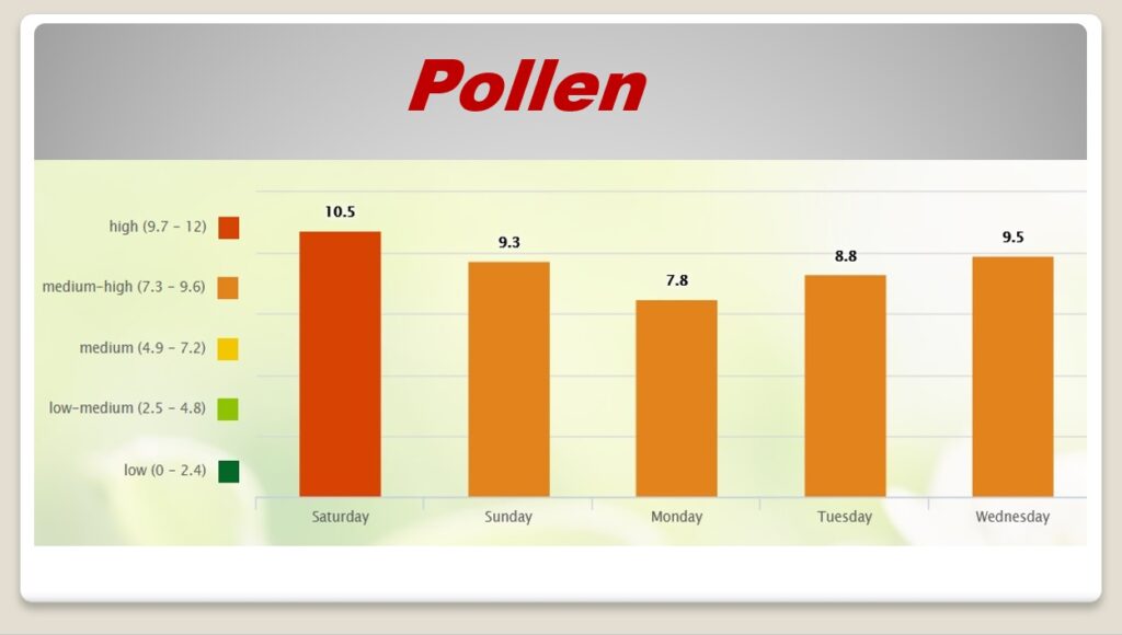
POLLEN: The pollen count continues in the high range today, and medium high through Wednesday.
.
I’ll have another Blog update in the morning. Enjoy this beautiful weekend weather.
–Rich