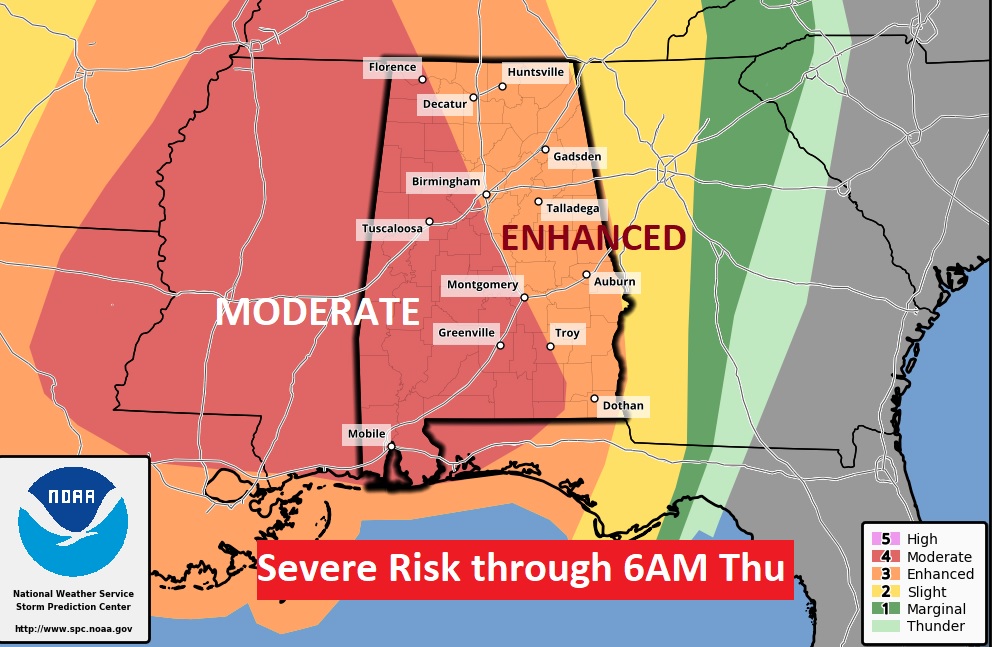
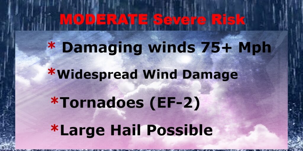
…Severe Weather Likely tonight, through the overnight hours… The Storm Prediction Center has expended the very concerning Level 4 Moderate Risk area. Now, all of the state west of Birmingham, Montgomery, Troy line is included. The rest of the state is in an Enhanced Level 3 Risk. Widespread Damaging wind gusts to over 75 mph, and SPC says, “Several Strong Tornadoes (EF-2+) are likely”. Not good. It’s a night for all of us to pay close attention to developments. On this video, I’ll bring you up to date on how with timeline will unfold. We’ll also look ahead to some nice late week weather.
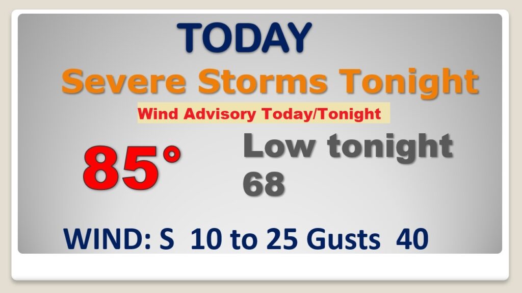
Wind Advisory. Ahead of the the significant storm system, wind gusts could easily reach 40 mph in some cases today and tonight. Secure objects outside the home. Some small trees could come down. Windy and warm today. Severe Storms and a tornado threat overnight tonight.
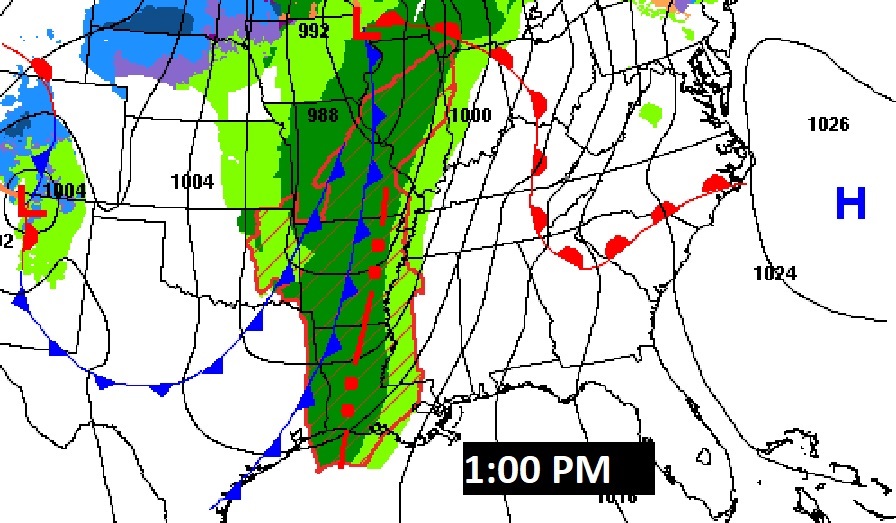
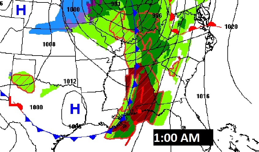
…Severe Weather Likely tonight, through the overnight hours… The Storm Prediction Center has expended the very concerning Level 4 Moderate Risk area. Now, all of the state west of Birmingham, Montgomery, Troy line is included. The rest of the state is in an Enhanced Level 3 Risk. Widespread Damaging wind gusts to over 75 mph, and SPC says, “Several Strong Tornadoes (EF-2+) are likely”. Not good. It’s a night for all of us to pay close attention to developments. On this video, I’ll bring you up to date on how with timeline will unfold. We’ll also look ahead to some nice late week weather.
Unfortunately, some of the most dangerous hours will happen in the overnight hours. Some models are faster than others on the time time line. Here’s a sample of a few models ideas.
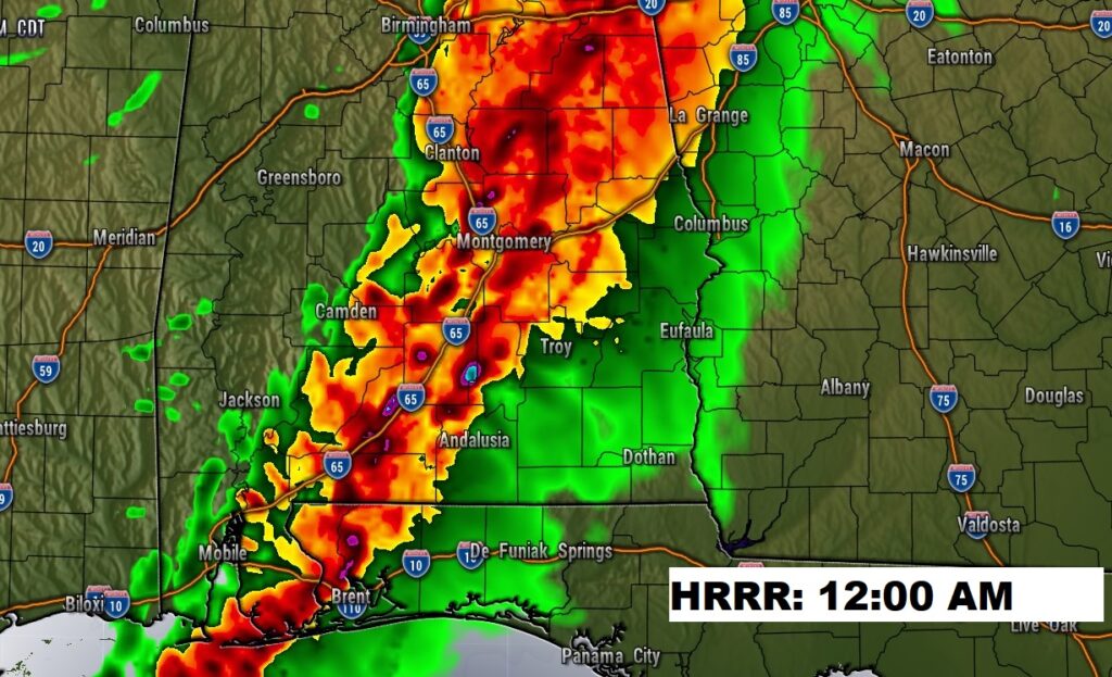
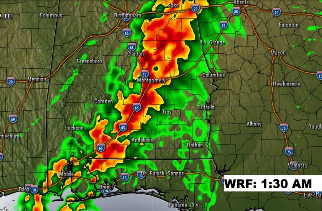
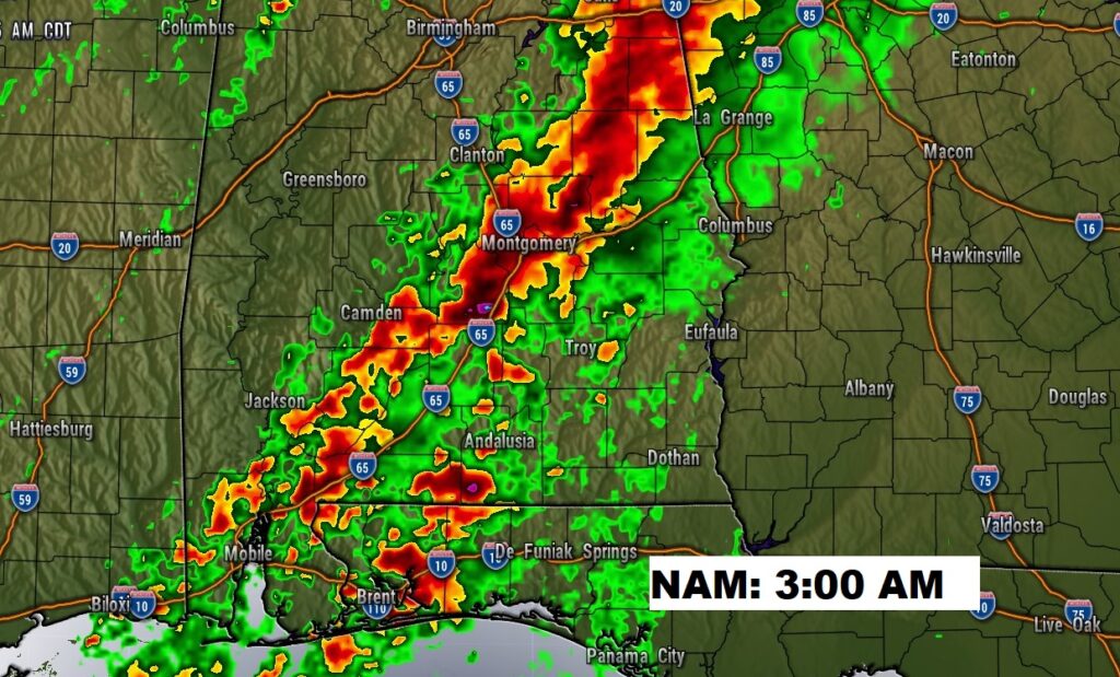
Here’s a summary of some of the main significant risks tonight.
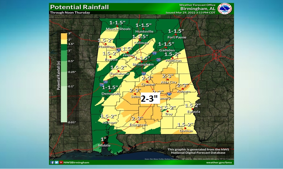
Rainfall amounts will be locally heavy across central Alabama.
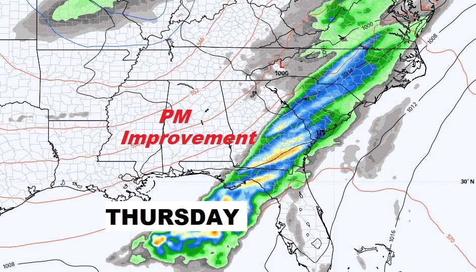
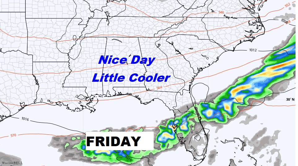
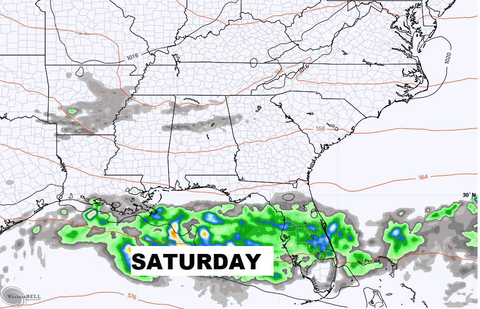
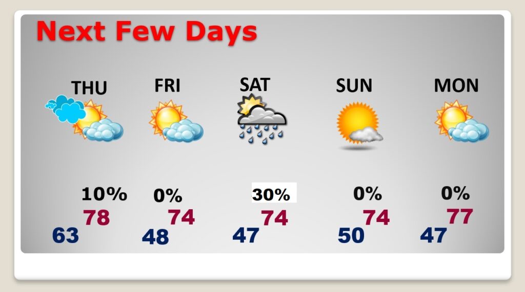
Nice weather follows the storm from Thursday afternoon through the weekend.
