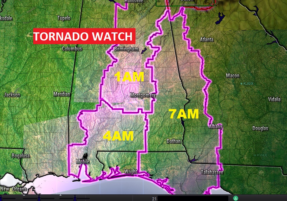
Tornado Watch has been issued for a large part of north & central Alabama until 1AM. The watch area extends as far southeast at Elmore, Montgomery and Lowndes counties. Another tornado watch covers much of south Alabama until 4AM. Damaging wind gusts to 80+ mph possible. A couple of strong tornadoes are possible. The watch extends as far northward as the Pike county line. The possibility of a widespread damaging wind gust event continues to unfold. Tornadoes will be embedded in the line of intense storms as it crosses the state in the overnight hours. Damaging wind gust in the 70 to 80 mph range is not out of the question. Power failures could be widespread. Outside of thunderstorm areas, as Wind Advisory continues in effect. Our Weather App will keep you on top of the action tonight. Also, make sure your Weather Radio is plugged up and in the Alert mode tonight. DO NOT depend on Weather Sirens! We will be with you through the night on social media, on your weather app, on the Radio on the eight station Bluewater radio group, and on TV on CBS 8 and ABC 32. Stay weather aware. Additional Watches are likely later.