
Good Morning! I hope you have been enjoying our nice weekend weather. This tranquil pattern continues today and tomorrow. Today will be absolutely beautiful. Monday will be even warmer. A great start to the new week. But, hang on….
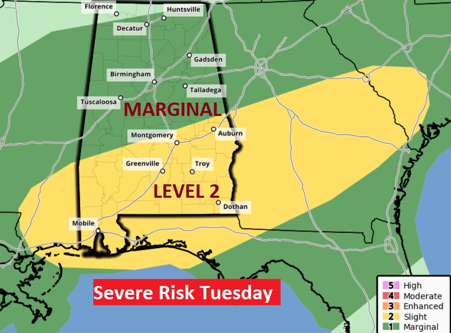
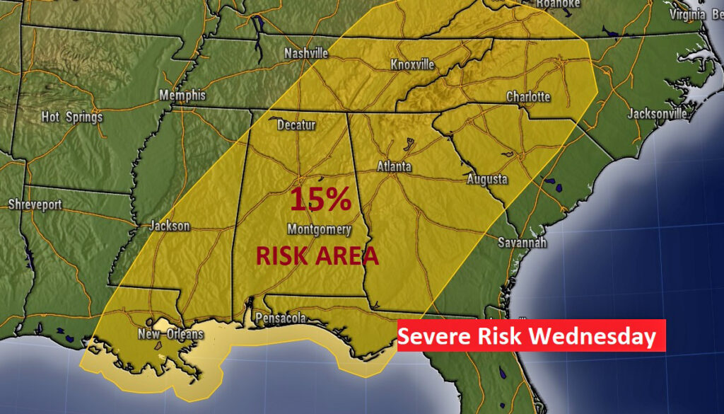
We’re still keeping close tabs on yet another concerning storm system, which will bring another severe weather threat to the state. In fact, it looks like the Threat will come in two parts. Part 1 Tuesday. And, part 2 on Wednesday afternoon & Wednesday night ahead of a strong cold front. Both days will include all modes of severe weather, including the risk for tornadoes. More on that below.
TODAY: Sunshine and warmer. Comfortable. High 77. North wind 5 to 10 mph. Mainly clear. Chilly tonight. Low 48. (Yesterday’s high was 72)
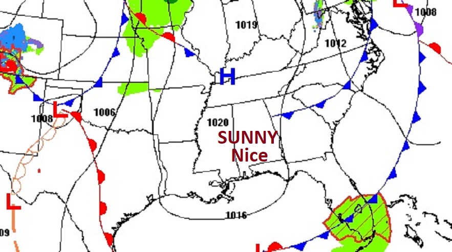
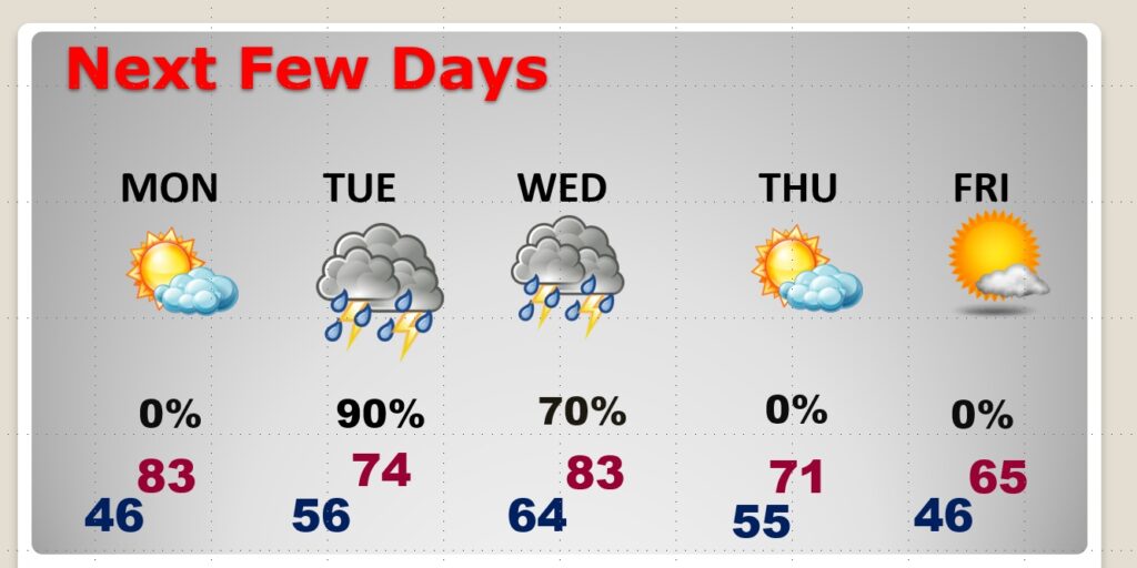
MONDAY: Mostly sunny & warmer. A great start to the new week. High 83. The last nice day before another severe weather threat.
THIS WEEK’S TWO PART SEVERE WEATHER THREAT: Expect a severe weather threat with a trough of low pressure Tuesday. (Just about anytime Tuesday into Tuesday evening) And, then a separate round of severe weather Wednesday afternoon into Wednesday night, ahead of a strong Cold Front sweeping through the state. Damaging wind gusts to 60+ mph are possible and at least a few tornadoes both days. More details, and a focused timeline will be known tomorrow.
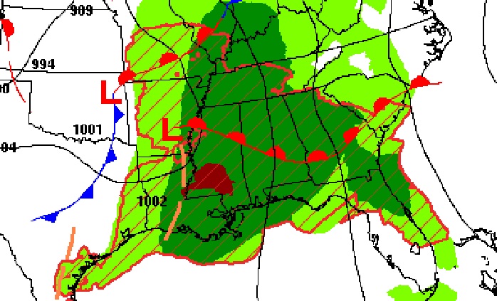
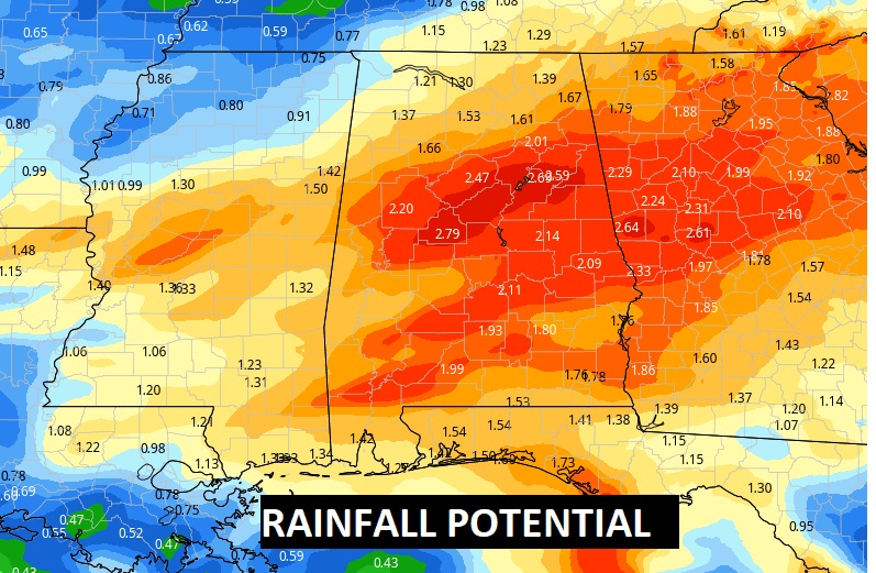
Like the last storm system, rainfall could be locally heavy in spots across central Alabama especially.
.
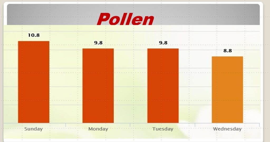
POLEN COUNT: The pollen count continues in the high range today, and medium high through Wednesday.
NEXT FEW DAYS: Sunny & Nice Monday. Lower 80’s Monday. Showers and locally severe storms Tuesday & Wednesday. Back to nice weather on Thursday. MUCH cooler late week.
.
Have a nice Sunday! I’ll have a complete video in the morning, online by 4:45 AM.
–Rich