
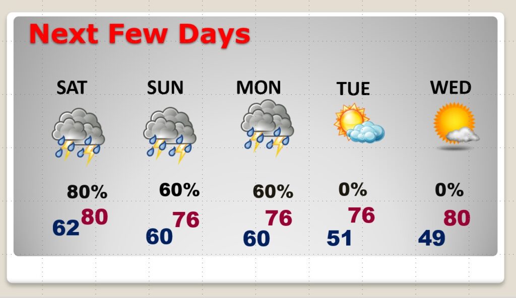
Good Morning! Unfortunately, Easter weekend will be wet & stormy at times. Be flexible. Have a Plan B for outdoor activities. Unfortunately, some storms will be strong to severe. Damaging wind gusts are the main threat, both today and again by Sunday afternoon & Sunday night. Some storms will have large hail. The storms will clear the state Monday morning. After that, get ready for and extended storm-free pattern.
So, stay weather aware throughout the weekend. Our weather app will certainly keep you up to date with instant push notifications for Severe Weather watches and warnings.
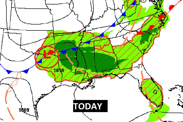
TODAY: Scattered to numerous showers & thunderstorms, from time to time. Some storms will be strong to severe. Damaging wind gusts will be the main threat. Some storms will have large hail. High today 78. The risk for Scattered Storms will continue tonight. Low 61.
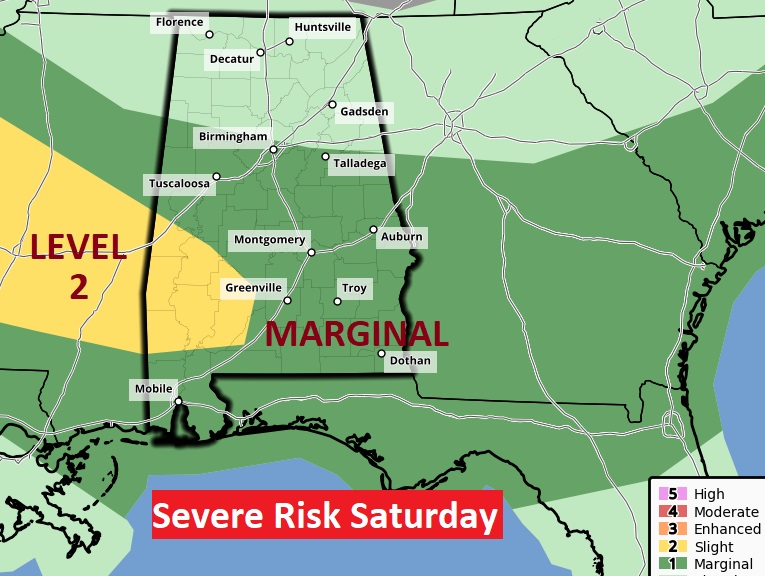
Most of us are in a Marginal Severe Weather risk today from the Storm Prediction Center. A level 2 risk covers much of southwest Alabama.
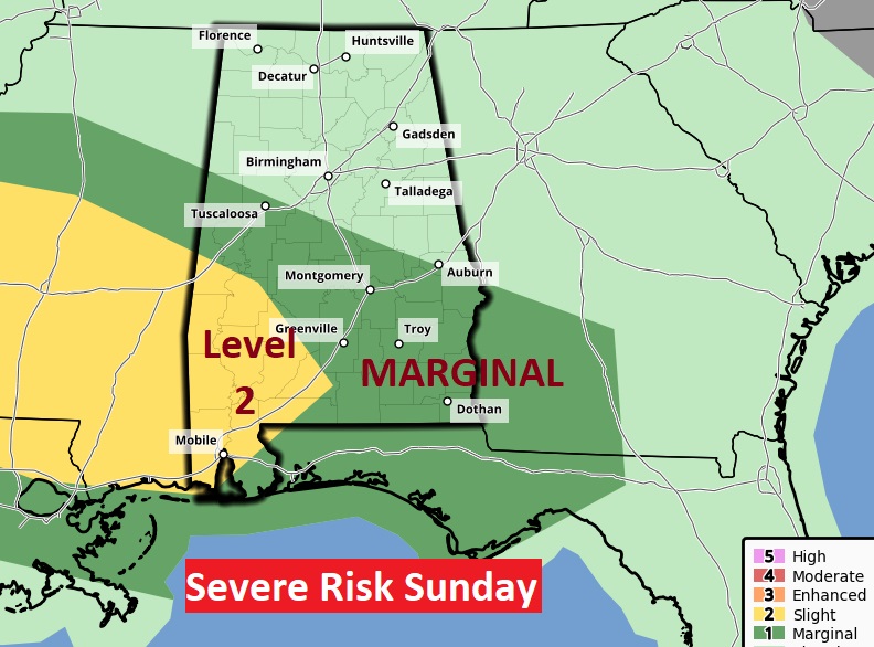
EASTER SUNDAY: The greatest threat of strong to Severe storms will be from lunchtime through Sunday night. Damaging wind gusts are the main threat. Some storms will have large hail. High Sunday 78. Scattered storms will continue Sunday night into Monday morning.
The Storm Prediction Center’s Sunday Severe Weather Risk map looks similar to today’s map. Most of the state, south of a Tuscaloosa to Auburn line is in a Marginal Risk. Southwest Alabama is in the Level 2 “Slight Risk” area.
NEXT FEW DAYS: After the storm exit the state by lunchtime Monday, get ready for a string on some really nice days for most of next week. Comfortable.
.
I’ll have another Blog update in the morning. Have a Nice Easter weekend.
–Rich