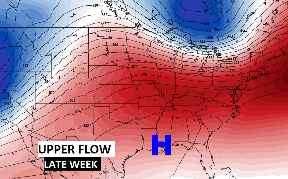
Good Morning! Our late season chill will soon begin to fade. A nice warming trend begins this afternoon. As an upper high pressure ridge builds, look for much warmer days and milder nights. Meanwhile, the upper ridge will also act as a protective dome. Approaching storm systems will be diverted. It looks like several more storm-free days ahead. How long can this last? When will rain return? On this video, I’ll walk you through the day-to-day details, through the weekend and beyond.
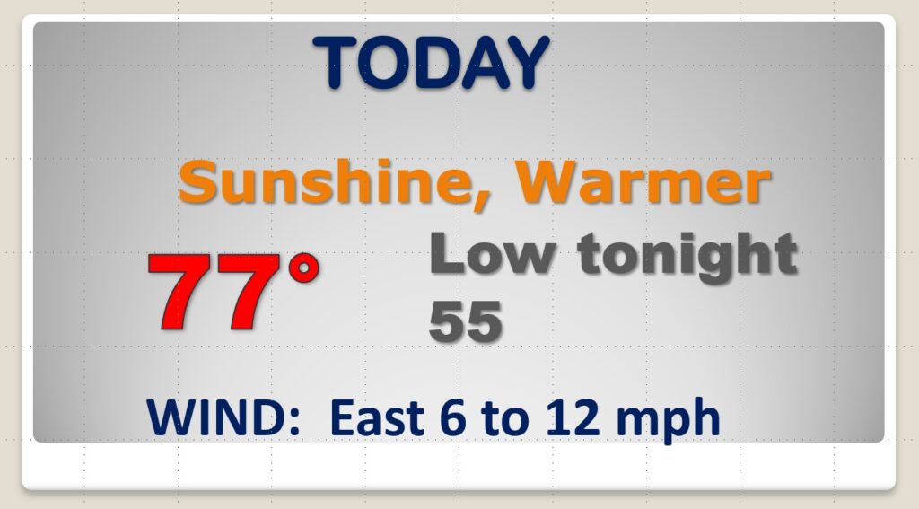
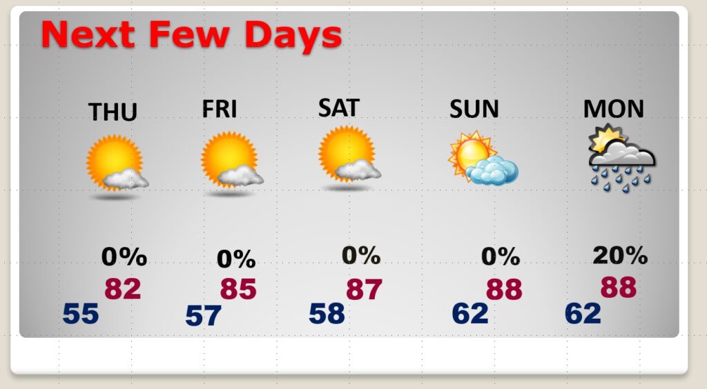
Our chilly start this morning will fade quickly. Expect a really nice Wednesday. Remarkable afternoon warm-up. Not as cool tonight.
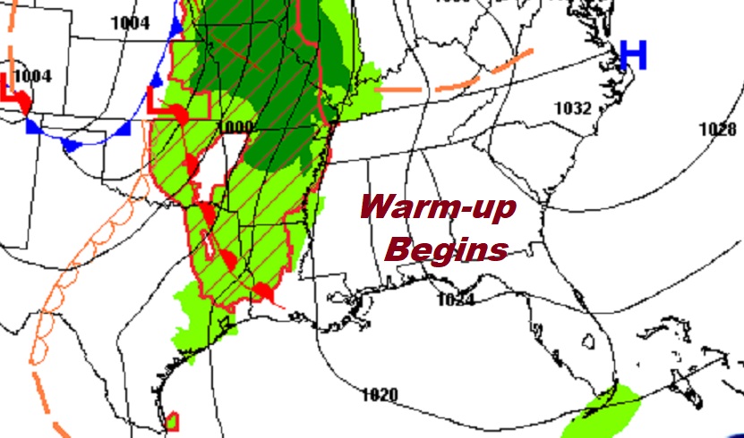
As this unusually late season cool air fades…an upper ridge of high pressure builds, and the pronounced warming trend begins.
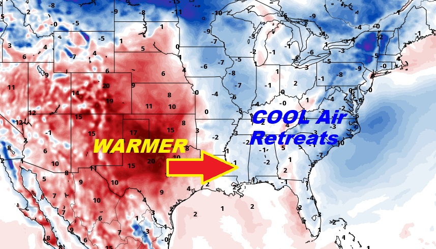
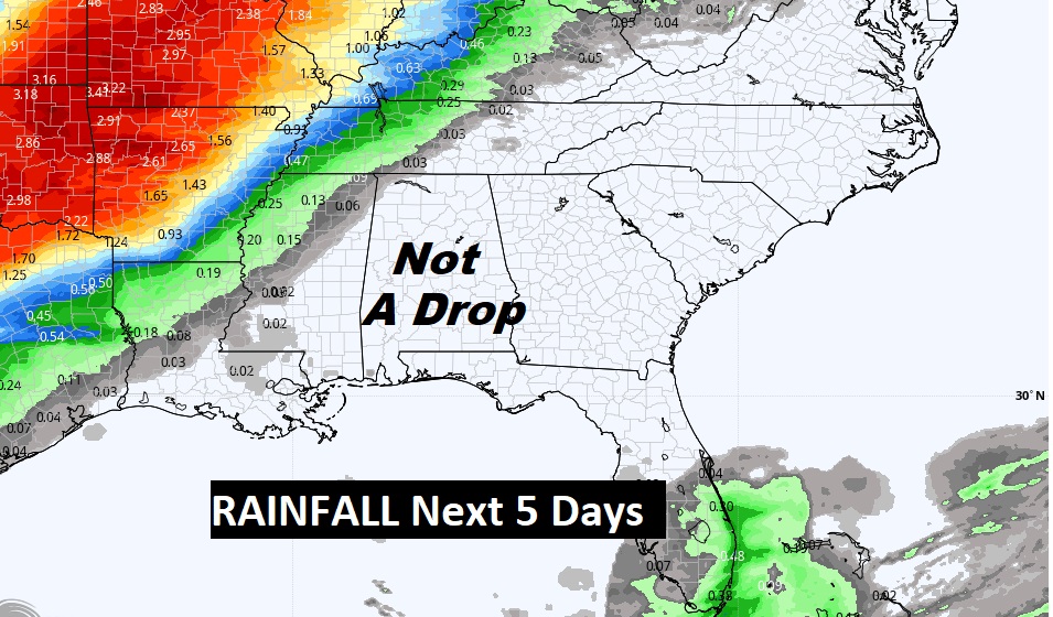
We’re dry as a a bone for at least the next 5 days….
Each day gets a little warmer. We’re dry at least through Sunday. What a nice weekend! Highs in the upper 80’s. A little summer preview?
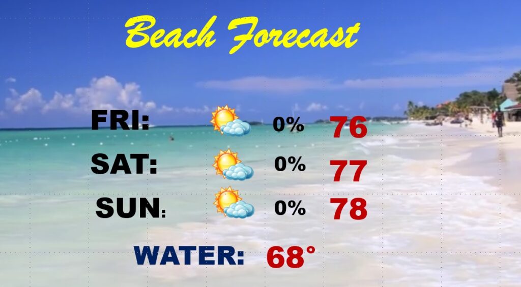
Gosh I wish I was going to the BEACH this weekend. What a nice forecast.