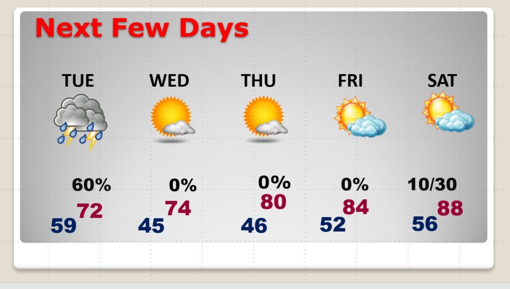
Good Morning! Our extended dry pattern is coming to an abrupt end. An approaching frontal system will bring showers & storms back to the state by this evening, tonight and especially Tuesday. This will not be a severe weather situation. Much cooler air follows the front. We’ll be in the mid 40’s by Dawn Wednesday. After the front, expect another extended string of very nice days for the rest of the week. It looks like we’ll be back to 80 or above by Thursday and Friday. On this video, I’ll break down the day to day details through next weekend.
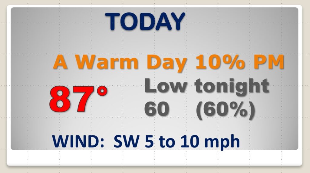
Much of this day will be dry and warm. A little more humidity. Upper 80’s. Scattered showers and thunderstorms over night tonight ahead of the front.
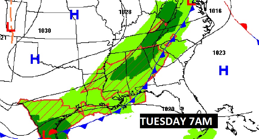
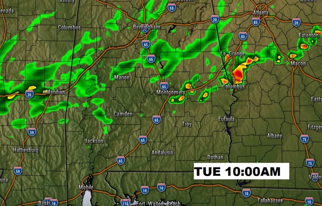
The front moves through early in the day Tuesday. Best chance of showers and thunderstorms will be first half of the day. Much cooler by Tuesday night.
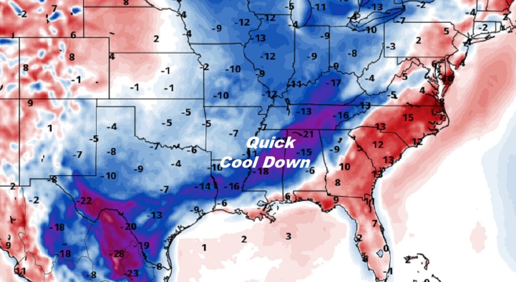
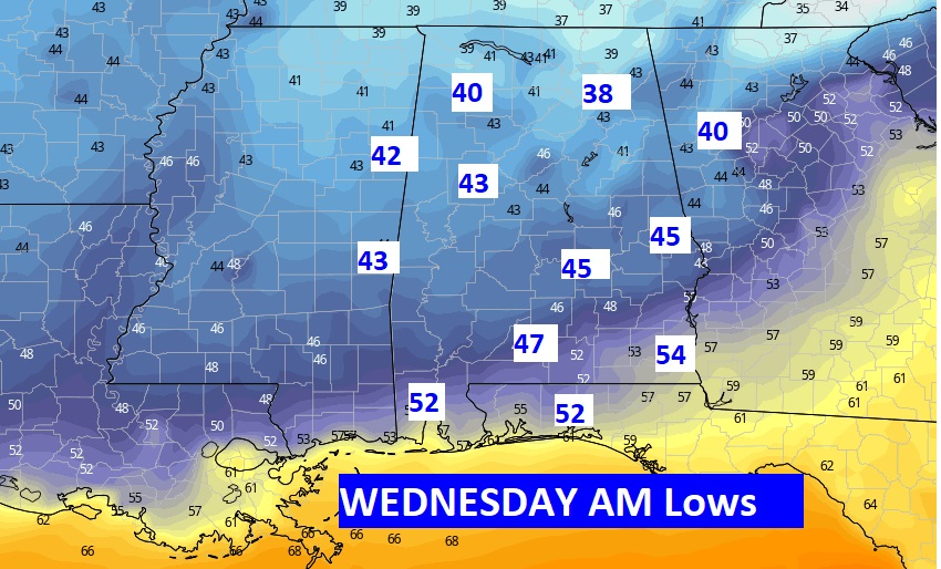
Quite chilly Tuesday and Wednesday night. Lows in the 40’s.
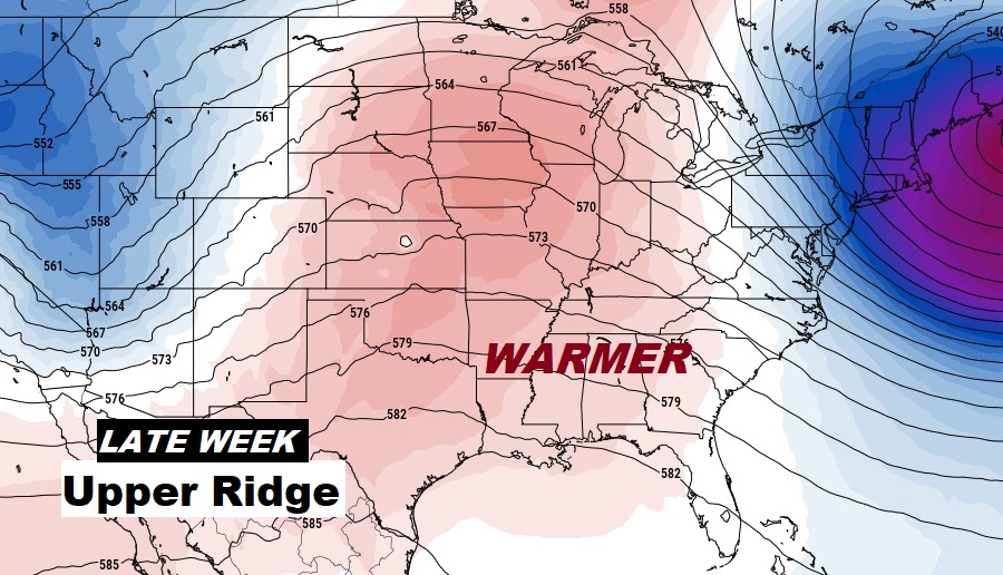
Look for a nice warm-up late week as a ridge builds.
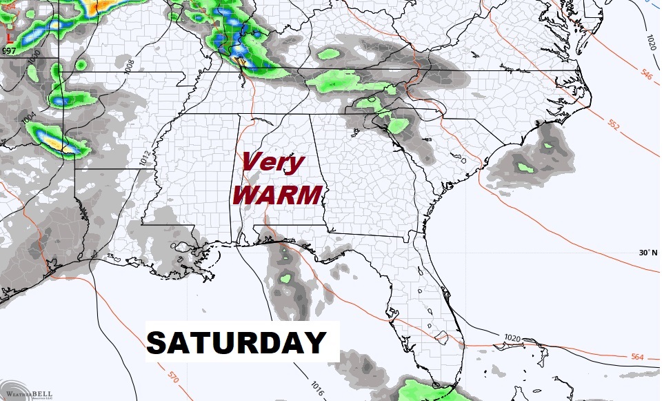
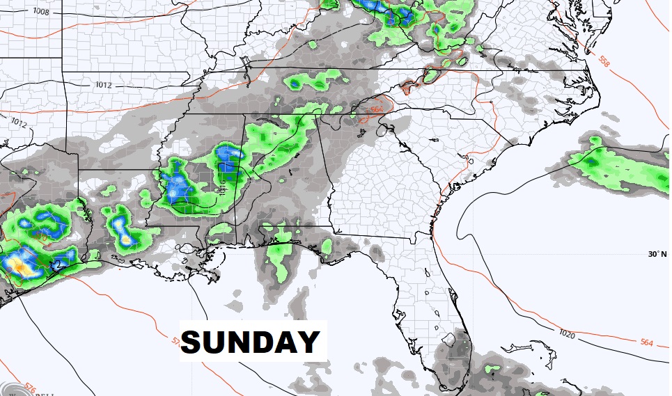
Right now I have us dry Saturday…BUT, we’ll have to keep an eye on that forecast. Scattered showers and thunderstorms Saturday night and Sunday.