
Good Morning! Our little early Summer Preview continues today and for the rest of the week. Here’s my brief video discussion.
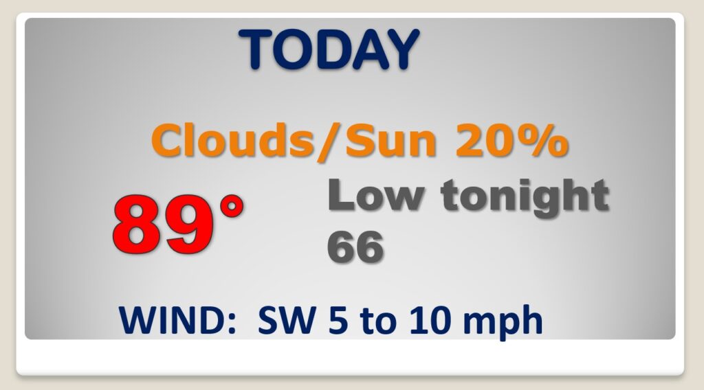
TODAY: Sun/Cloud Mix today. High in the upper 80’s. (Dewpoints in the 60’s will make it seem muggy) Widely scattered mainly afternoon & evening showers and thunderstorms. Low tonight mid 60’s.
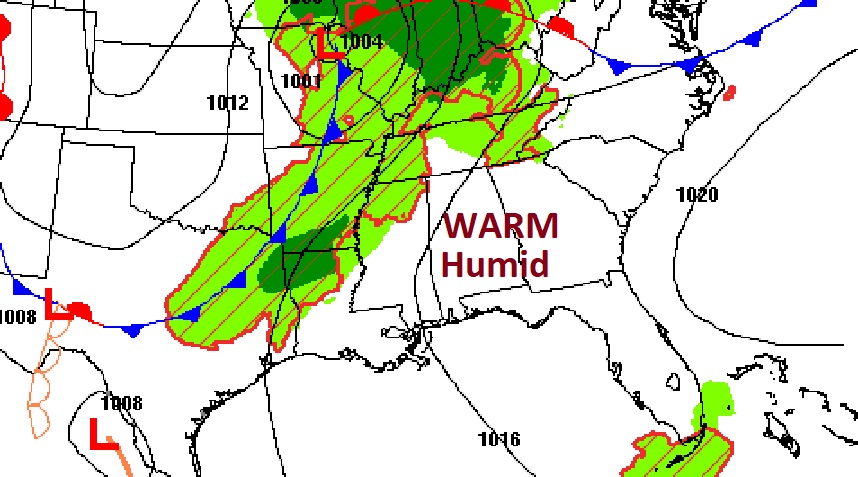
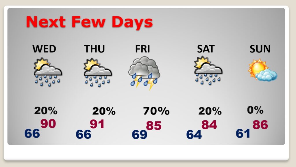
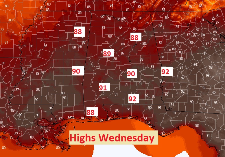
NEXT FEW DAYS: This little summer pattern rolls on and on. Warmth, humidity and a few spotty random storms. On average we usually don’t see our first 90 degree day until about June 8th. But, this week, we will at least tease 90 degrees on Wednesday and Thursday. The rain chance gets a little better Friday. In fact, we could see a few strong/severe storms on Friday, too. We’ll hang onto a small rain chance Saturday. Sunday should be dry & warm.
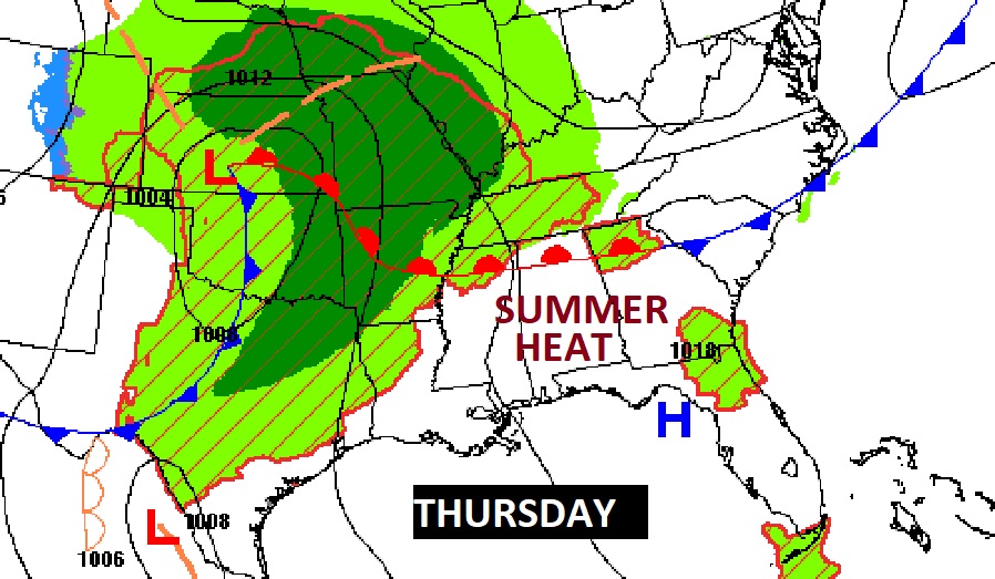
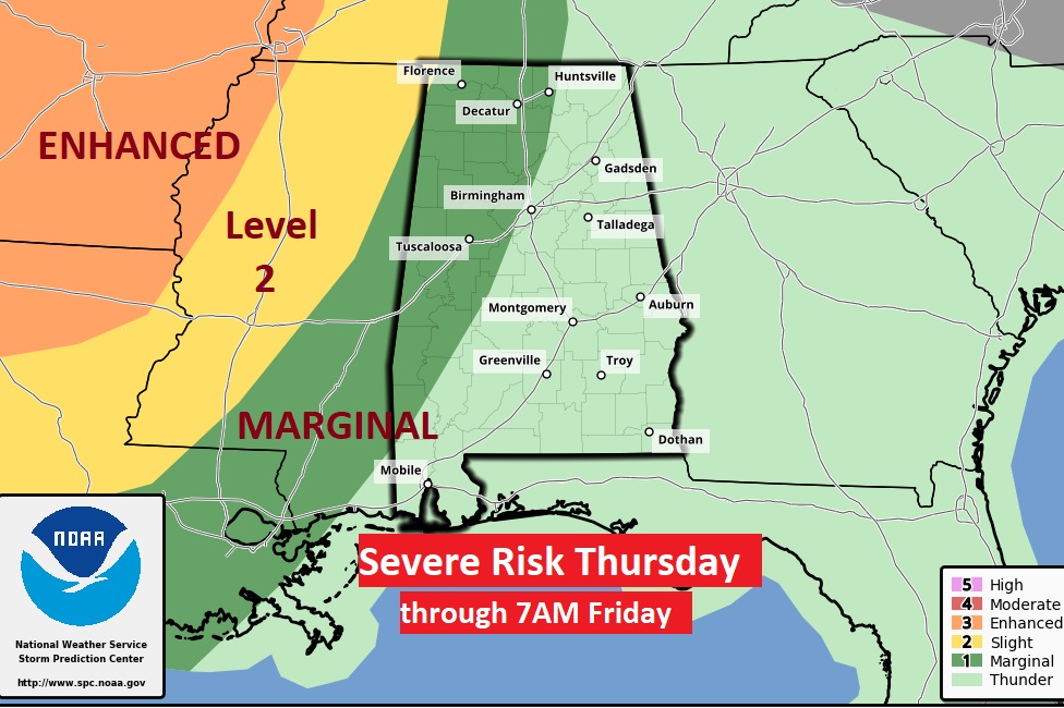
A Potent storm system will cross from the plains state into the Mississippi Valley Thursday. Severe Risk reaches into West Alabama by late Thursday night.
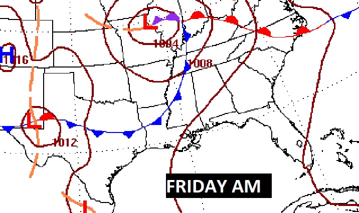
Potent storm system moves into Alabama Friday. Severe weather threat.
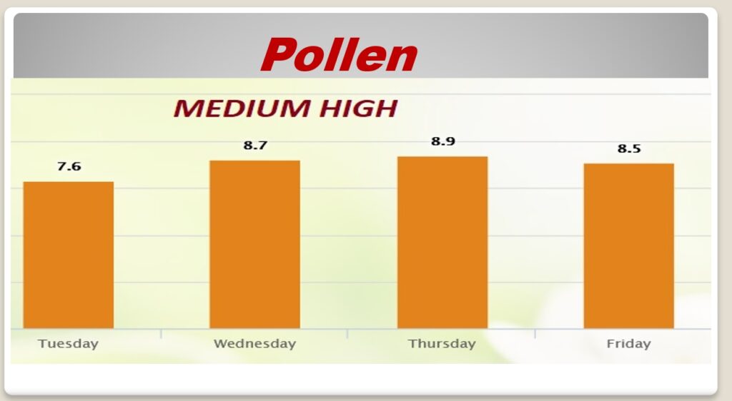
POLLEN: The pollen count is in the moderate range today. And Medium High for the rest of the week.
—
Thanks for reading this Blog this morning. I’ll continue to try to tweak and refine this new more economical format. I invite your comments.
This morning we are LIVE on the radio from 6 to 9 on NewsTalk 93.1. Watch us on TV on CBS 8 and ABC 32. I’ll have another update for you in the morning. Have a nice day.
–Rich