
Good Morning! Here’s my brief video forecast discussion.
TODAY: DENSE FOG ADVISORY TILL 9AM… Otherwise, Very warm & humid, today. Sun/cloud mix. We’ll be near or at 90 degrees for the afternoon High. (Dewpoints in the 60’s) Widely scattered mainly afternoon & evening showers and thunderstorms. Low tonight mid 60’s.
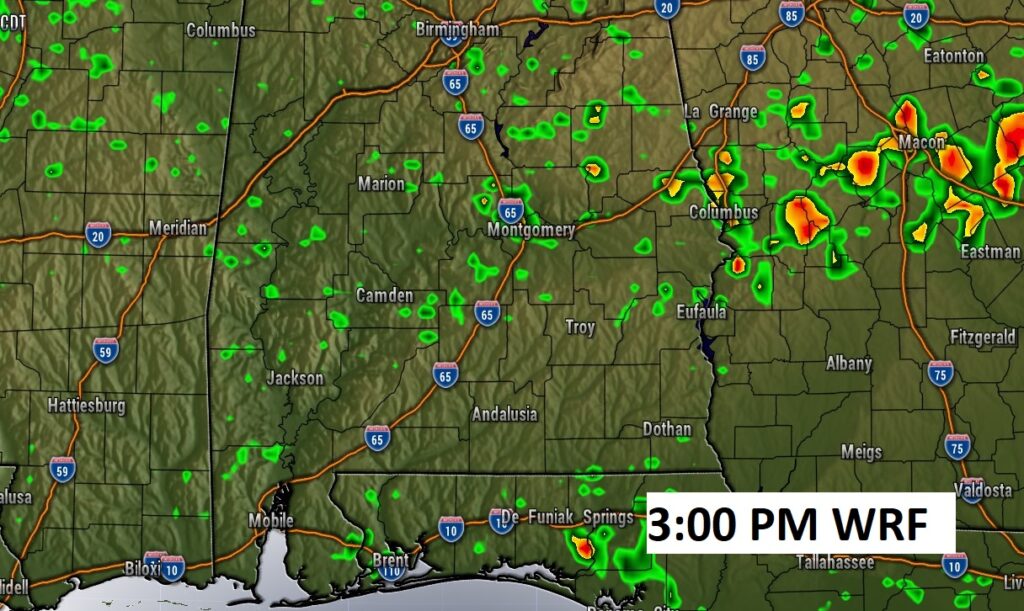
Here’s a Future radar snapshot at 3PM. Showers and storms will be random and isolated. Most towns stay dry.
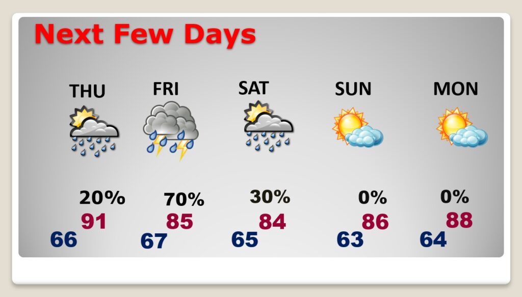
NEXT FEW DAYS: Widely scattered PM storms through Thursday. High near 90. Showers and thunderstorms are likely Friday. Some storms could be strong to severe. Widely scattered storms Saturday, mainly south Alabama. Right now Mother’s day look dry & warm with highs in the mid 80’s.
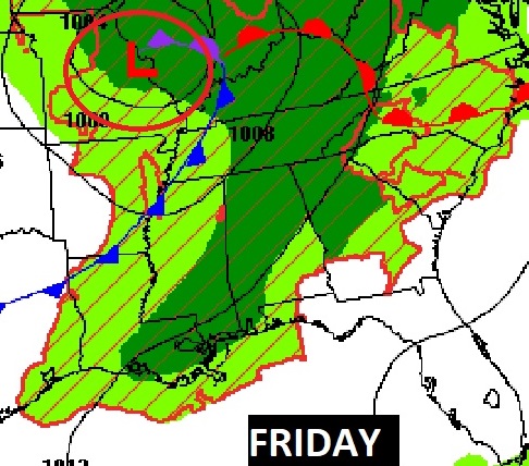
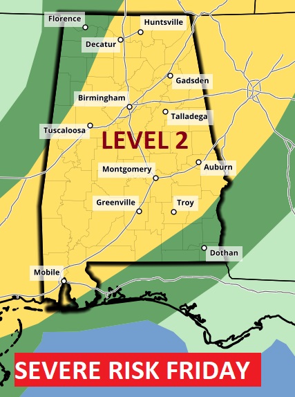
STORMY FRIDAY: An approaching frontal system will bring a LEVEL 2 Severe weather Risk on Friday, Damaging wind gusts would be the main threat. An isolated tornado or two can’t be ruled out.
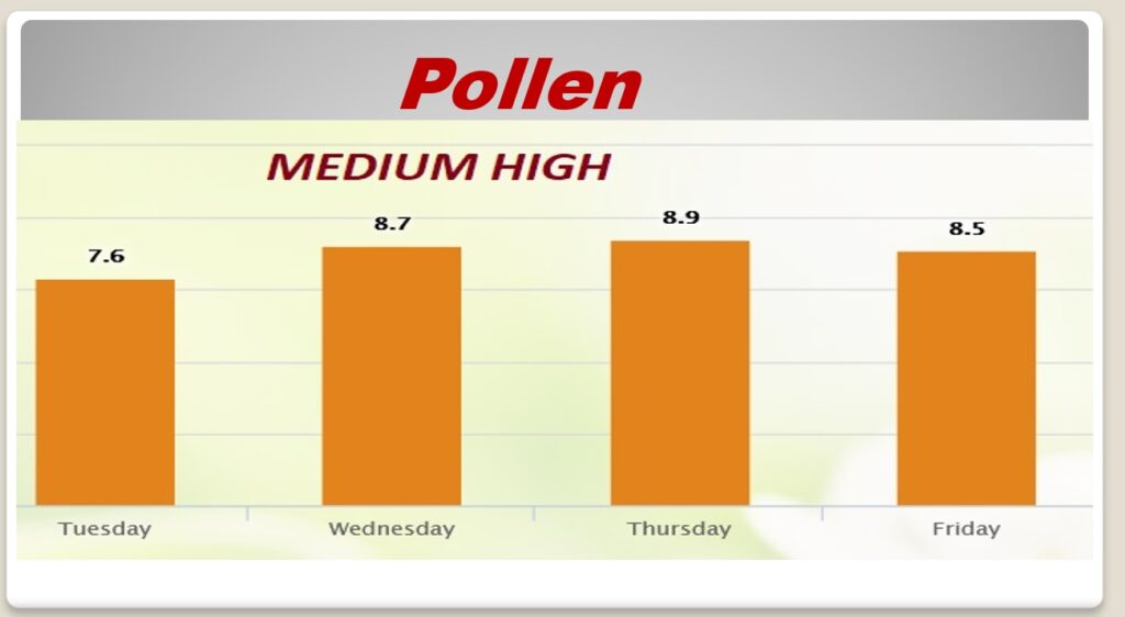
POLLEN: The pollen count is in the moderate range today. And Medium High for the rest of the week.
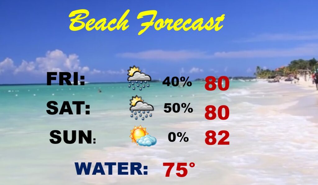
BEACH FORECAST: Potentially stormy Friday, especially late. Scattered thunderstorms Saturday. Nice Day Sunday.
—
Thanks for reading this Blog this morning. I’ll continue to try to tweak and refine this new more economical format. I invite your comments.
This morning we are LIVE on the radio from 6 to 9 on NewsTalk 93.1. Watch us on TV on CBS 8 and ABC 32. I’ll have another update for you in the morning. Have a nice day.
–Rich