
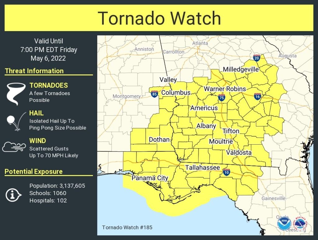
12 Noon Update:
Tornado Watch now covers extreme East and Southeast Alabama until 6PM. A few tornadoes. Scattered wind gusts to 70 mph and up to ping pong size hail. #alwx
11:40 UPDATE:
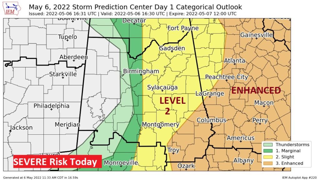
SPC continues to trim back the Level 3 Enhanced Severe Risk area. Now just covering southeast Alabama and Georgia. #alwx
10:45 AM UPDATE:
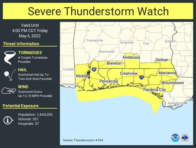
New Severe Thunderstorm Watch includes extreme south Alabama until 4PM. Scattered wind gusts to 70 mph. Hail up to 2″ in diameter. A couple of tornadoes are possible. #alwx
10:15 AM UPDATE:
We can’t declare the severe risk over…but I like the trends we are seeing at this hour. This is from the NWS in Birmingham: Stronger activity this morning is ongoing along the AL coast. we continue to see only spotty showers at the moment. We’ll continue to monitor trends, but the severe threat continues to gradually end from west to east as the western boundary is already approaching I-65.
Good Morning! Here’s my brief video forecast discussion with an enhanced look at today’s Severe Threat today.
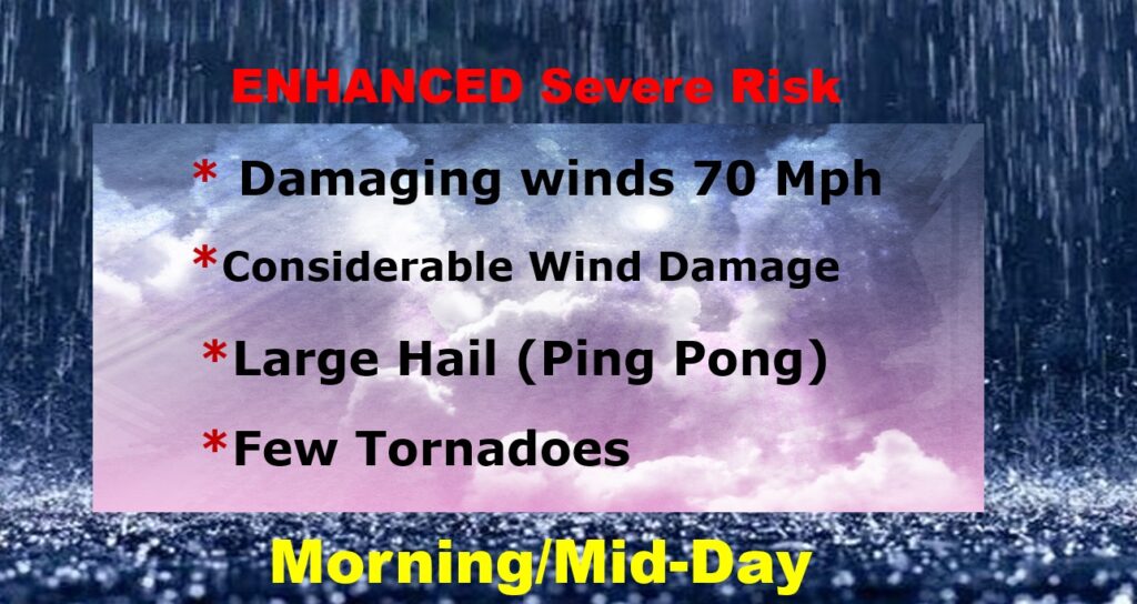
TODAY: Showers and Strong to Severe Storms. Damaging wind gusts if the main risk. A few tornadoes can’t be ruled out. The main window for many of us will be morning and mid-day. Then, shifting into southeast Alabama in the afternoon. Clearing Friday night. Less humid. Low 62.
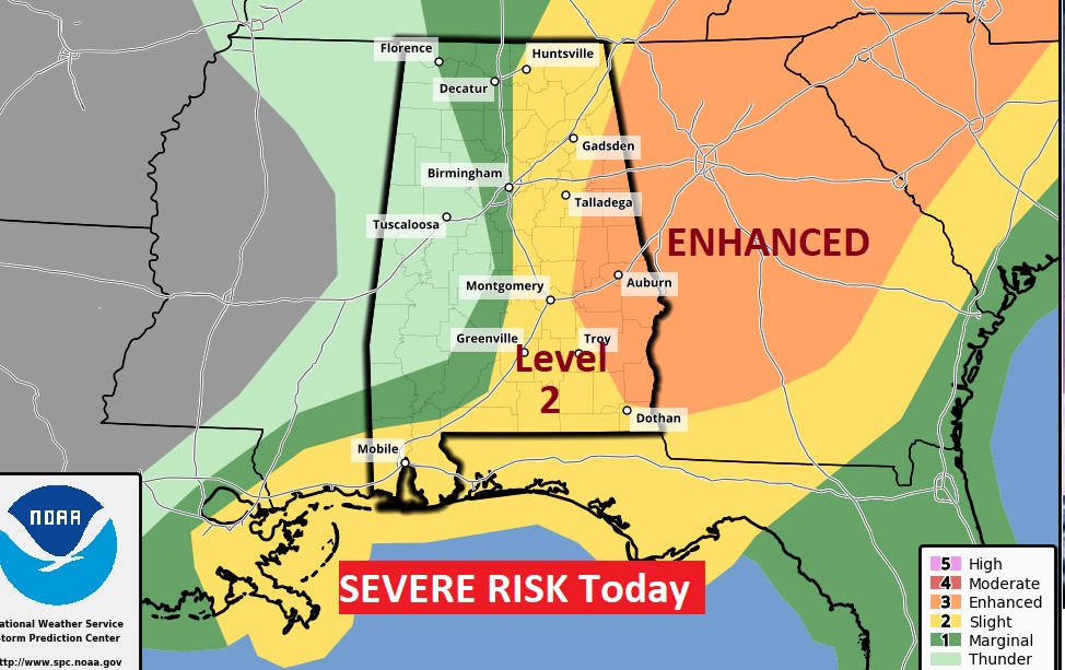
From the Storm Prediction Center…and ENHANCED (Level 3 Severe Risk) covers most of east Alabama. All modes of severe weather. The greatest Risk would be damaging wind gusts and large hail. Tornadoes are possible. For a lot of us, the threat would be from morning until early afternoon. The greatest severe weather threat today is generally east of I-65.
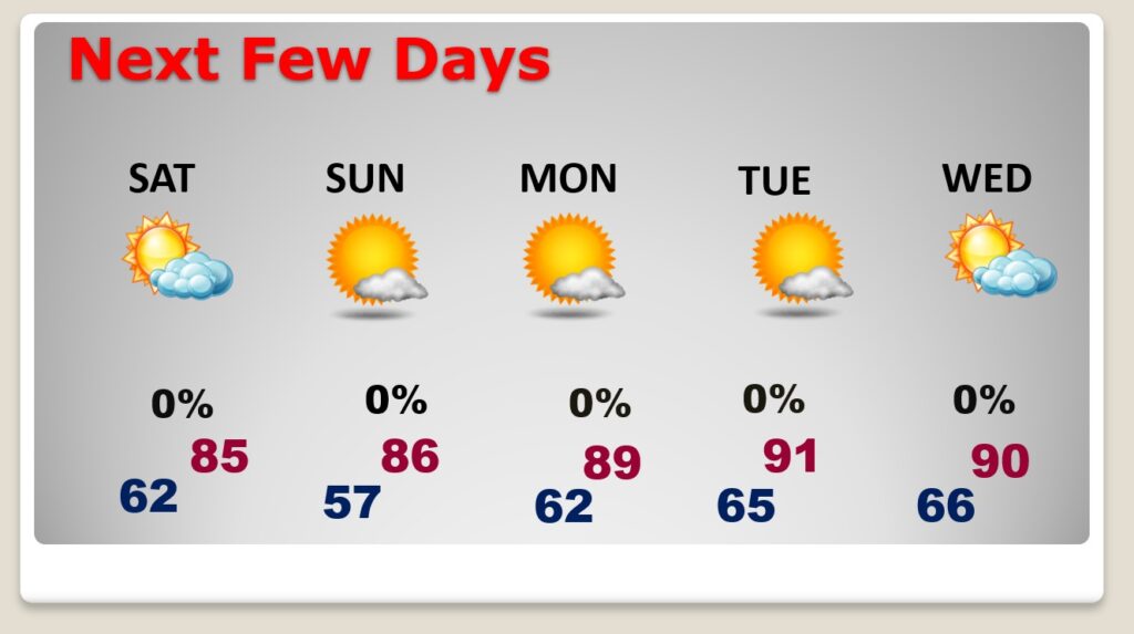
NEXT FEW DAYS: Less humid Saturday. Sunny and nice. Mother’s Day Sunday should be dry & warm & nice. Monday and Tuesday look very warm. We’ll tease 90 degrees each day Monday through Wednesday. Should be dry.
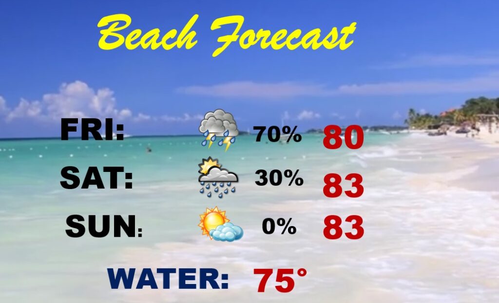
BEACH FORECAST: Thunderstorms likely Friday. Risk of scattered storms Saturday . NICE on Mom’s Day Sunday. HIGH rip current risk Friday & Saturday and a moderate risk Sunday.
—
Thanks for reading this Blog this morning.
This morning we are LIVE on the radio from 6 to 9 on NewsTalk 93.1. Watch us on TV on CBS 8 and ABC 32. I’ll have another update for you in the morning. Stay weather aware today.
–Rich