
Good Morning! Here’s my brief video forecast discussion.
TODAY: Expect lots of sunshine. Hot for May. High 90-92. Northeast wind at 5 to 10. Mainly clear. Comfortable tonight. Low 64.
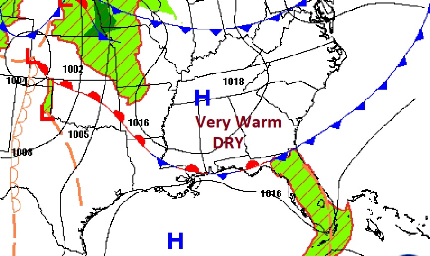
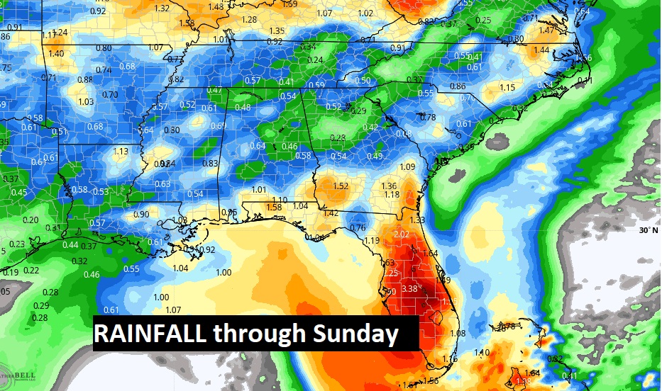
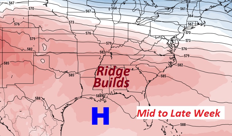
NEXT FEW DAYS: Hot days on the way and continued dry.. Lots of sunshine. Mid 90’s Wednesday. Flirting with mid to perhaps upper 90’s late week. The record high for Wednesday & Thursday is 97. We’ll be in the neighborhood both days. Scattered thunderstorms return for Saturday & Sunday.
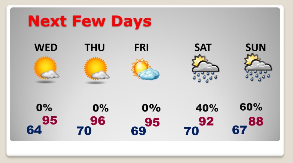
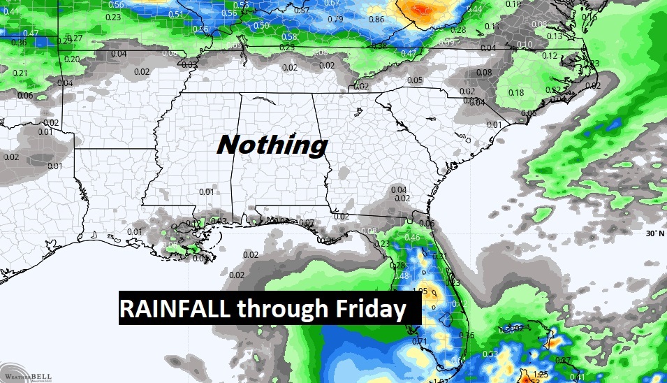
Rain chances through Friday…ZERO. But Showers and thunderstorms return this weekend.
Our record highs of 97 Wednesday & Thursday are probably safe. But, not too far away many records may fall. Upper level high pressure will be in place.

.
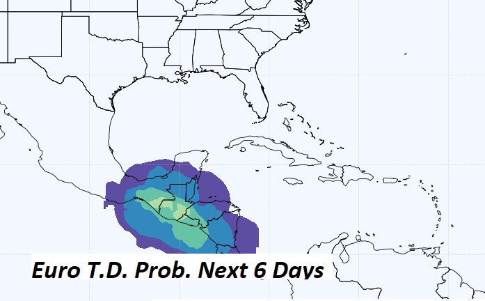
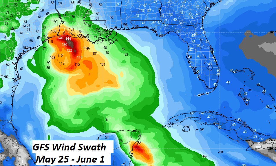
FUTURE GULF TROPICAL MISCHIEF?: Could we see some early pre-season activity coming out of the west Caribbean into the Gulf before this month is over? Maybe. The long range models keep hinting. We’ll continue to watch. First name up this year is Alex.
—
Thanks for reading this Blog this morning!
This morning we are LIVE on the radio from 6 to 9 on NewsTalk 93.1. Watch us on TV on CBS 8 and ABC 32. I’ll have another update for you in the morning. Have a nice day.
–Rich