
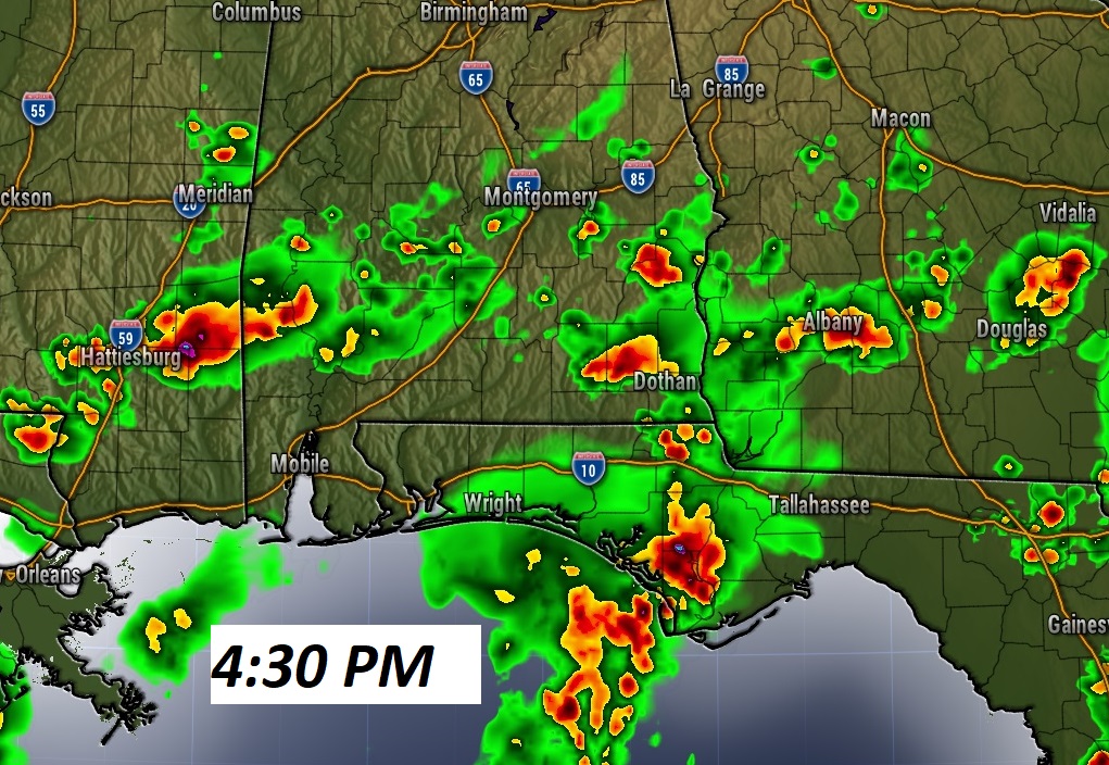
TODAY : Partial sunshine. High 92. Random Scattered showers and storms, most numerous this afternoon and this evening..then, thinning out later tonight. Not every town will get wet today. In fact, many towns will not. Low tonight near 70.
Here’s a Future Radar example late this afternoon.
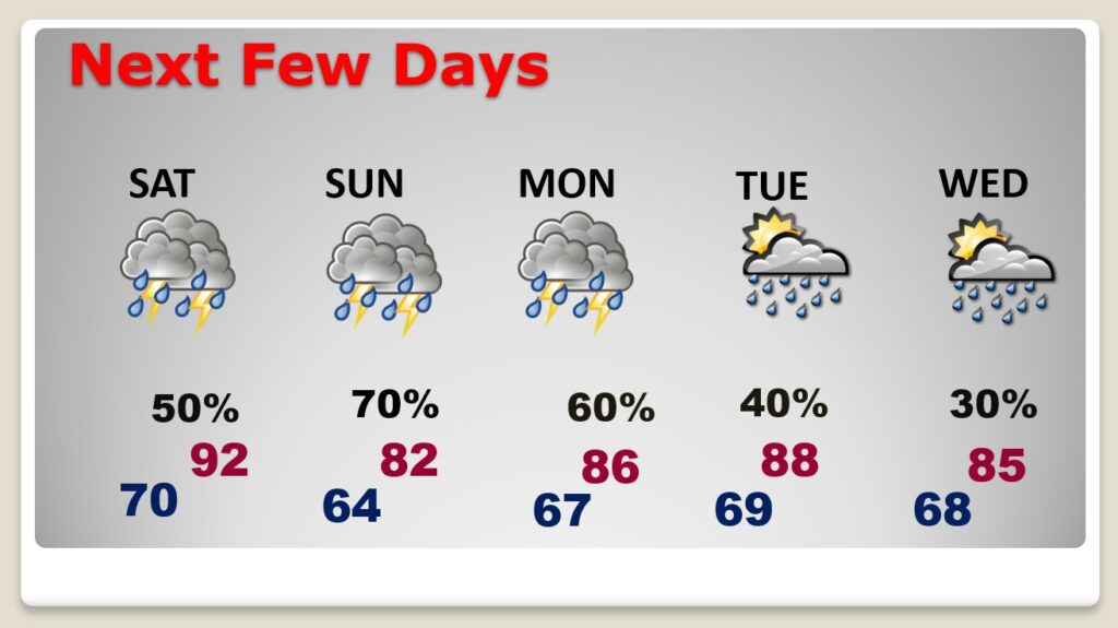
SUNDAY: Much better rain chance. 70 to 80% chance of showers and storms especially by afternoon and evening. High 87.
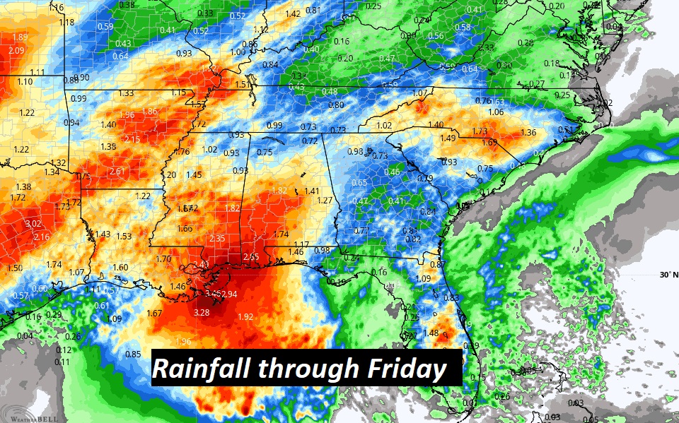
NEXT FEW DAYS: Best rain chance Sunday & Monday. Showers and thunderstorms likely. Lower rain chance on Election Day Tuesday. The wet forecast continues through the end of the week. Another front brings a stronger rain chance on Thursday. So far, the Memorial Day Weekend is looking nicer.
Looks like a major pattern change. Expect a rather wet period of days, at times, through Friday of next week.
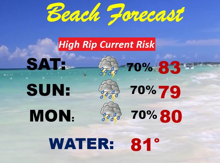
BEACH & HANGOUT FEST FORECAST: Not the best forecast. Showers and thunderstorms are quite likely Saturday, Sunday & Monday. Stay out of the water. High rip current risk. Gulf water now 81 degrees.
.
I’ll have another Blog update in the morning. Have a nice weekend!
–Rich