
Good Morning! Hope you had a nice weekend! Here’s my brief video forecast discussion.
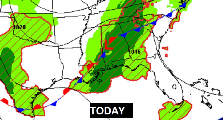
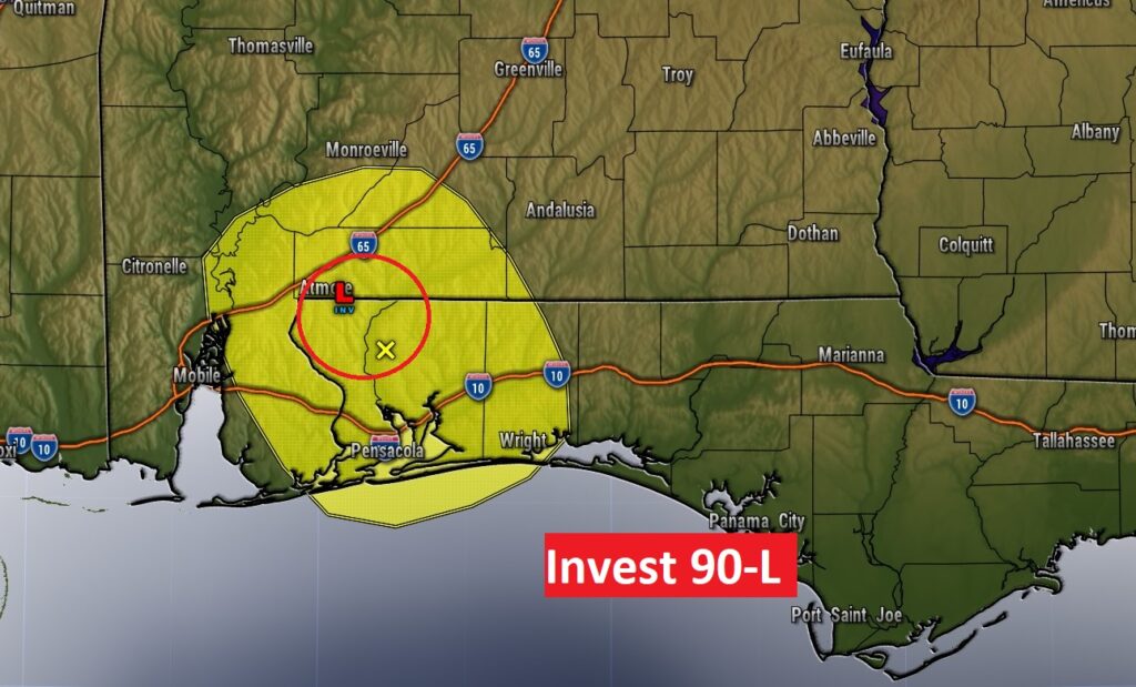
TODAY: We’re experiencing our First Tropical Low of the year. Invest 90-L is spinning through South Alabama now. moving northeastward. Deep tropical moisture will lead to yet another round of widespread showers and thunderstorms. There will be two periods of increased rainfall chances. One round this morning. But, there will be a second round this afternoon & this evening. Rainfall amounts could be locally heavy. Due to clouds & showers…today’s high will be held back to about 78. Low tonight 68.
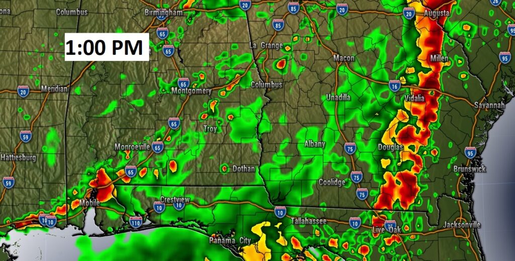
Future Radar shows round two of the rain by early afternoon.
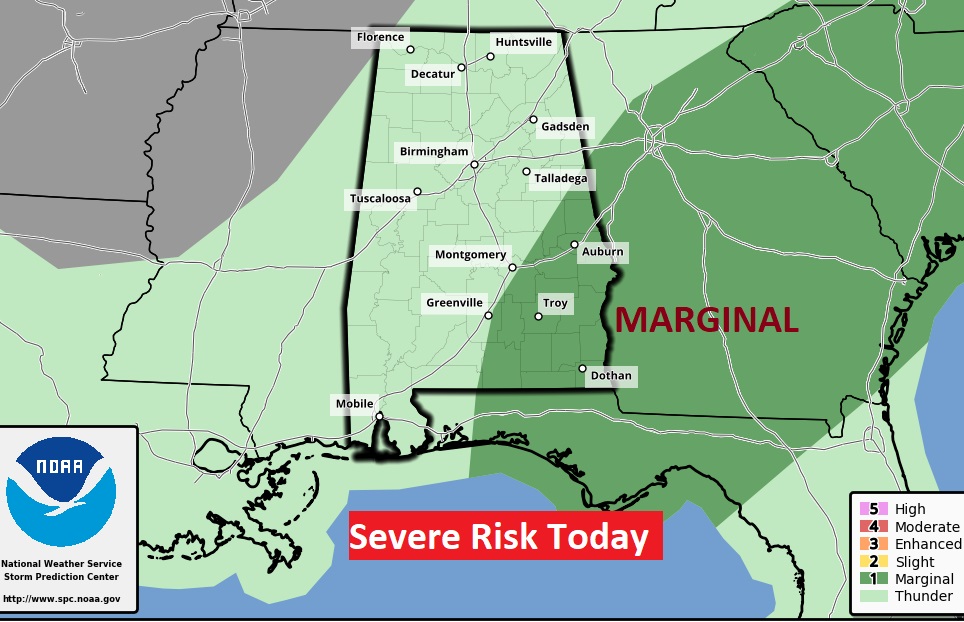
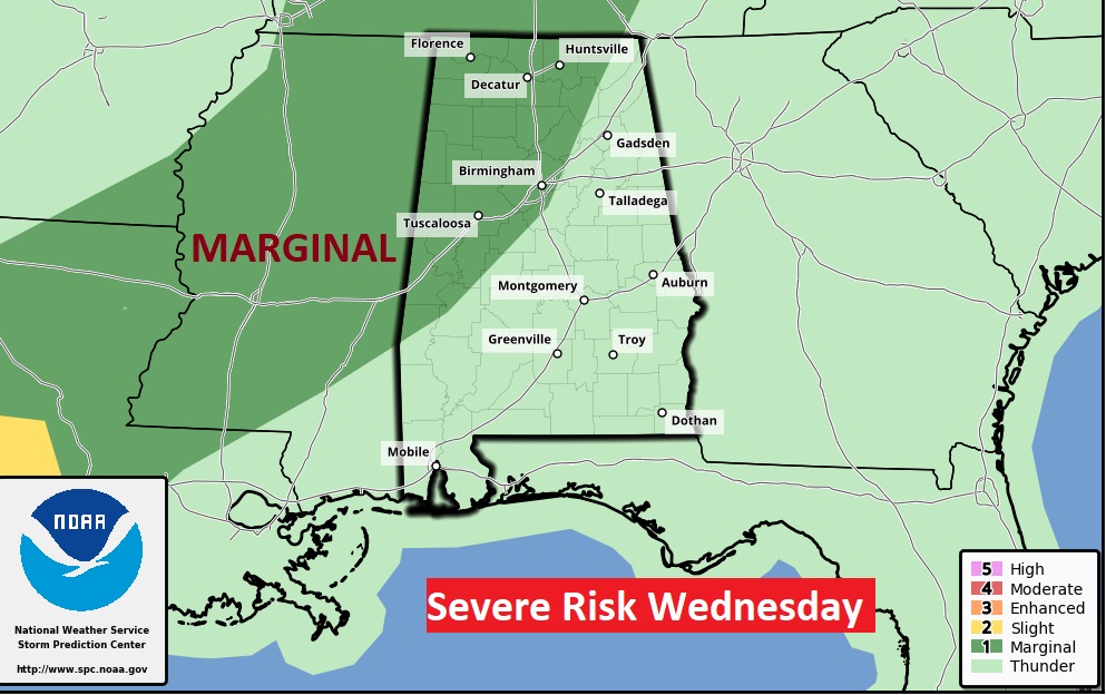
A few storms could reach severe limits. Marginal Severe Risk. Damaging wind gusts are the main risk.
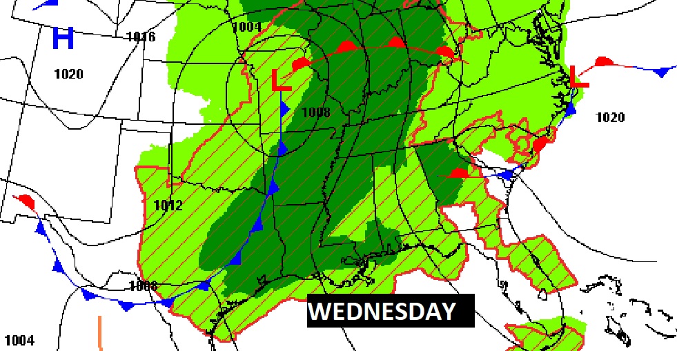
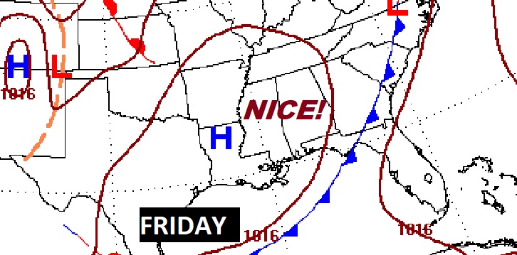
NEXT FEW DAYS: Scattered storms on Election Day Tuesday…but not as many on the radar. Rain and storms become much more numerous Wednesday and Thursday, as a front approaches. A few strong/severe storms are possible. Behind the front, there’s early encouraging signs of a nice Memorial Day Weekend forecast.
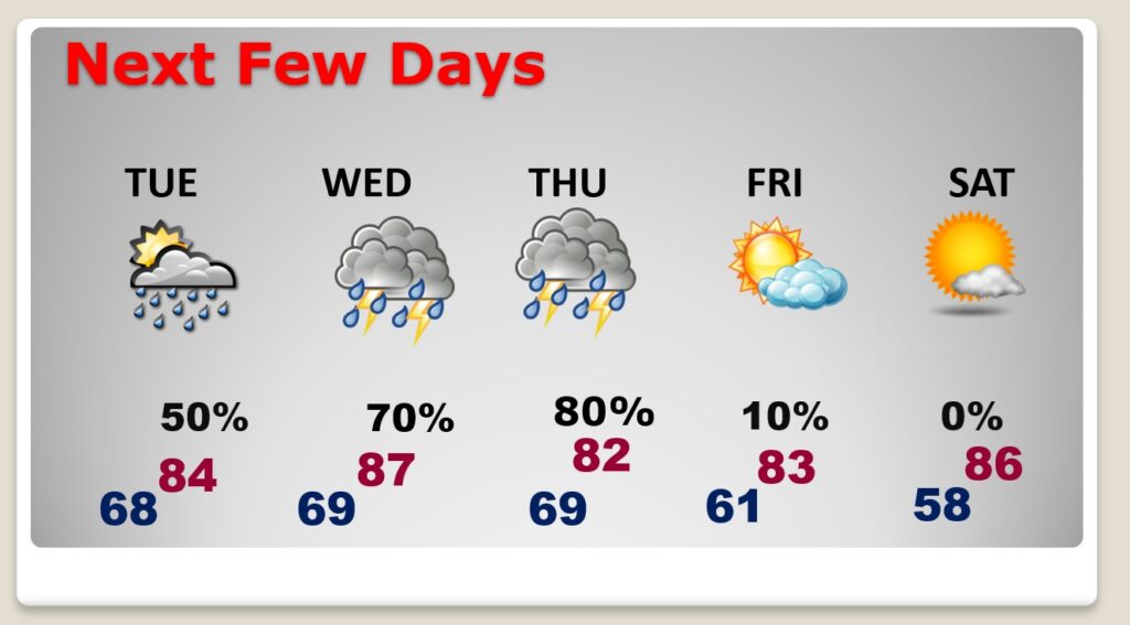
Potential wet times through Thursday.
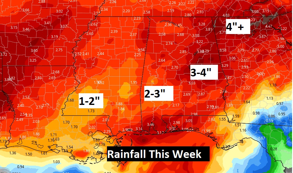
The main event this week will be a frontal system affecting the area Wednesday & Thursday. A few storms could reach severe limits. Marginal Severe Risk. Damaging wind gusts are the main risk.
The early indications for Memorial Day Weekend look good!
INVEST 90-L: ‘Lo and behold, Invest 90-L Formed in the North Central Gulf yesterday. Surface pressure remain high, and conditions do not appear favorable for development as this system has already moved inland along the Gulf coast near Pensacola. Hurricane season officially begins on June 1st . We’ll get the NOAA Hurricane Season forecast this week.
—
Thanks for reading this Blog this morning!
This morning we are LIVE on the radio from 6 to 9 on NewsTalk 93.1. Watch us on TV on CBS 8 and ABC 32. I’ll have another update for you in the morning. Have a nice day.
–Rich