
Good Morning! Here’s my brief video forecast discussion.
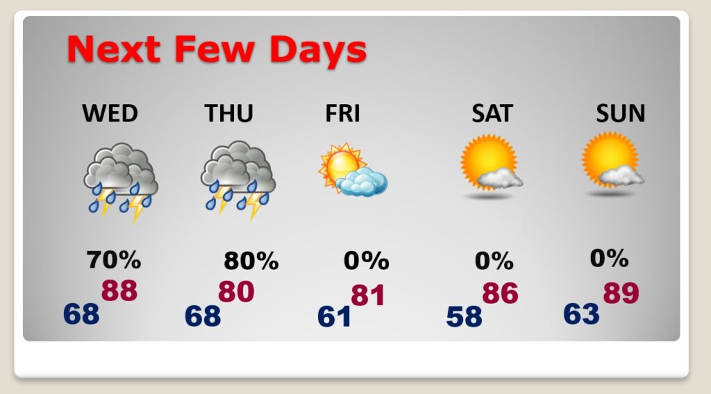
TODAY: Mostly cloudy. Little warmer. High 83. Scattered showers and thunderstorms just about anytime, but most numerous in the afternoon & evening hours. A few strong storms are a good bet. Low tonight 68.
Future Radar snapshot at 4:00PM, to give you just a general idea on potential storm coverage.

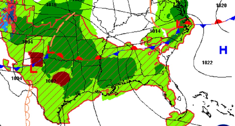
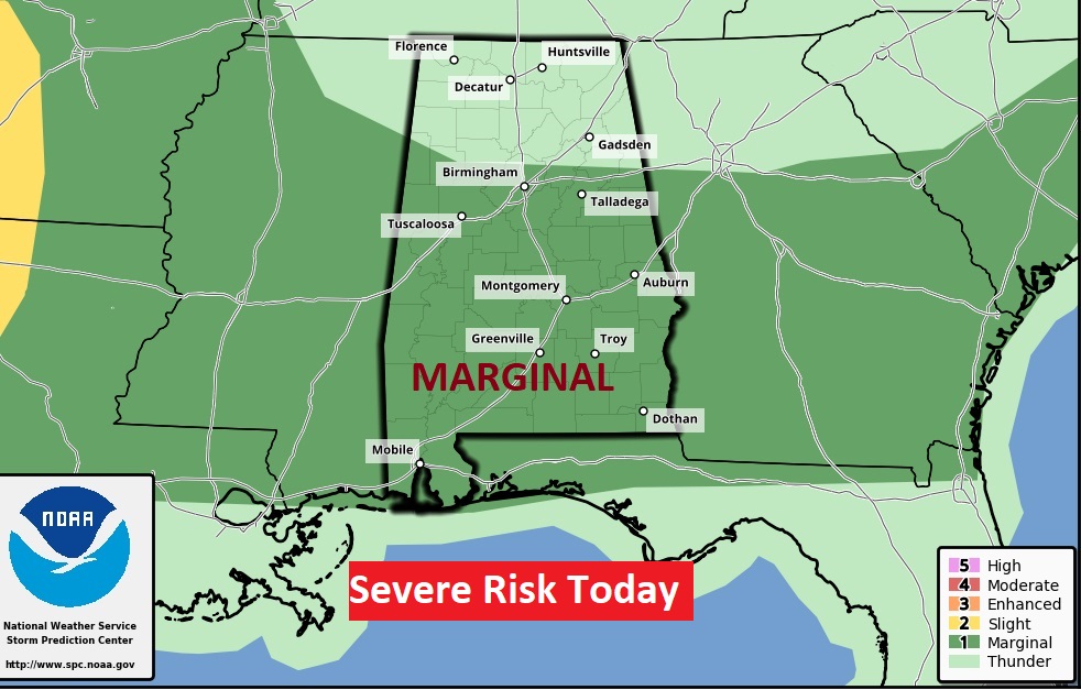
It’s a juicy airmass. A few storms could reach severe limits. Marginal Severe Risk. Damaging wind gusts are the main risk.
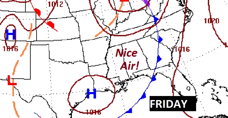
NEXT FEW DAYS: Rain and storms become much more numerous Wednesday and Thursday, as a front approaches. A few strong/severe storms are possible. Marginal Severe Risk. Damaging wind & hail possible, especially Thursday with the front. But, stand by.. Timing is everything. Behind the front, we’ll see some big improvements, starting Friday, just in time for what looks like a sensational Memorial Day Weekend.
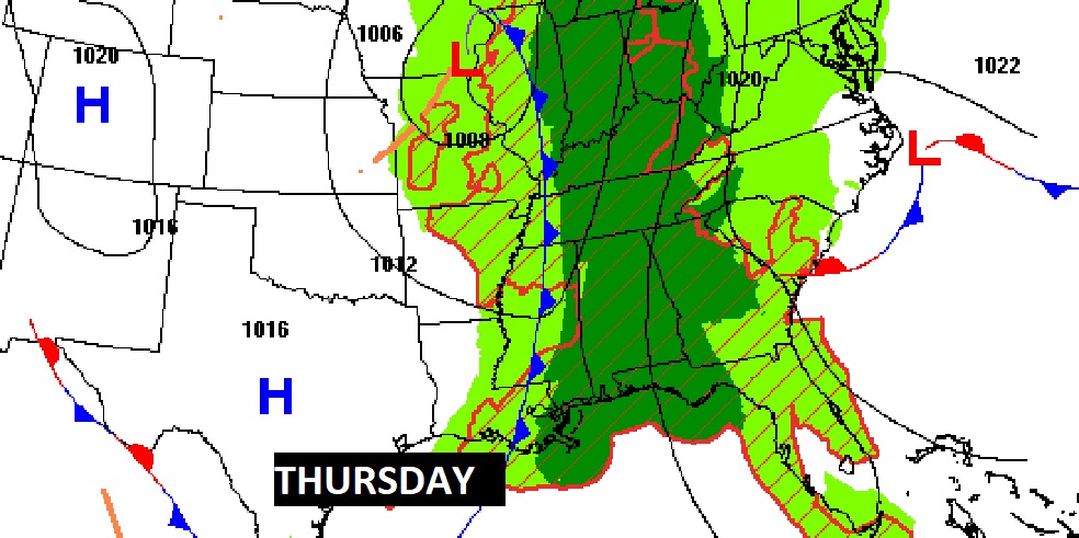
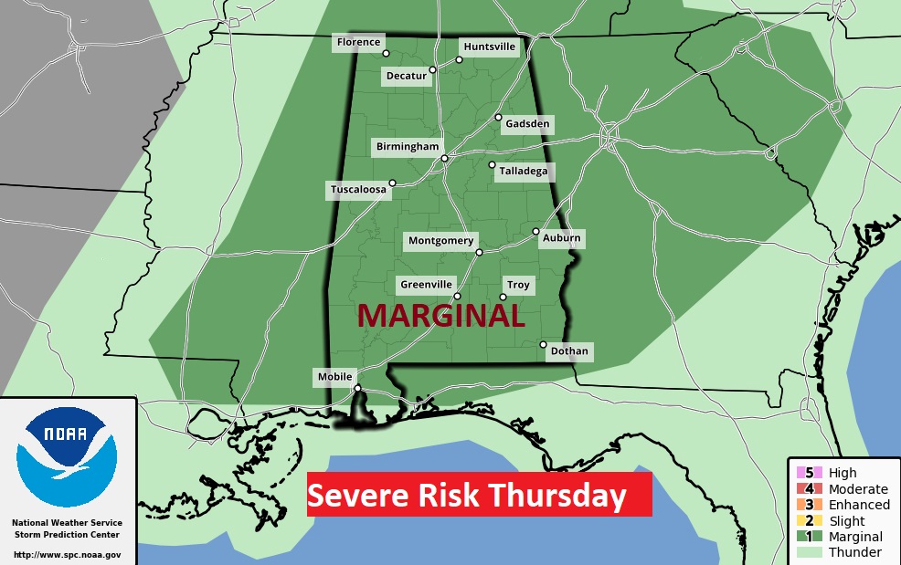
The main event this week will be a frontal system sweeping across the state Thursday. A few storms could reach severe limits. Marginal Severe Risk. Damaging wind gusts are the main risk. Hail is also possible.
Get ready for some really nice weather starting Friday! Looks like a great weekend of weather for the memorial day weekend.
—
Thanks for reading this Blog this morning!
This morning we are LIVE on the radio from 6 to 9 on NewsTalk 93.1. Watch us on TV on CBS 8 and ABC 32. I’ll have another update for you in the morning. Have a nice day. PLEASE VOTE!
–Rich