
8AM UPDATE:
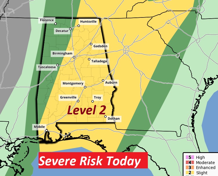
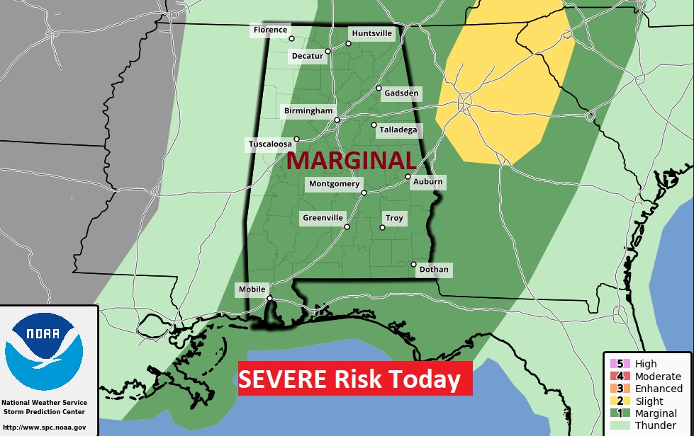
UPGRADED Severe Risk from SPC. They decided to elevate the Severe Weather Risk to Level 2. I do not agree with them..but, that is their decision.
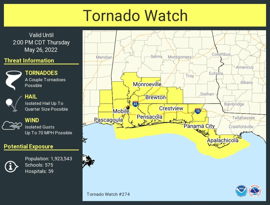
ALSO — A tornado Watch is effect for 8 SW Alabama counties until 2PM.
EARLY MORNING UPDATE:
Good Morning! Here’s my brief video forecast discussion.
TODAY: Frontal system moves through the state today. Numerous showers and thunderstorms. Some storms could produce damaging wind gusts and maybe some hail. Marginal Severe Weather risk. High today near 80. Gusty south wind at 10 to 20 gusting to 25 mph. Showers will diminish in the overnight hours. Low tonight 63.
Future Radar at 2:30. Two areas on stronger storms. One in southeast Alabama. Another line of storms along the front itself in Central Alabama.
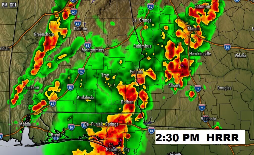
A few storms could reach severe limits. Marginal Severe Risk. Damaging wind gusts are the main risk. Level 2 risk in Georgia.
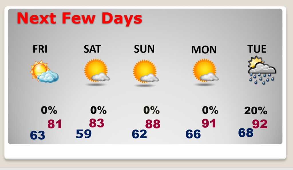
NEXT FEW DAYS: Are you ready for a nice change? Stand by.. Timing is everything. Behind the front, we’ll see some big improvements, starting tomorrow, just in time for what looks like a sensational Memorial Day Weekend. Low humidity, Sunshine. Comfortable nights. Really nice. Hotter Tuesday. Small risk of showers returns. Summerlike on the last day of May.
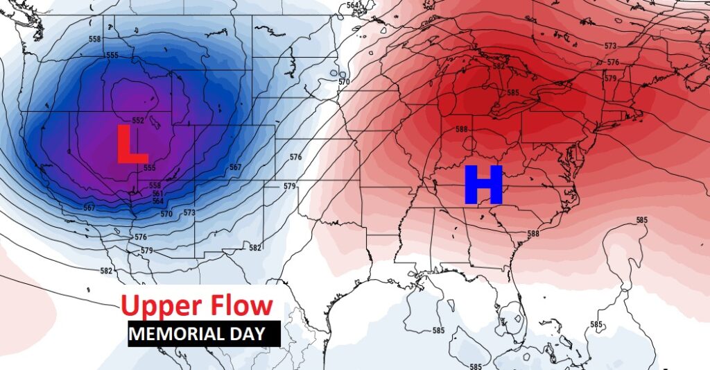
Should be great travel weather wherever your headed across the Southeast US on the Memorial Day Weekend. Upper Level High pressure is in control.
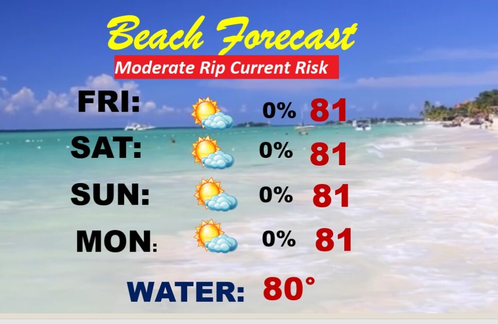
BEACH FORECAST: If you’re headed south to the Beach on this Memorial Day Holiday Weekend..the news continues to be very good. Actually remarkable. Enjoy. Watch for the Yellow Flags on the Beach. Moderate Rip Current Risk. Water temperature 81.
—
Thanks for reading this Blog this morning!
This morning we are LIVE on the radio from 6 to 9 on NewsTalk 93.1. Watch us on TV on CBS 8 and ABC 32. I’ll have another update for you in the morning. Have a nice day.
–Rich