
Good Morning! Our string of nice days continues. It’s been a beautiful holiday weekend of weather, and that continues today. Great weather for a cook-out or a trip to the Lake or the Beach. Not too humid. There were a few blips on the radar yesterday, but I’ll keep the rain chance at 10% today.
Looks like clear sailing for most of the week ahead. Widely Scattered Random afternoon and evening storms return to the forecast Tuesday through Saturday.
Meanwhile, we’ll be watching the extreme southern Gulf and NW Caribbean for possible tropical development over the next few days. Hurricane Season officially begins Wednesday. More below.
TODAY: Great weather for a cook-out or a trip to the Lake. Mostly sunny. Warm, but not too humid. South wind at 5 to 10 mph. Mainly clear tonight. Low 68.
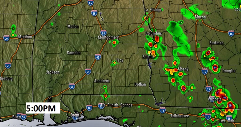
Could there be some “blips” on the radar like yesterday. Maybe. I have the rain chance at 10% today and 20% Tuesday afternoon. Here’s a Future Radar Snapshot.
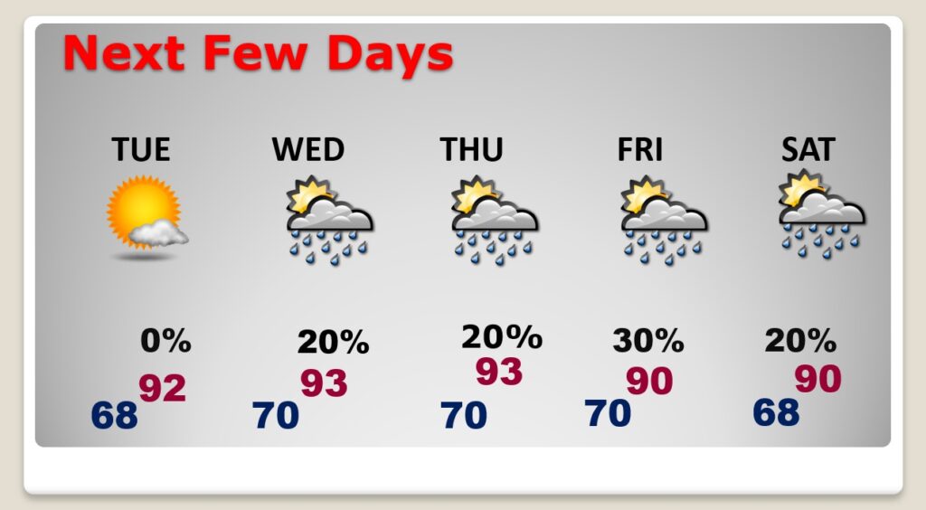
NEXT FEW DAYS: The string of storm-free days continues as May ends and June begins. Lower 90’s each day. Starting to feel more and more like summer. Dewpoints will be well into the 60’s. Small chance of random widely scattered mainly afternoon & evening pop up storms by Tuesday through Saturday, mainly in the afternoon & evening hours.
Rain chances get a little better Friday as a frontal system slips southward through the state.
.
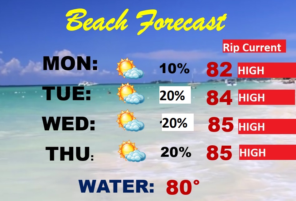
BEACH FOREAST: Lots of people go to the beach on this weekend and the week ahead. The forecast looks pretty good. Rain chance generally 20% or less. There were a few showers Sunday. Mostly sunny. Highs in the low to mid 80’s. Gulf water at 80 degrees. HIGH Rip current risk, especially for the beaches from Destin east through Panama City.
WATCHING THE TROPICS: Major East Pacific Hurricane Agatha with 110 mph winds will make land shore on the coast of Mexico this afternoon. Then, the track will take it across Mexico in the general direction of the Gulf of Mexico, by Tuesday night or Wednesday.
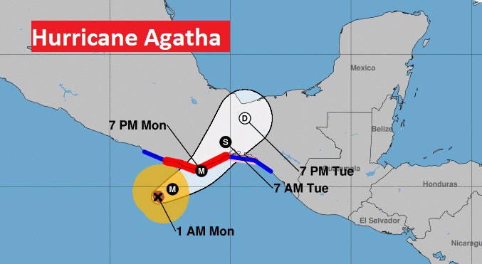
The remnants of Agatha will need to be monitored in the Gulf and/or NW Caribbean. NHC has an Area to Watch with a 30% chance of development next 5 days.
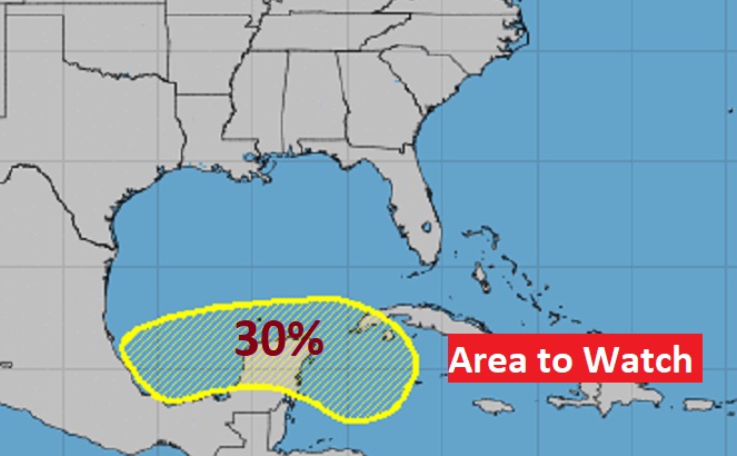
The Euro models continues to hint at possible Tropical Storm development in towards Florida eventually, then off the SE US coast. If it ever got a name, it would be Alex on this side of the tropical world.

Remembering all the heroes who sacrificed their freedom for ours. Never forget the reason for this day.

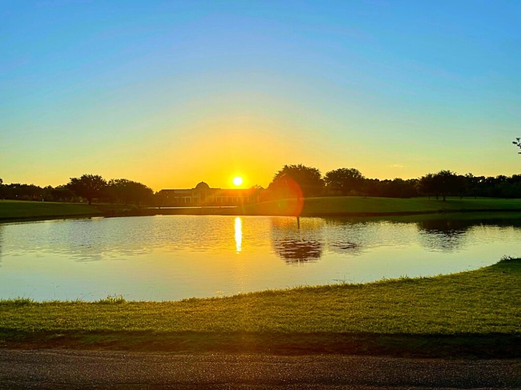
Here’s the Montgomery Museum of Fine Arts at Sunrise This morning. It’s going to be a beautiful day.
—
Thanks for reading this brief Blog this morning. We’ll get back to a video update tomorrow morning. Tomorrow everything will return to normal, including Live on the radio and Live on TV. Enjoy this day.
–Rich