
Good Morning! Here’s my brief video forecast discussion.
TODAY: It’s getting hotter. It’s getting more humid. It’s feeling more and more like typical summer weather. Mostly sunny today. High 92. Random, widely scattered afternoon & evening storms. Small chance. Wind: Southeast at 5 to 10 mph. Mostly clear tonight. Overnight low near 70.
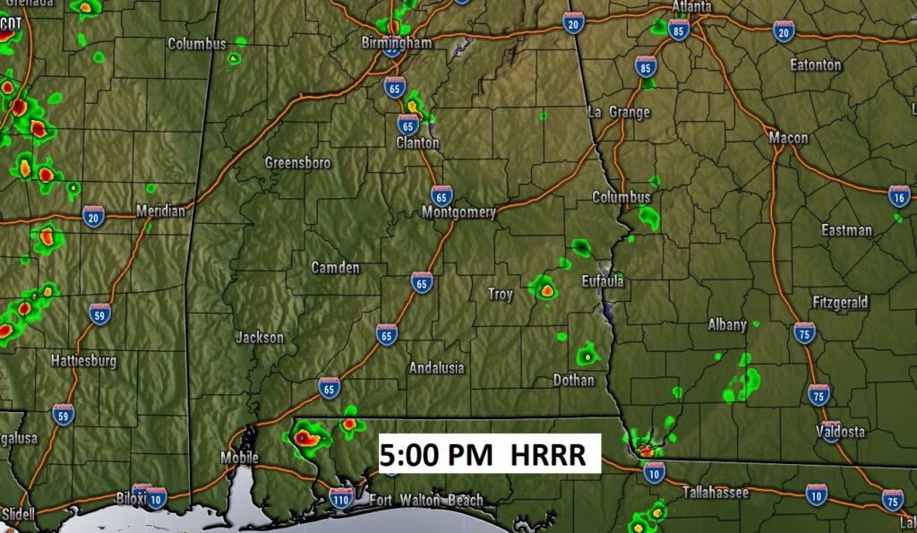
Here’s a late afternoon Future Radar snapshot at 5PM. Sparce on the radar. BUT, yesterday, at my house in East Montgomery, I had .40” with very few showers on the radar. 20% chance. Just luck.
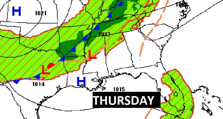
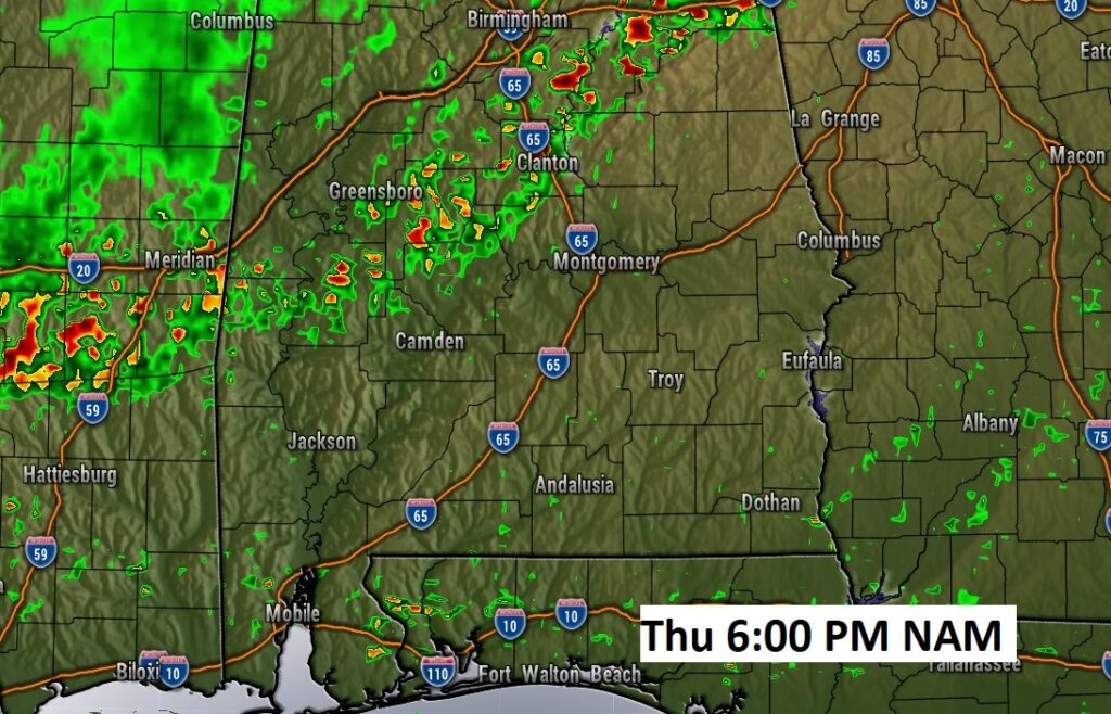
A frontal system approaches tomorrow. It could bring a few stronger storms especially to NW Alabama.
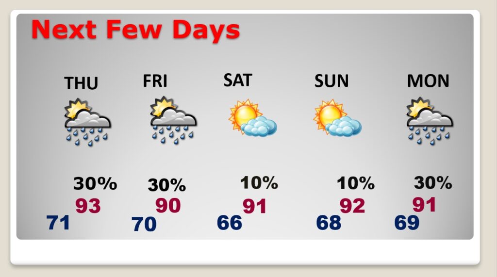
NEXT FEW DAYS: It’s getting hotter and more humid. Expect random, widely scattered afternoon & evening storms through Friday. A weak front moves through the state Friday. The air will be slightly drier by Saturday & Sunday.
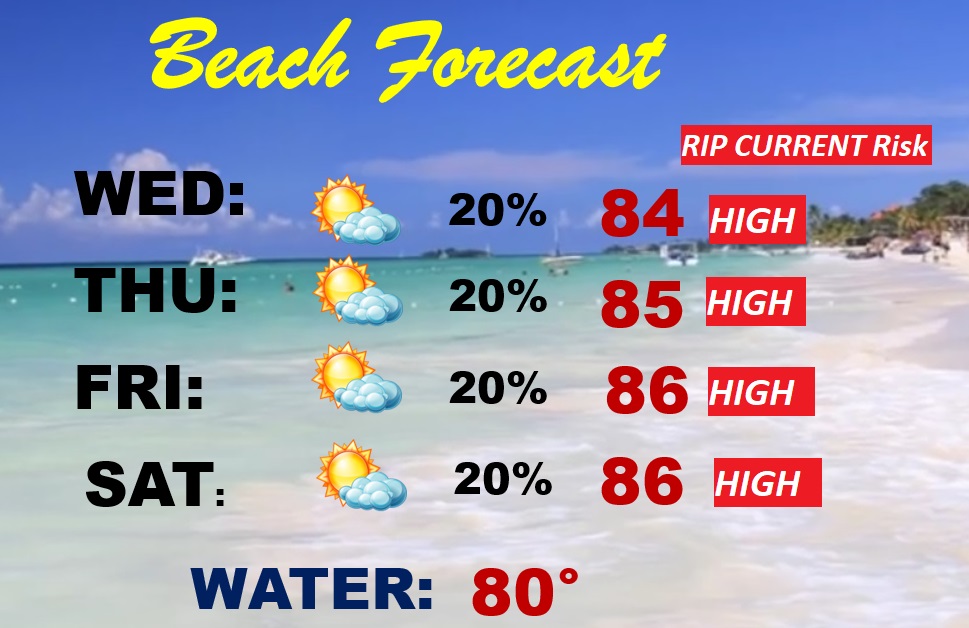
BEACH FORECAST: It’s a pretty routine summer-like forecast as June begins. Partly cloudy. Breezy & warm. Random, widely scattered afternoon & evening storms. Gulf water temperature at 80. High rip current risk, especially from Destin through Panama City.
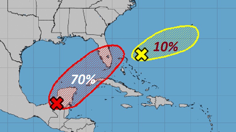
WATCHING THE GULF: The remnants of Pacific Hurricane Agatha could have a rebirth in the Gulf of Mexico in the next 5 days. NHC now has given this system a 70% chance of development. There’s a second area to watch…a second X on the map near the Bahamas. Welcome to the first day of Hurricane Season.
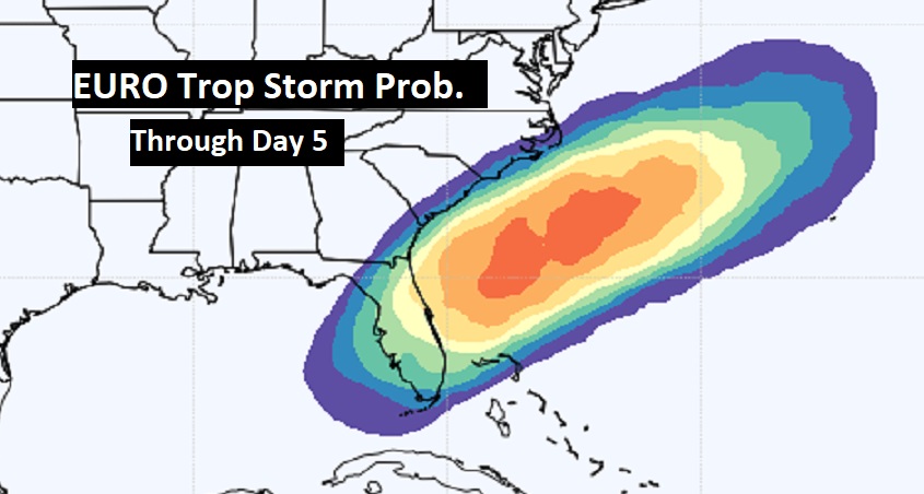
The Euro Tropical Depression Probability indicates this system could become Alex later this week and maybe target Florida.
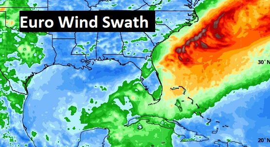
Further development of this system could take place in the Atlantic, off the SE US coastline.
—
Thanks for reading this Blog this morning!
This morning we are LIVE on the radio from 6 to 9 on NewsTalk 93.1. Watch us on TV on CBS 8 and ABC 32. I’ll have another update for you in the morning. Have a nice day.
–Rich