
Good Morning! Here’s my brief video forecast discussion.
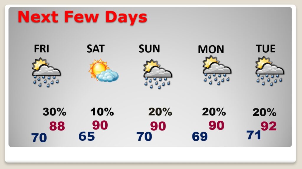
TODAY: Sun/cloud mix today. High 92. Random, scattered afternoon & evening storms. Not every town will get wet. Wind: Southeast at 5 to 10 mph, will become westerly in the afternoon. Partly cloudy with a risk of thunderstorms tonight. Overnight low near 70.
Here’s a couple Future Radar snapshots this afternoon from a two different Hi-res Models, just to give you an idea of potential coverage.
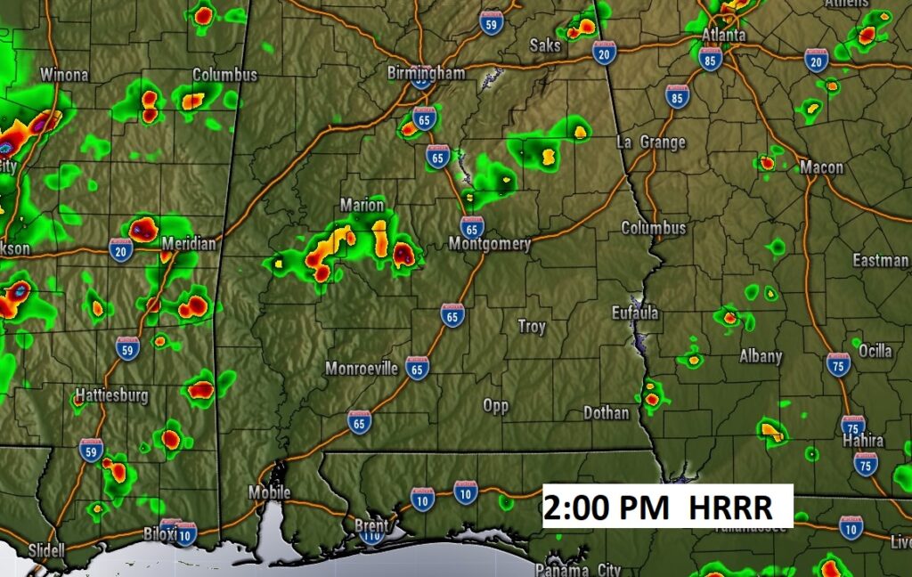
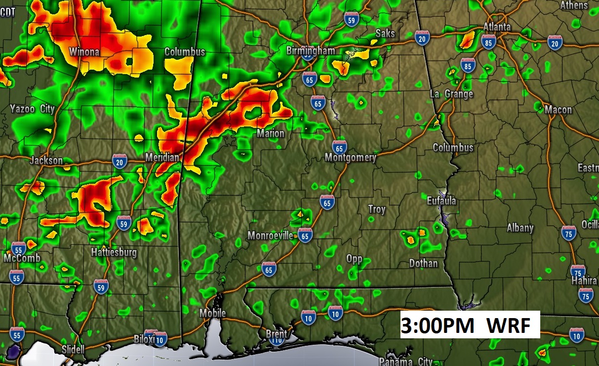
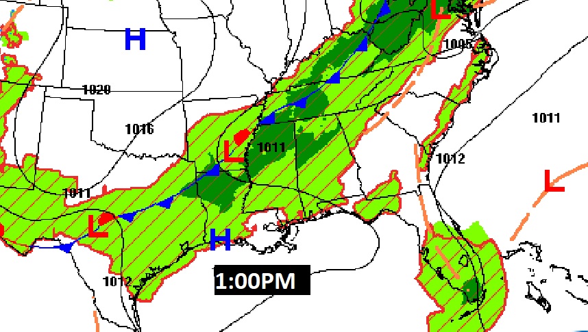
A southward moving front will be the culprit for thunderstorms in the state today.

SPC Has a Marginal Severe Risk for much of the state northwest of Montgomery. The main risk would be damaging wind gusts.
NEXT FEW DAYS: The weak front moves southward through the state, toward the coast Friday. Widely scattered storms. The air will be slightly drier on Saturday. Mostly sunny. High near 90. A few isolated random pop-up storms return Sunday through Wednesday. Typical, routine summer forecast.
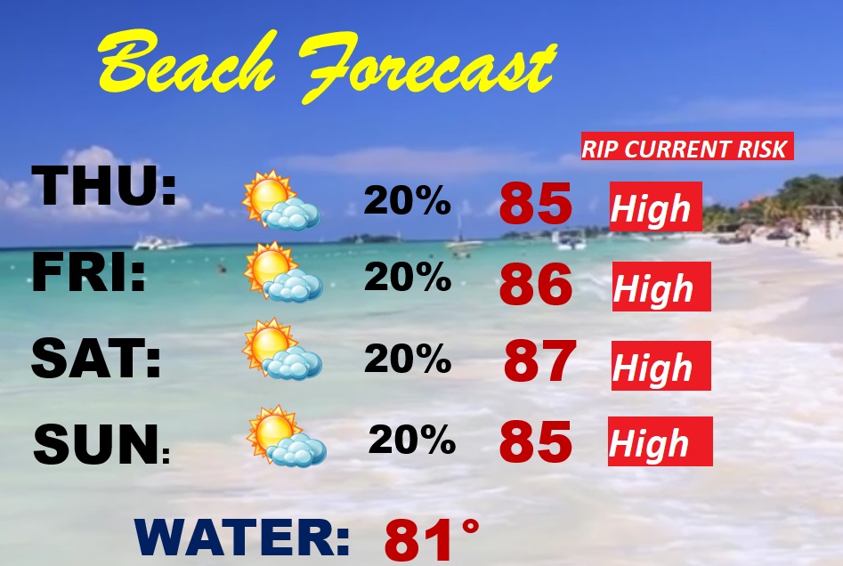
BEACH FORECAST: It’s a pretty routine summer-like forecast. Partly cloudy. Breezy & warm. Random, widely scattered afternoon & evening storms. Gulf water temperature at 81. High rip current risk, especially from Destin through Panama City.
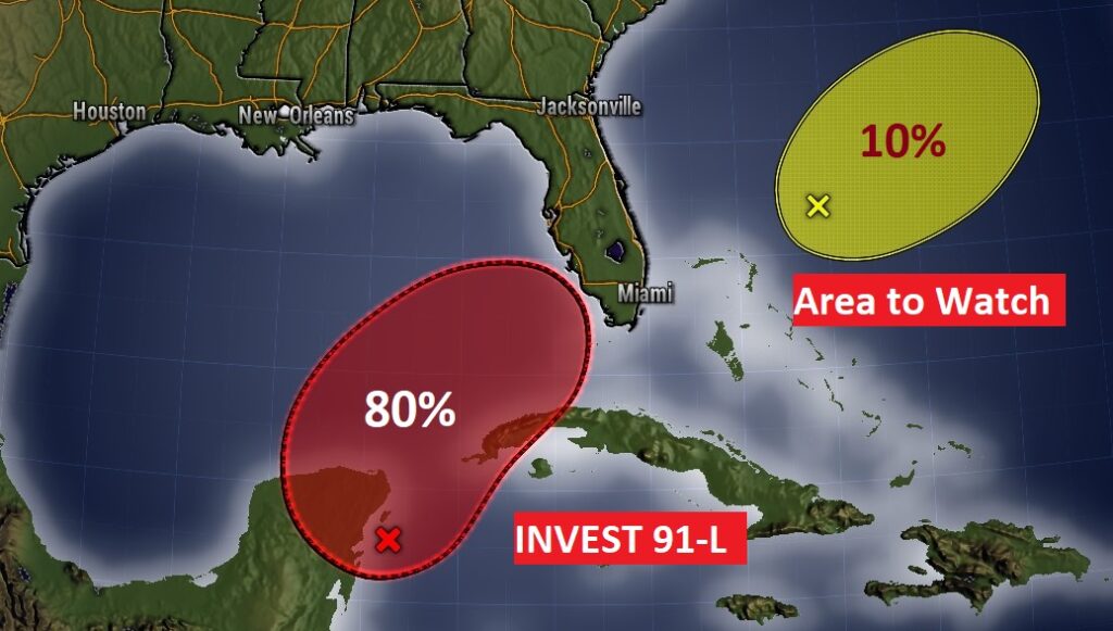
WATCHING THE GULF: The Remnants of Agatha (Invest 91-L) has a 80% chance of developing into a tropical cyclone near the Yucatan in the next 48 hours, before impacting south Florida.
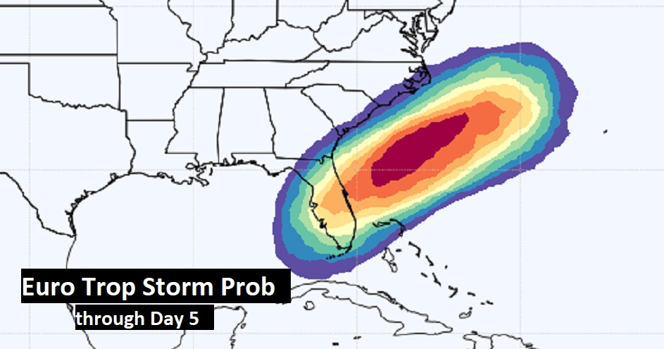
The Euro Tropical Storm Probability indicates this system could become Alex, if not over Florida, somewhere off the SE US coastline in the next 5 days,
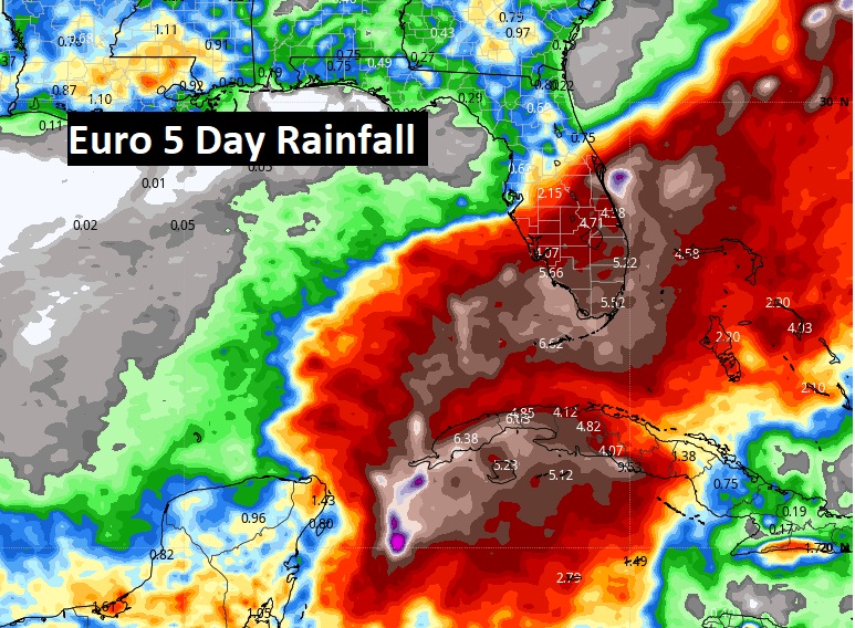
Excessive rainfall amounts will impact south Florida.
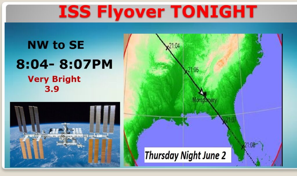
SPACE STATION (ISS) FLYOVER TONIGHT: If the clouds cooperate in your area, there will be an excellent Space Station Flyover tonight, flying from the NW sky to directly overhead to the SE Sky from 8:04 8:07 PM. Very bright at 3.9 magnitude.
—
Thanks for reading this Blog this morning!
This morning we are LIVE on the radio from 6 to 9 on NewsTalk 93.1. Watch us on TV on CBS 8 and ABC 32. I’ll have another update for you in the morning. Have a nice day.
–Rich