
1:30 PM UPDATE:
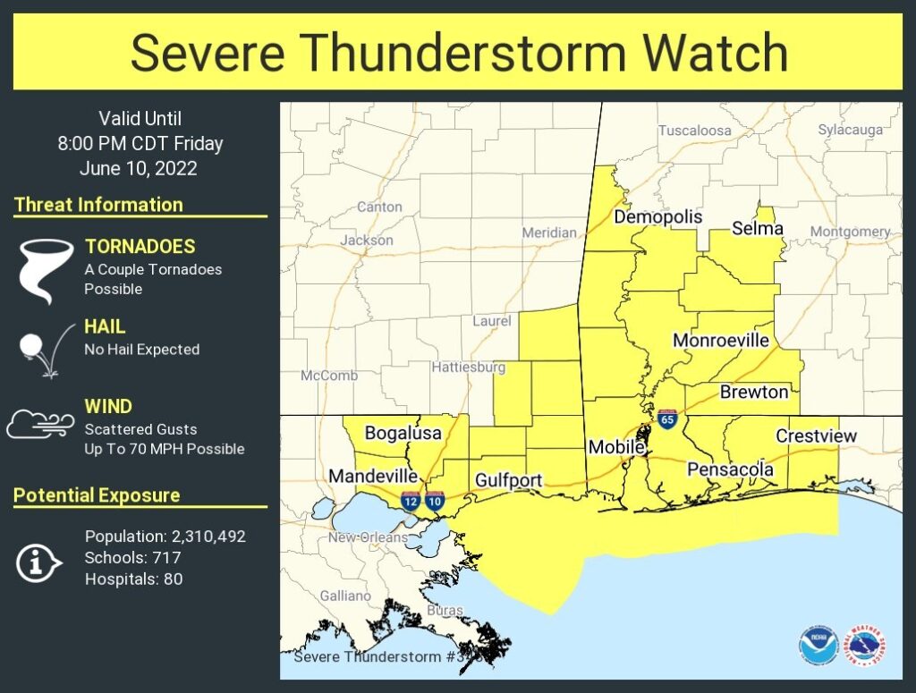
No big surprise here. A severe thunderstorm watch now covers much of west and SW Alabama, generally west of a Selma to Brewton line till 8PM. Damaging wind gusts to 70 mph are possible. A couple of tornadoes can’t be ruled out. The massive complex of storms in MS (MCS) continues sliding SE. #alwx
Good Morning! Here’s my brief video forecast discussion.
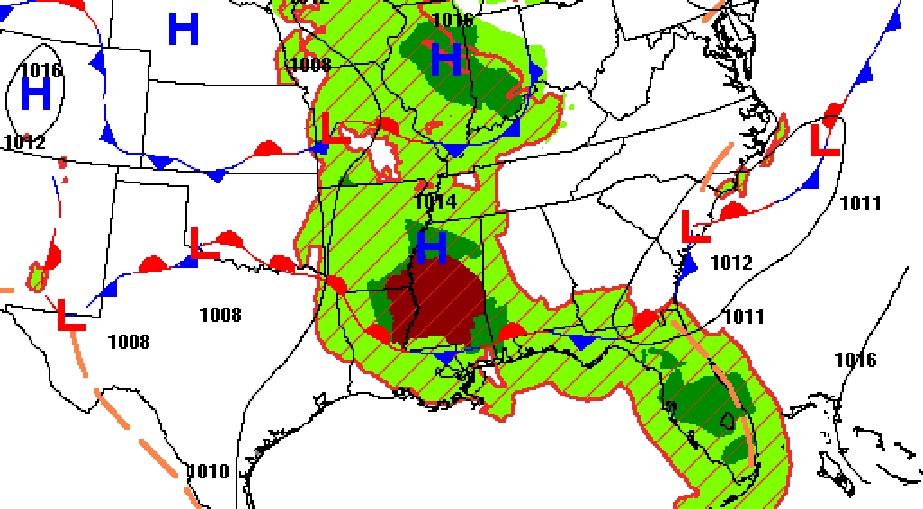
Today, that frontal system in south Alabama will be a big player.
TODAY: Hot & humid today. Sun/clouds High 92. Random, widely scattered this afternoon. Showers & thunderstorms this evening & tonight. A few storms could be strong. Overnight low near 72.
Radar will be rather quiet through the afternoon for most of us. Future radar shows that big complex/cluster of strong/severe storms west of us, travelling SE across Mississippi and into SW Alabama. Will it be a close miss for those of us in central Alabama? Maybe…. Here’s the HRRR model snapshots.
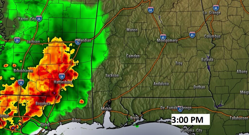
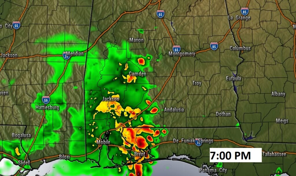
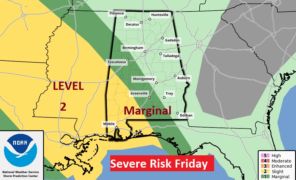
Some storms this could be strong possibly severe with damaging wind gusts especially west of I-65. Some of us are in the Marginal Severe risk. Southwest Alabama is in the Level 2 “slight risk” area. We’ll be radar-watching this evening.
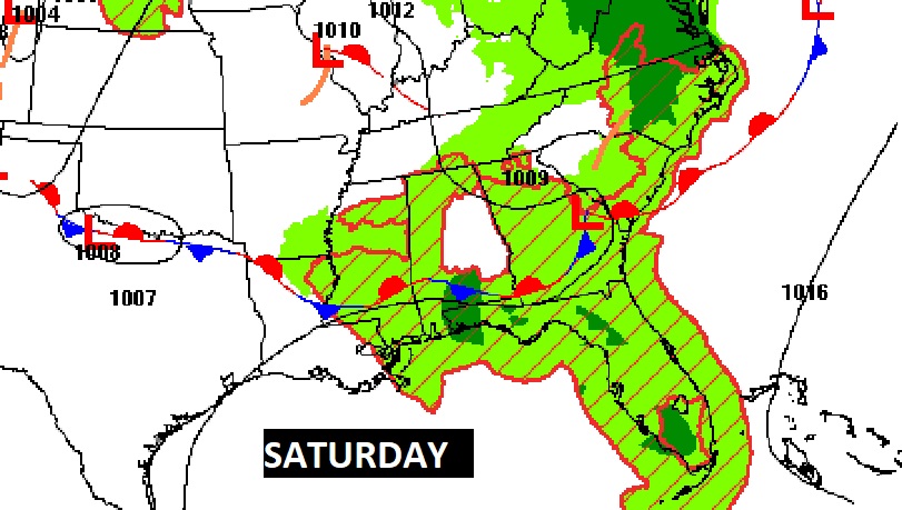
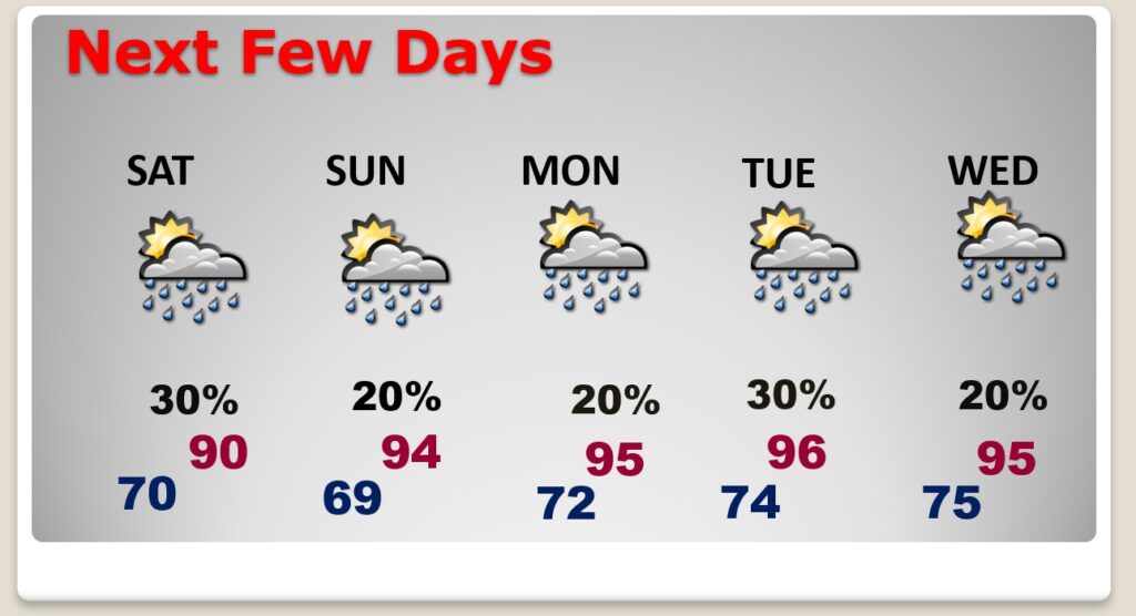
NEXT FEW DAYS: Scattered afternoon storms Saturday. Widely scattered storms Sunday through Wednesday. Hotter days ahead. Mid 90’s Monday through Wednesday. Triple digit heat index.
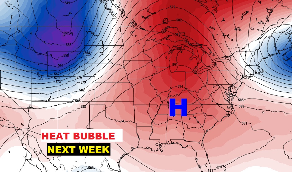
Are you ready for a June heatwave? Looks like a scorcher next week. Hottest week of the year so far. Get ready. A big upper level “Heat Bubble” will be in control.
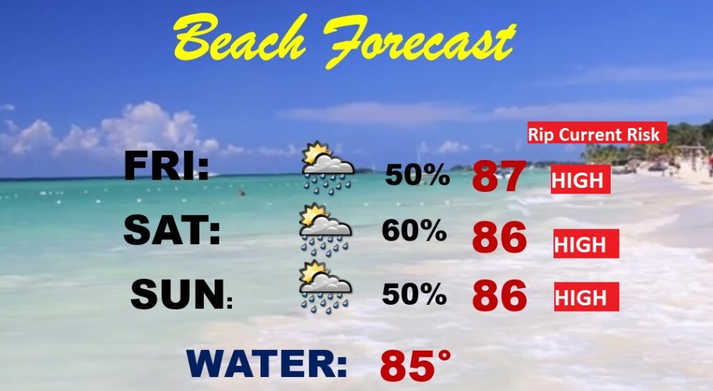
BEACH FORECAST: Not ideal. Stormy at times, through the weekend. Highs in the mid 80’s Gulf water temperature is at a season high of 85. Rip Current Risk HIGH , especially from Ft. Walton Beach/Destin through Panama City to Mexico Beach.
TROPICAL UPDATE: The tropics at the moment are quiet at the moment.
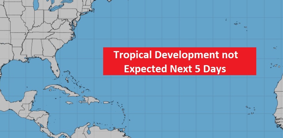
Models hint at Gulf Tropical Trouble over the next 10 days. We’ll see.
—
Thanks for reading this Blog this morning!
This morning we are LIVE on the radio from 6 to 9 on NewsTalk 93.1. Watch us on TV on CBS 8 and ABC 32. I’ll have another update for you in the morning. Have a nice day.
–Rich