
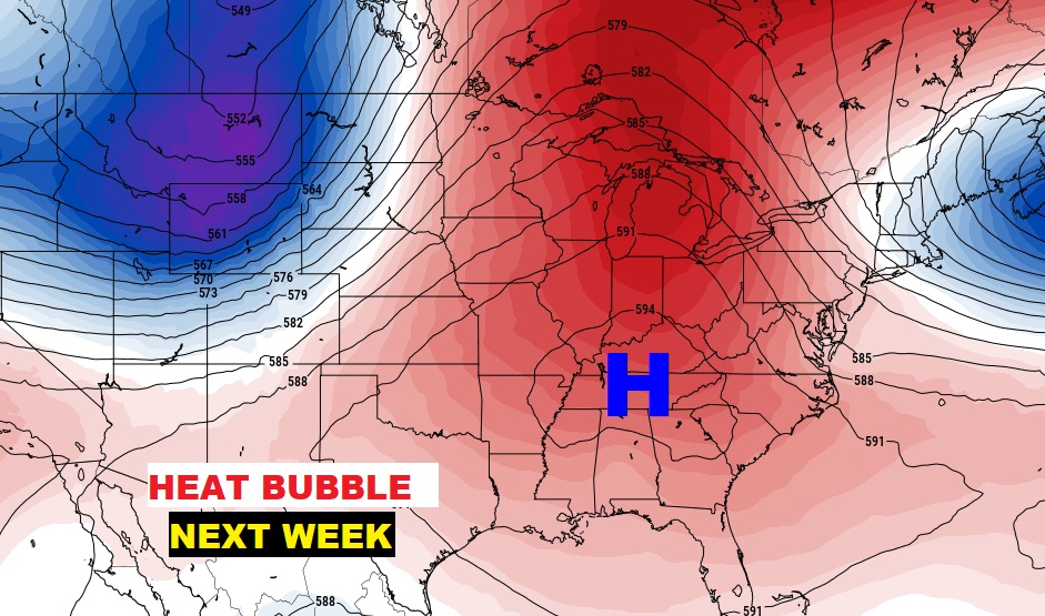
The big news, over the next few days, involves a Big June Heatwave next week. An upper level ridge of high pressure will lead to a series of days in the mid 90’s and triple digit heat indices. Get ready for a hot week.
The best news is….the tropics are quiet for now.
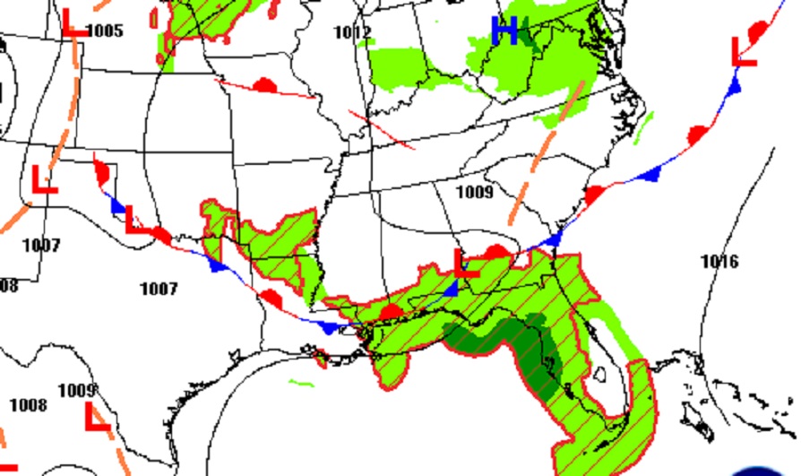
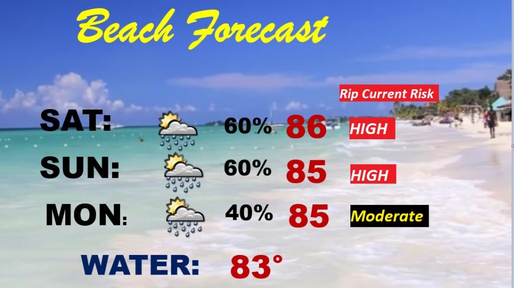
That front parked on the Gulf Coast will keep the better rain chance at the Beach this weekend.
TODAY Fairly routine. Good bit of sun, mixed with clouds. Hot day. High near 90. Rain chance fairly small. Widely spaced random showers and storms in the afternoon & evening hours. Tonight’s Low 72. Light wind.
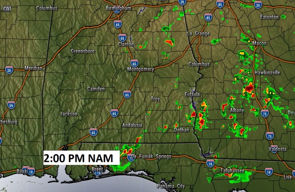
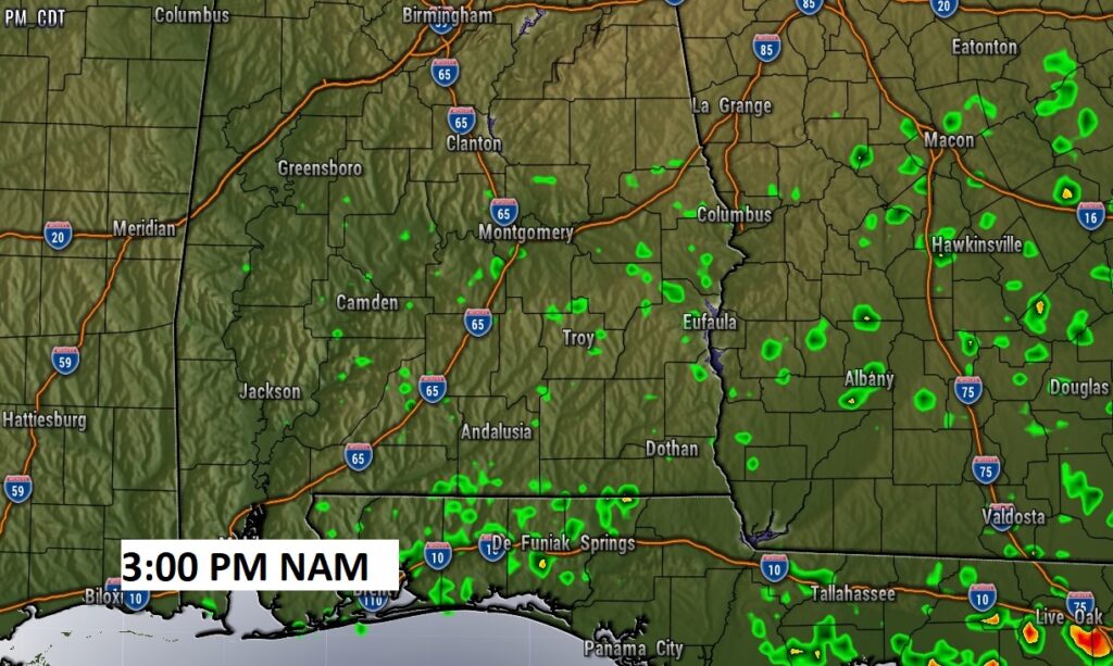
Here’s a couple of Future Radar snapshots this afternoon. Storms should be few and far between.
SUNDAY: Very similar to Saturday. Only isolated random storms. Hot day. High 94.
NEXT FEW DAYS: Only isolated, mainly widely scattered, random afternoon and evening storms for the next several days.
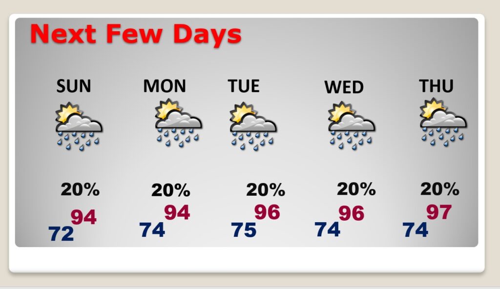
Hotter days are on the menu. Mid 90’s heat Monday through Wednesday. Perhaps upper 90’s on Thursday. Heat index will be in the triple digits.
Up at 18,000 feet, here’s the Upper Level Heat “bubble” that will dominate the week ahead.
BEACH FORECAST: A little stormy at times, with a front parked near the coast. Showers and thunderstorms at times. Highs in the 80’s. Gulf water temperature 83. High rip current risk through Sunday, especially from Destin eastward.
TROPICAL OUTLOOK: For now, the Atlantic, the Caribbean and the Gulf of Mexico are quiet for now.
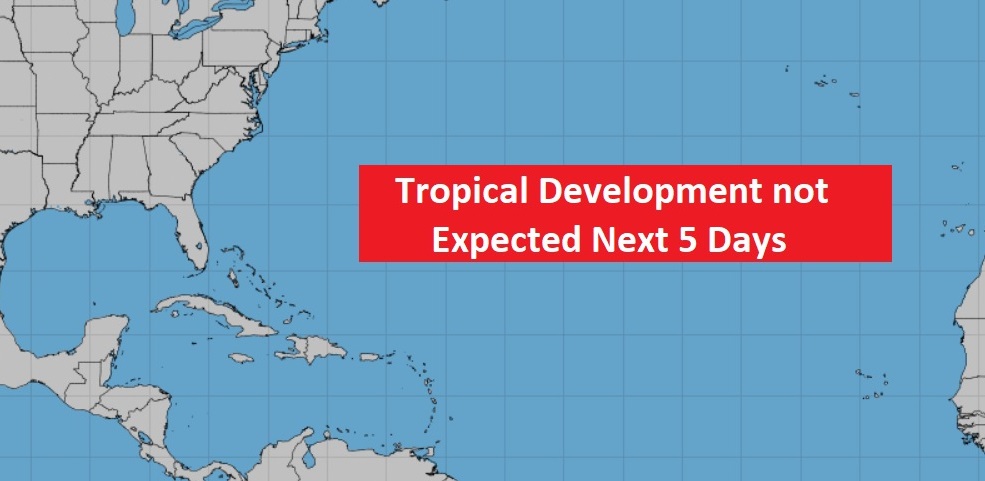
We’ll continue to monitor the future potential of tropical activity in the Caribbean and Gulf in the next 10 days.
—
I’ll have another Blog update in the morning. Have a nice weekend!
–Rich