
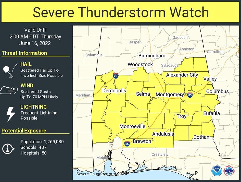
SEVERE THUNDERSTORM WATCH…7:30 PM Update:
Very Stormy night ahead. Severe thunderstorm Watch until 2AM. Damaging wind gusts too 70 mph possible. Hail possible up to to 2” in diameter. #alwx
Good Morning! Here’s my brief video forecast discussion.
CLIMATE DATA: Yesterday’s high was 99, just shy of the record high of 100 from 1963. Heat index got to an excessive 110. Normal High 92, Low 69. Today’s record high is 100 from 1881. Tuesday was the hottest day since 10/4/2019. The hottest temperature all last summer was 97.
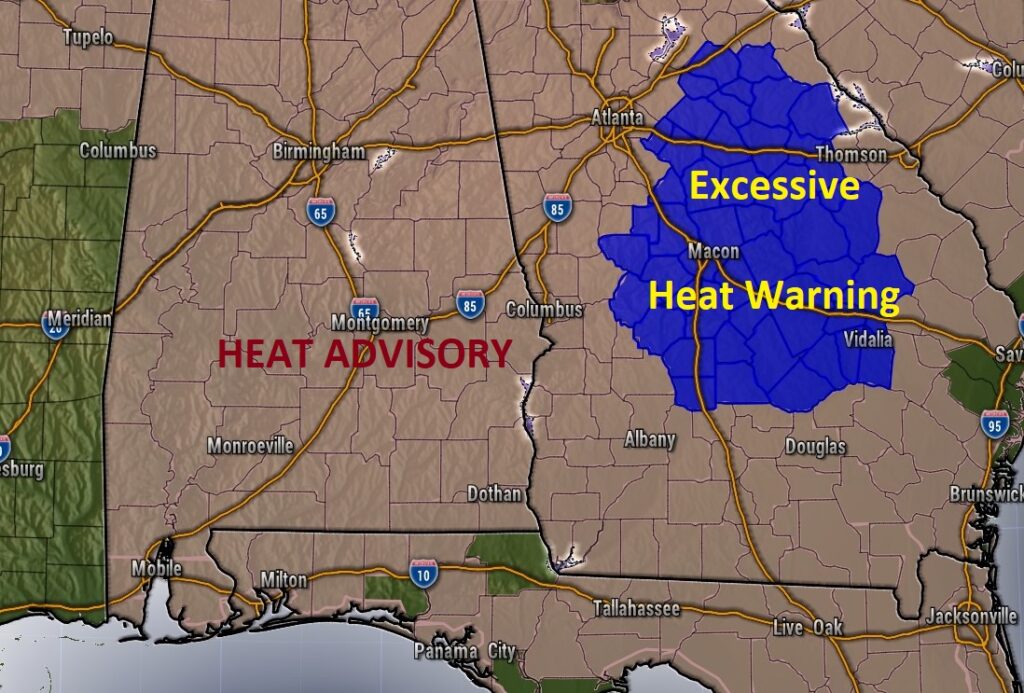
TODAY: HEAT ADVISORY still in effect. Hot & humid again today. Dangerous heat. Sun/clouds. High 98. Heat index could be as high as 107 or higher. That’s the danger zone. Stay hydrated. Scattered this afternoon. Level 2 Severe Weather Risk today. A few warnings area a good bet. The main risk would be damaging wind gusts, like yesterday. Storms fade out overnight. Very humid tonight. Low 76.
Heat Advisory Remains in effect today over a multi-state area. Heat index could reach 105 to 108. Higher in some spots. DANGEROUS HEAT….
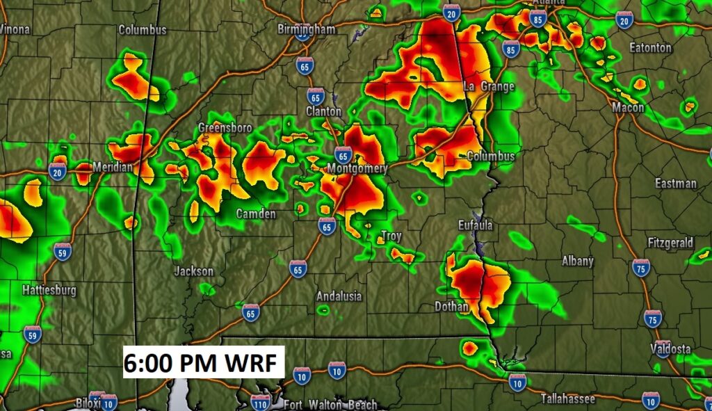
Radar should be quite active again today. Big heat produces Big Storms. Once again today, there will be a few monster thunderstorms roaming around. Our Weather App will keep you on top of the action. Here’s a Future Radar sample snapshot at 6PM.
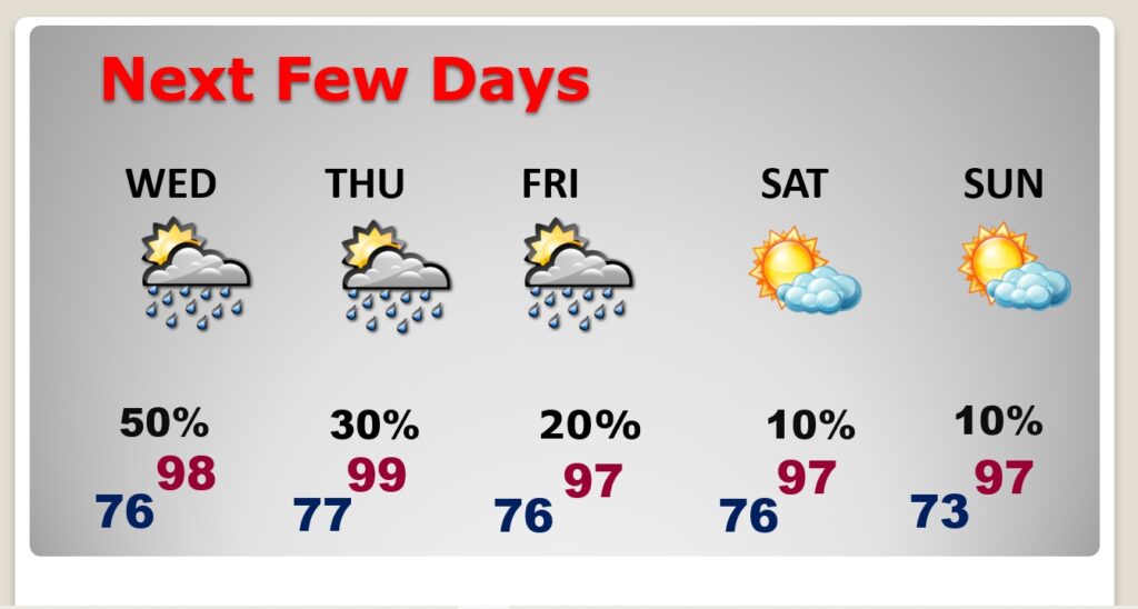
NEXT FEW DAYS: Dangerous heat. The Heat Index each day will be near or above the 105 danger range. Highs in the mid to upper 90’s. Random scattered storms in the afternoon & evening hours. Very little day to day change. So far the weekend looks relatively dry and very hot. Rain chances over the weekend about 10%.
.
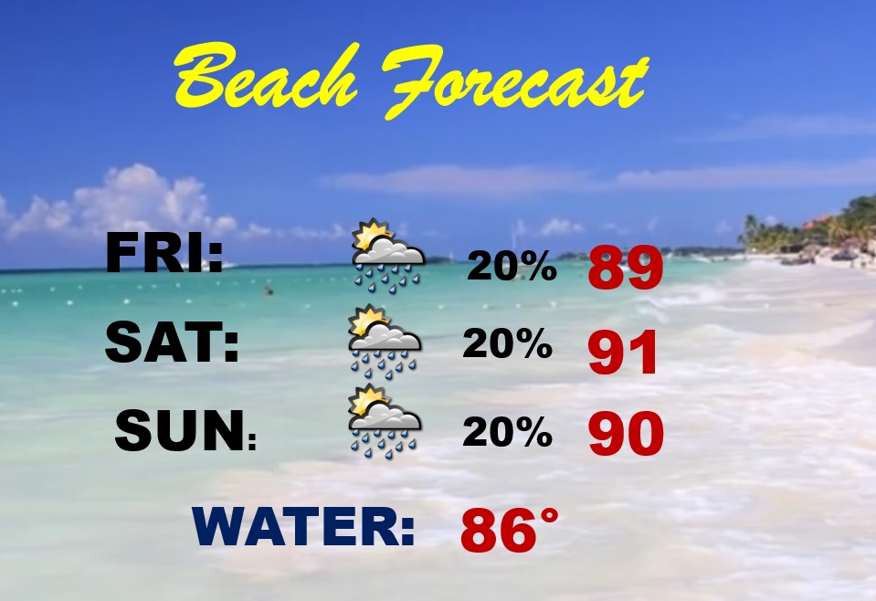
BEACH FORECAST: Highs this weekend upper 80’s to near 90. Spotty random thunderstorms. Gulf Water 85. High Rip Current risk… especially from Destin to Panama City. Be careful. Watch the flags on the Beach.
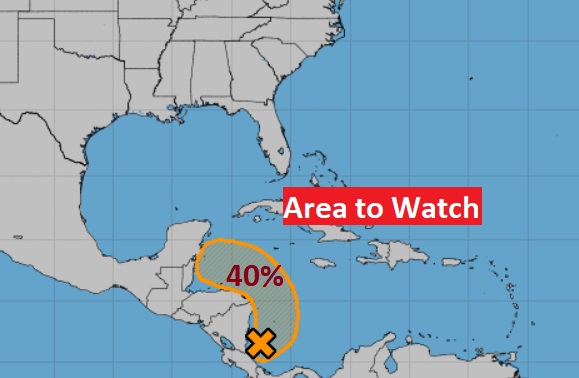
TROPICAL UPDATE: Area to Watch in the western Caribbean is now INVEST 93-L. No Change. NHC has a medium 40% chance of development next 5 days.
—
Thanks for reading this Blog this morning!
. I’m at the American Meteorological Society Conference in Milwaukee — Listening and learning. Have a great day! I’ll have another update for you in the morning from Milwaukee. I’ll have a blog update for you every morning. And, of course, you’ll still here my daily updates on the 8 station Bluewater Broadcast group.
–Rich