
Good Morning! Here’s my brief video forecast discussion.
CLIMATE DATA: Yesterday’s high was 100, which tied the record high of 100 from 1881. Heat index got to an excessive 113. Normal High 92, Low 69. Airport had .04”, but recorded a 51 mph wind gust in the storm. Today’s record high is 100 from 1911 and 1881. Let’s hope we don’t get to the record. We’ll be close.
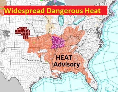
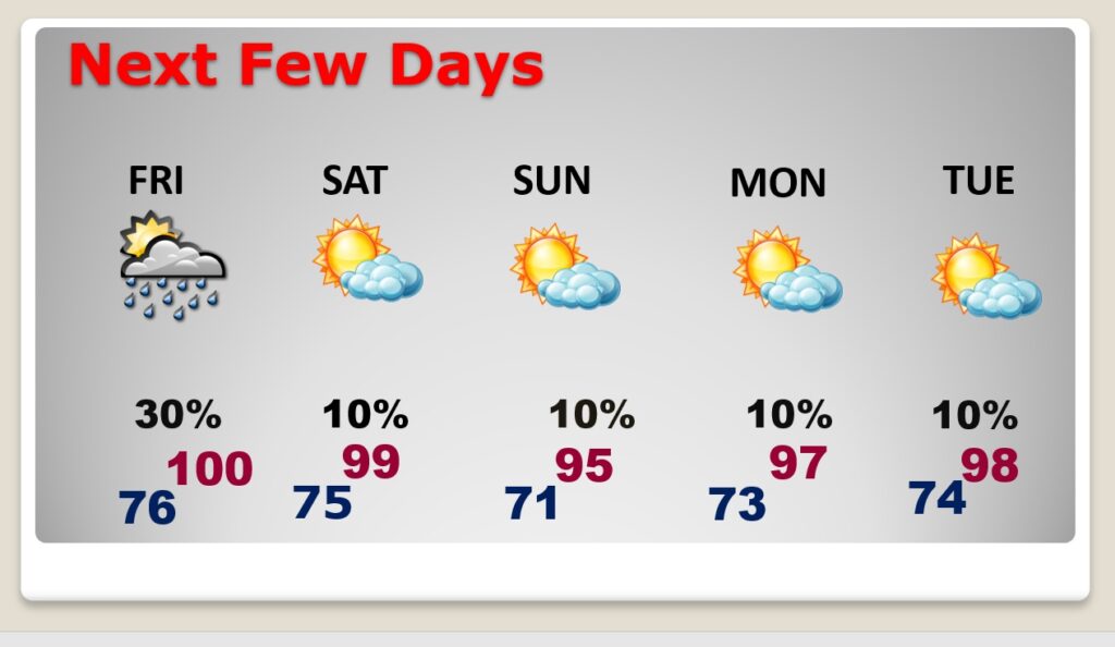
TODAY: HEAT ADVISORY still in effect (through Friday). Hot & humid again today. Dangerous heat. Sun/clouds. High 98 too 100. Heat index could be as high as 107-111. Scattered this afternoon and this evening . Not as many as yesterday. A few stronger storms, once again, are not out of the question. Storms fade out overnight. Very humid tonight. Low 76.
Heat Advisory Remains in effect today (through Friday) over a multi-state area. Heat index could reach 105 to 108.
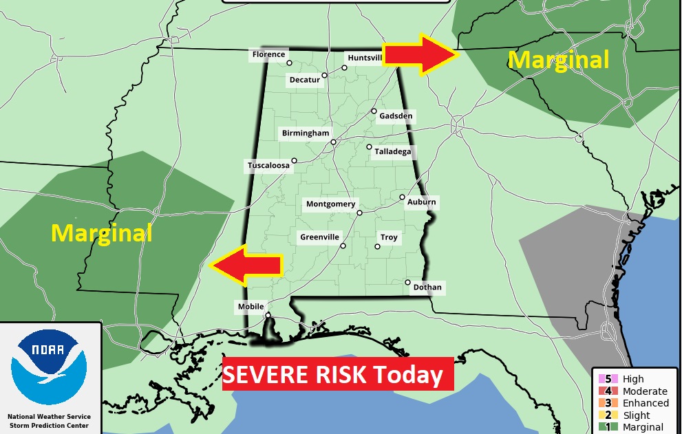
The Models are not quite aggressive on storms coverage. But, in this kind of heat… A few stronger storms, once again, are not out of the question. So Far SPC does not have us in a Severe Weather Risk zone. We’ll see if they change there mind later.
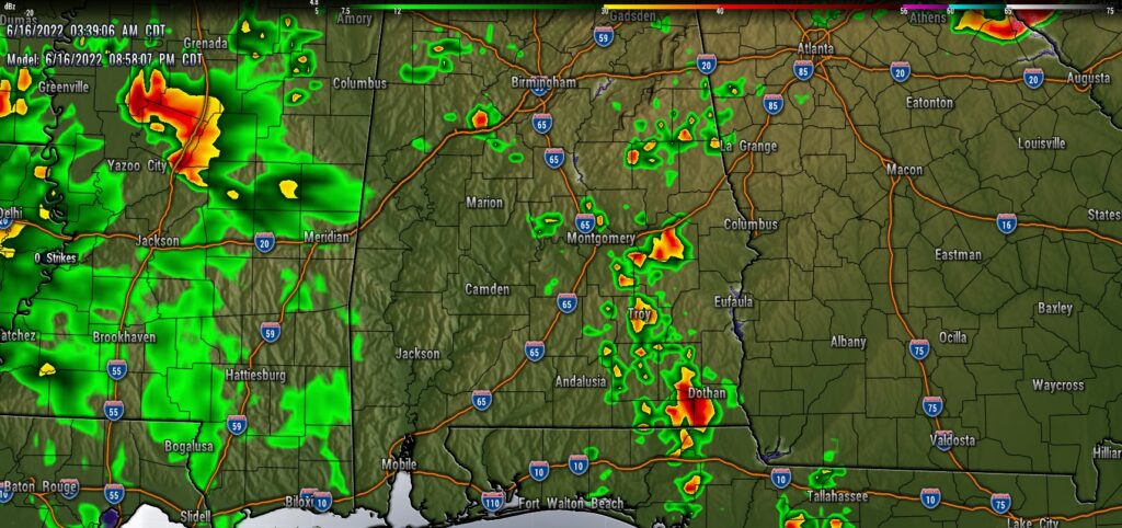
Here’s a model example. This is the WRF model at 8:30 PM…showing another westward moving cluster of storms.
NEXT FEW DAYS: The Heat Advisory remains in effect at least through Friday. More dangerous heat indices. We’ll be in record high territory again today and Friday. Excessive heat continues this weekend, but the dewpoint may come down just a bit. . Rain chances over the weekend about 10%. Looking to next week…OUCH.. More Heat. A couple days could be in the low 100’s by next Wednesday & Thursday.
.
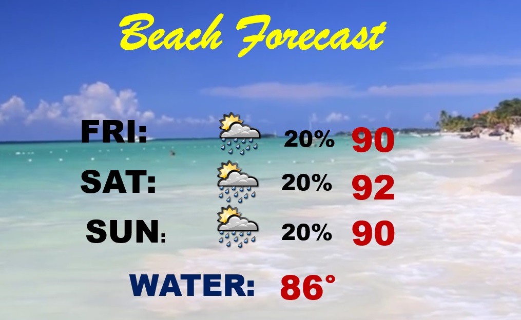
BEACH FORECAST: Highs this weekend 90 to 92. Spotty random thunderstorms. Gulf Water 86. High Rip Current risk… especially from Destin to Panama City. Be careful. Watch the flags on the Beach.
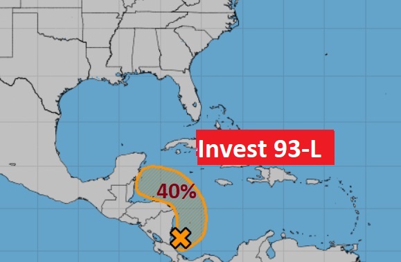
TROPICAL UPDATE: NHC is monitoring Invest 93-L in the NW Caribbean. They now give this system a 20% of development next 5 days as it heads toward the SW Gulf. Rest of the tropics are quiet.
—
Thanks for reading this Blog this morning!
. I’m at the American Meteorological Society Conference in Milwaukee — Listening and learning. Have a great day! I’ll have another update for you in the morning from Milwaukee. I’ll have a blog update for you every morning. And, of course, you’ll still here my daily updates on the 8 station Bluewater Broadcast group.
–Rich