
Good Morning! Here’s my brief video forecast discussion.
CLIMATE DATA: Yesterday’s high was 100, which tied another record. Heat index got to an excessive 112. Normal High 92, Low 69. Today’s record high is 101 from 1944. Today’s record is probably safe. The airport had a TRACE of rain. I had .03″ at my house in East Montgomery.
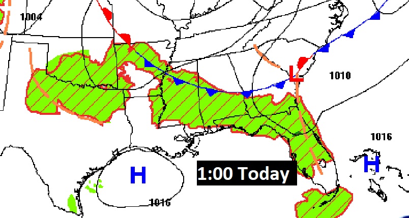
TODAY: HEAT ADVISORY still in effect, Day 6 . Hot & humid again today. Sun/clouds. High 98 to near 100. Heat index could be as high as 107. Widely scattered this afternoon and this evening. (only abut 20% coverage). Storms fade out this evening. Partly cloudy tonight. Low 72.
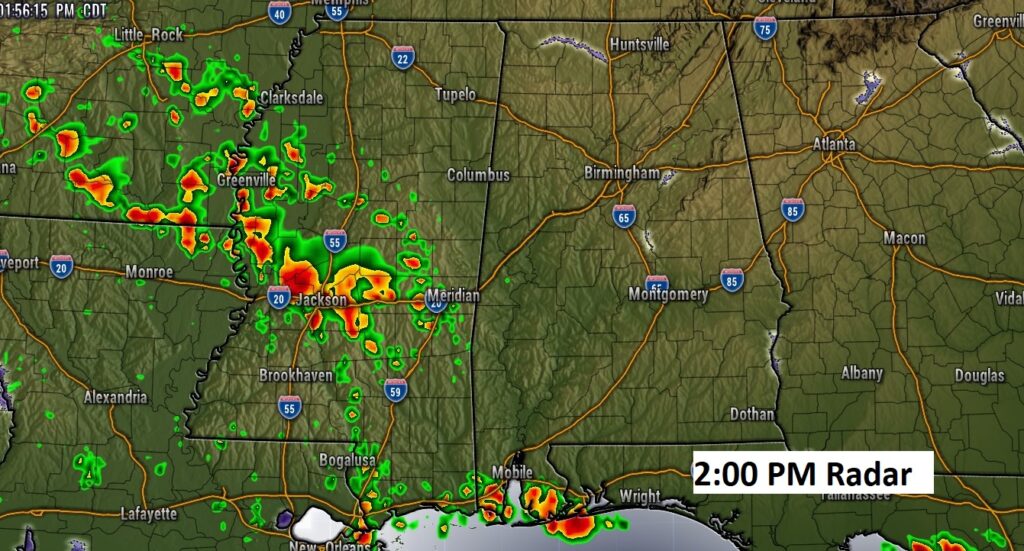
Here’s a model example. This is the WRF model at 2:30 PM. It shows the most likely corridor of strong thunderstorms will stretch across Mississippi into coastal Alabama.
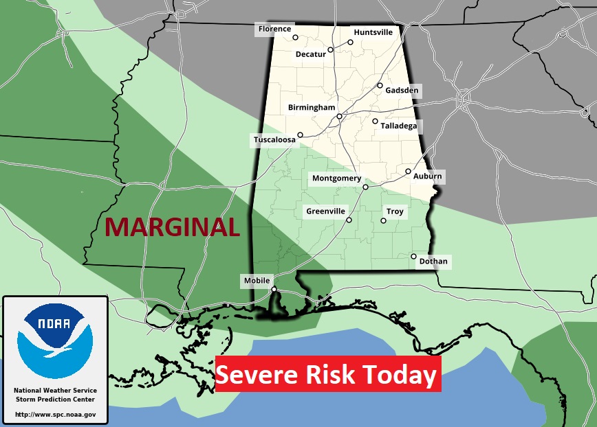
SPC agrees. It has a Marginal Severe Risk stretched across Mississippi into coastal Alabama.
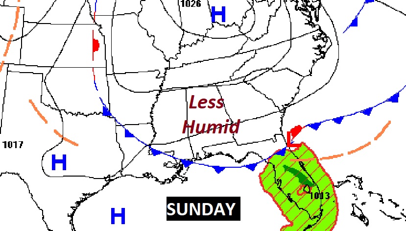
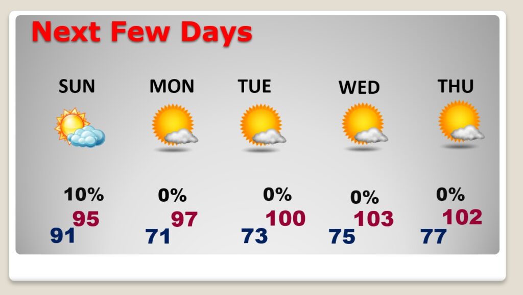
NEXT FEW DAYS: Excessive heat continues this weekend, but the dewpoint may come down just a bit. Rain chances over the Should be dry. Rain chance under 20% Looks like 100+ degree temperatures Tuesday through Thursday.
.
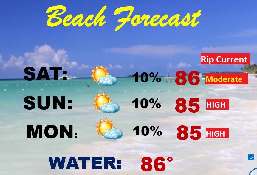
BEACH FORECAST: Hot & humid. Highs this weekend 90 to 92. Spotty random thunderstorms. Gulf Water 86. Moderate Rip Current risk… especially from Destin to Panama City. Be careful. Watch the flags on the Beach.
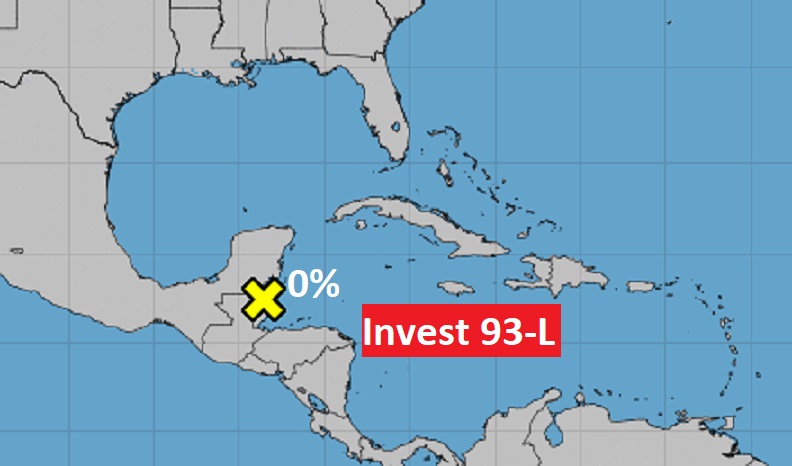
TROPICAL UPDATE: Tropics are quiet this morning. NHC has declared Invest 93-L dead…with a 0% chance of development.
—
Thanks for reading this Blog this morning!
I’ve been at the American Meteorological Society Conference in Milwaukee all week. I return home Today. Stay cool. Have a great day! I’ll have another update for you in the morning from back home in Montgomery, reunited with my dog Chase!
Pre-dawn here in Milwaukee. In the 50’s with low humidity. North wind at 10.

–Rich