
Good Morning! Here’s my brief video forecast discussion.
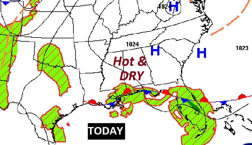
TODAY: Last day of Spring, today. The Summer Solstice is tomorrow. Sunshine will dominate today. It’ll be hot, but like yesterday, fairly tolerable humidity levels, compared the last week. Last week dewpoints were in the mid 70’s. Today dewpoints will be in the lower 60’s. East wind at 5 to 10 mph. Mainly clear tonight. Low 71.
SUMMER BEGINS TUESDAY: Tuesday is the summer Solstice. Summer begins at 4:13 AM CDT. Technically, it’s the longest day of the year. 14 hours, 16 minutes and 36 seconds long. But, it’s only one second longer than today. Wednesday will be one second shorter than Tuesday.

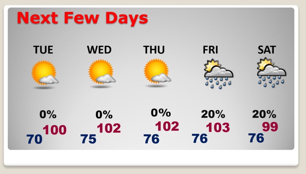
NEXT FEW DAYS: We should be dry through Thursday. We have a shot at record highs each day today through Friday. Near 100 Tuesday, on the first day of summer. Low 100’s Wednesday & Thursday. Widely scattered PM storms return to the forecast Friday & Saturday. We have a shot at perhaps 103 on Friday, with higher humidity.
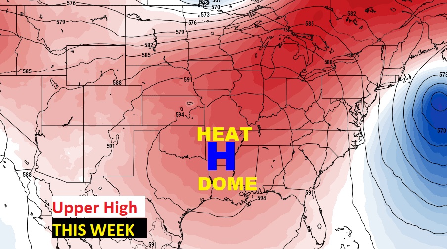
A huge Upper Level High will act as a heat dome, centered over the lower Mississippi valley.
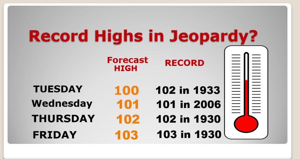
Record Highs are in jeopardy for the rest of this week.
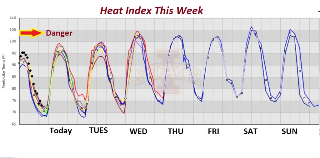
This week won’t be as awful as last week on the Heat Index. Generally, most days we should be under the 105 danger level. Hot for sure. But just not as excessive as last week.
.
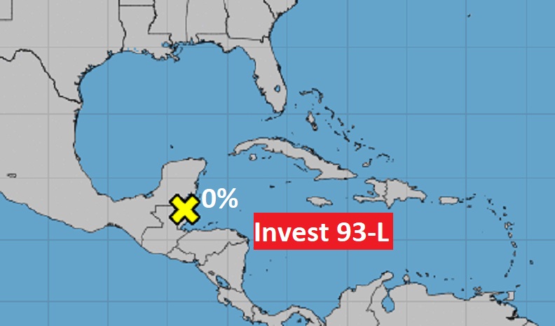
TROPICAL UPDATE: Tropics are quiet this morning. But, for how much longer?
—
Thanks for reading this Blog this morning! This morning we are LIVE on the radio from 6 to 9 on NewsTalk 93.1. Watch us on TV on CBS 8 and ABC 32. I’ll have another update for you in the morning. Have a nice day.
–Rich