
Good Morning! Here’s my brief video forecast discussion.
CLIMATE DATA: We blew away the record high in Montgomery Thursday. The record was 102 from 1930. Yesterday’s high in Montgomery was 104°. Hottest day since 2007. Heat index reached 106. Normal high 92. Today’s record time is 103 from 1930. We’ll be in the neighborhood.
TODAY: HEAT ADVISORY again. Near record heat, again today . Sunshine mixed with clouds I have the rain chance at 20% or less. The record for today is 103 from 1930. The Heat index will be near the 105 danger range today. Light wind. Mainly clear tonight. Low 76.
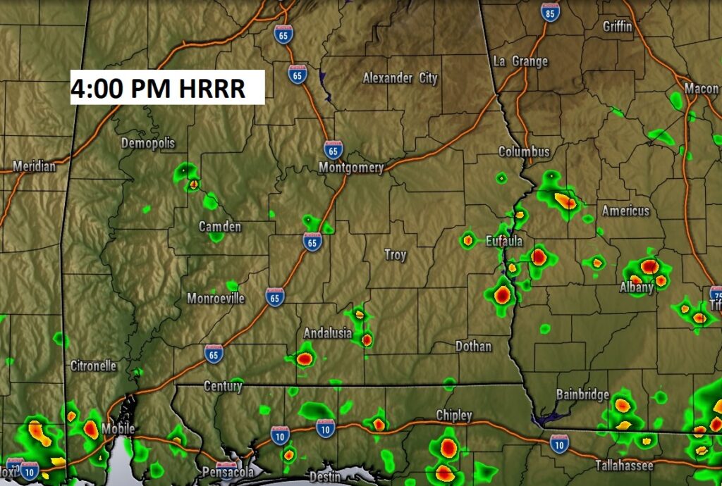
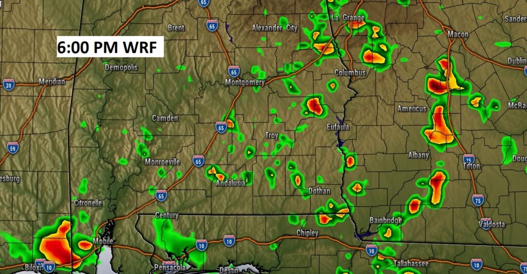
There will be a few Random Isolated storms around. Here’s an example of two hi-res models late this afternoon/early this evening.
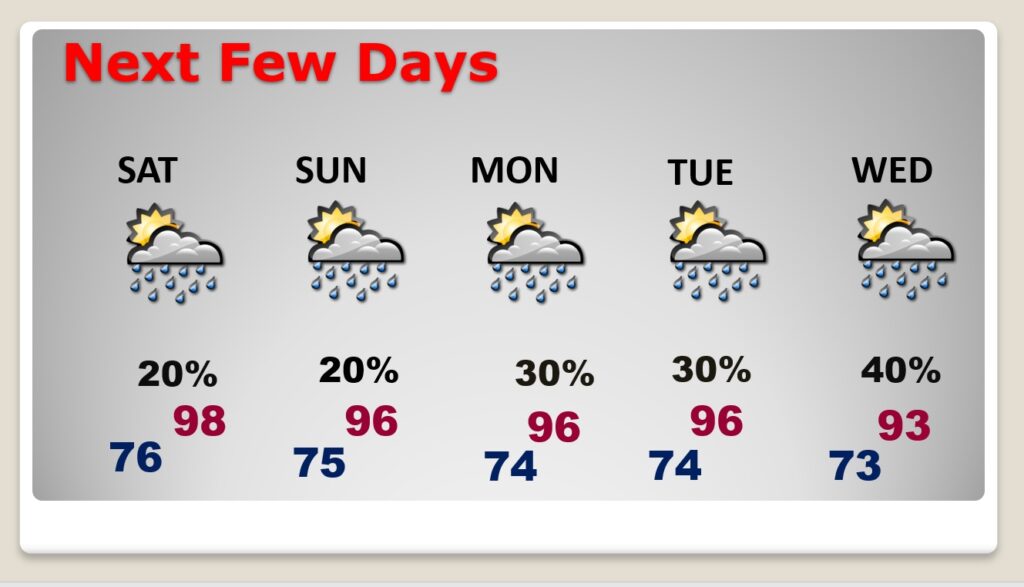
NEXT FEW DAYS: The excessive heat continues. Upper 90’s Saturday. Near 96 Sunday through Tuesday. Triple digit heat index continues. Widely scattered PM storms return to the forecast Friday and through the weekend. Scattered storms…better odds, Monday through Wednesday.
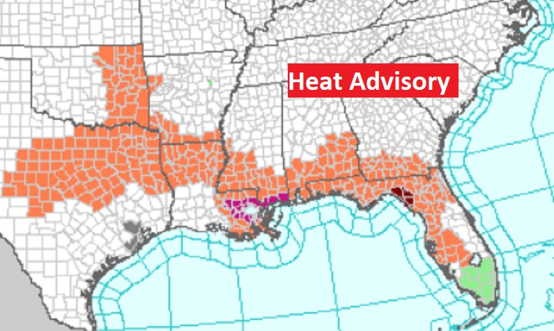
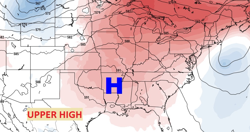
For the Third Day in a row… Heat Advisory stretches across the Deep South.
The upper level Heat Dome High, is not as strong, but it’s still KING.
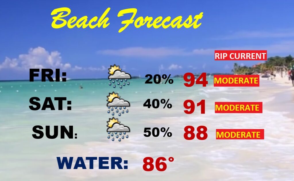
BEACH FORECAST: A tropical Low in the northeast Gulf will help enhance the risk of a few thunderstorms over the weekend. Highs mostly upper 80’s into the low 90’s. Very humid. Gulf Water Temp. 86. Watch the flags on the Beach. Moderate Rip Current Risk.
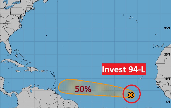
TROPICAL UPDATE: There’s a new disturbance in the Tropical Atlantic. NHC says Invest 94-L has a 50% chance of development in the next 5 days. We’re watching.
—
Thanks for reading this Blog this morning! This morning we are LIVE on the radio from 6 to 9 on NewsTalk 93.1. Watch us on TV on CBS 8 and ABC 32. I’ll have another update for you in the morning. Have a nice day.
–Rich