
Good Morning! Yesterday was an active day on the radar. Lots of showers & storms. Today will be a rather routine summer day with widely scattered random storms. The heat index will be in the triple digit range. Not much day to day change in the week ahead. Random Scattered PM storms will be much more numerous in the week ahead. More storms to go around. We’re keeping on two systems in the tropics, too.
CLIMATE: Did you get rain at your house yesterday? Many folks did. The airport officially had 0.00. I had .55″ in East Montgomery. Yesterday’s high was 96, after a morning low of 76. Normal 93 and 71. Sunrise this morning is 5:41, Sunset 7:56.
TODAY: Routine. Sun/cloud mix. Hot & humid. Mid 90’s. Widely Scattered afternoon & evening storms. (Not as many storms on radar than yesterday. East wind at 5 to 10. Tonight’s low 74.
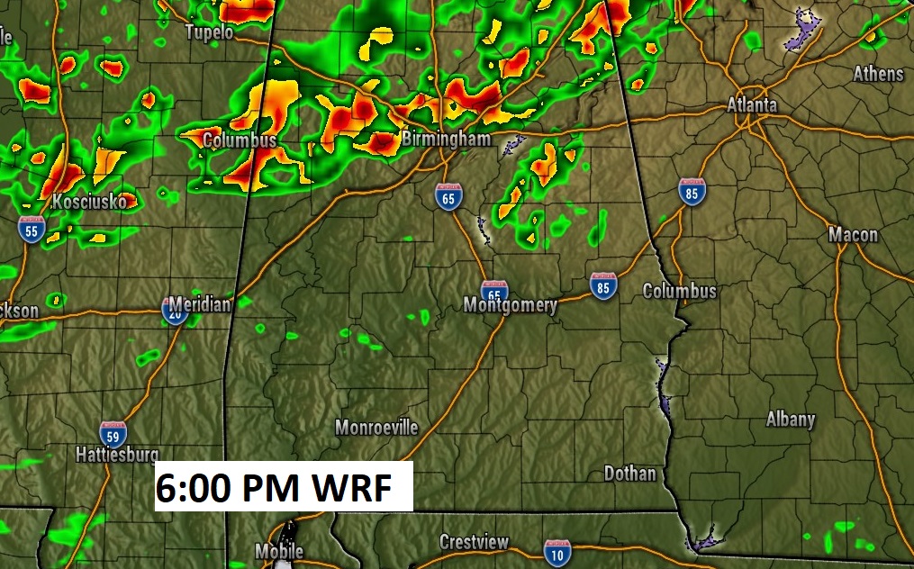
Here’s an example of Future Radar examples Late this afternoon.
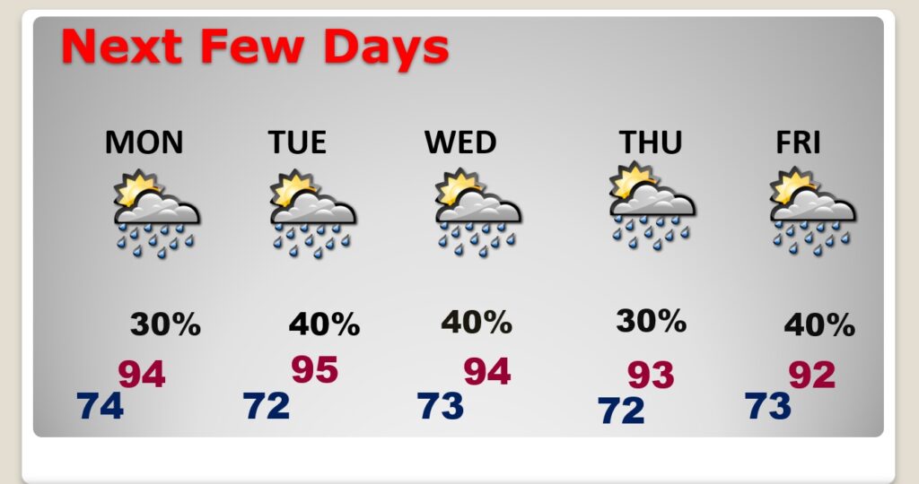
NEXT FEW DAYS: Close to summertime normal. Scattered afternoon and evening storms will be more numerous in the week ahead..
.
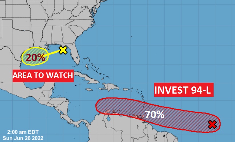
TROPICS: Invest 94-L in the tropical Atlantic has the best chance of becoming Tropical Storm Bonnie over the next 5 days. In fact, NHC now give it a 70% chance of development. It could become a depression by early week and eventually Tropical Storm Bonnie.
There’s also an Area to Watch in the NW Gulf. It has a 20% chance of development. in the next 5 days.
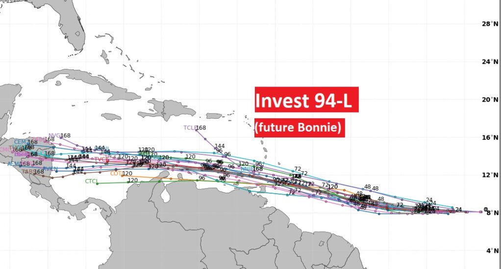
Models agree on 94-l’s future movement at a particularly lower latitude.
.
I’ll have another update for you in the morning. Have a nice Sunday!
–Rich