
Good Morning! Here’s my brief video forecast discussion.
TODAY: Hot & humid today. High 93. Scattered Random showers & thunderstorms today, most numerous in the afternoon & evening hours. Feast or famine. Some towns will get no rain at all. Other towns will get very heavy rain. Low tonight 72
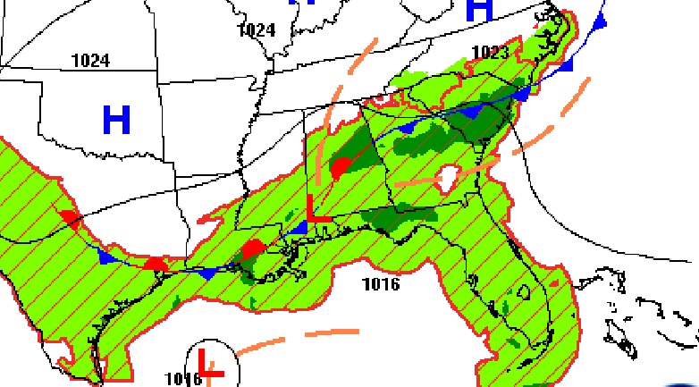
A stalled front will be the focus for increased storms today.
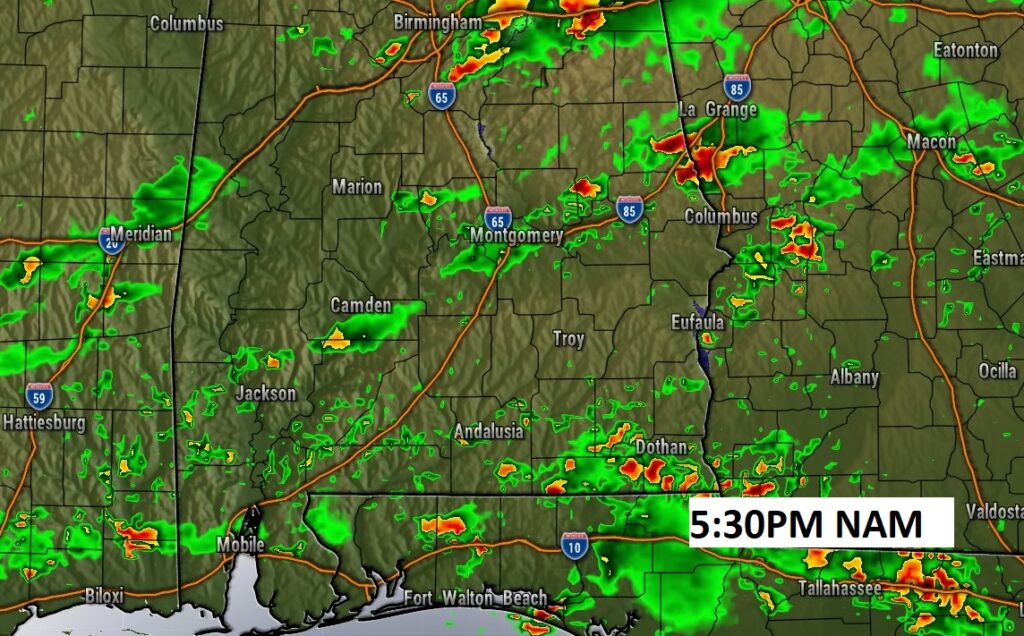
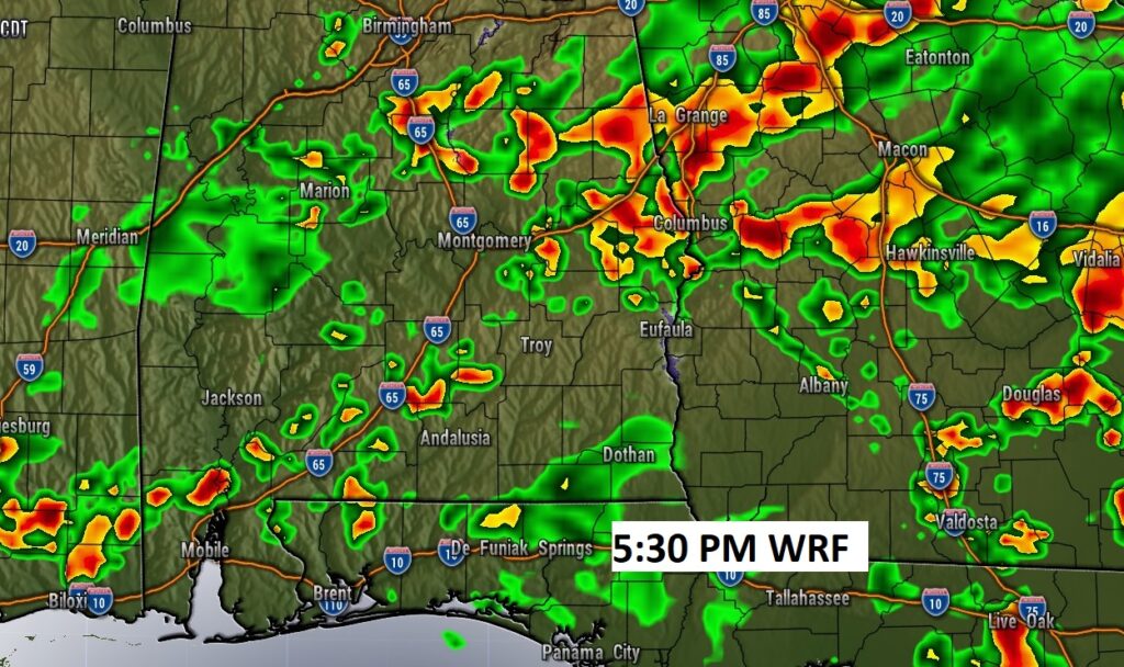
Here’s a couple of Future Radar examples around 5:30 PM today…just to show you potential coverage and how each models has a different take.
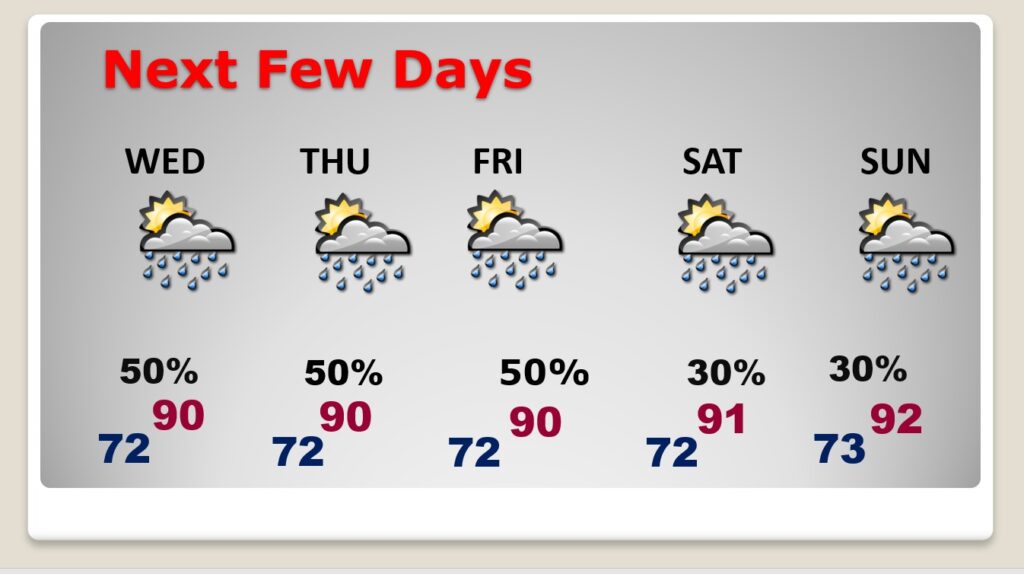
NEXT FEW DAYS: Very little day to day change. Hot & humid. Highs mostly 89-92. Scattered Random showers & thunderstorms, most numerous in the afternoon & evening hours. A couple could be quite strong. Some towns will get no rain at all. Other towns will get very heavy rain. Not much change through Saturday.
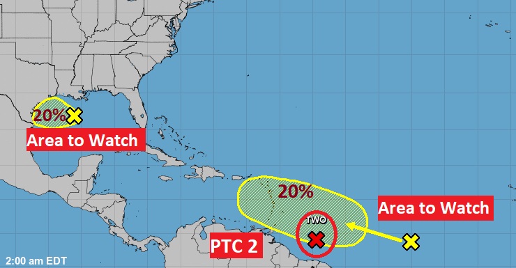
TROPICAL UPDATE: NHC is tracking two Area’s to Watch. But, the star of the show is Potential Tropical Cyclone Two. This system could become Tropical Storm Bonnie by this evening. It could reach Hurricane status in the west Caribbean.
Almost every model keeps this system moving westward at a very low latitude.
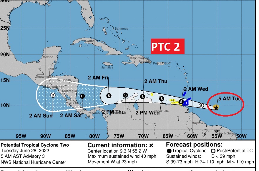
If you want to get more into the meat and potatoes of the details, here’s the forecast discussion from NHC on PTC 2….Future Bonnie.
https://www.nhc.noaa.gov/text/refresh/MIATCDAT2+shtml/280239.shtml?
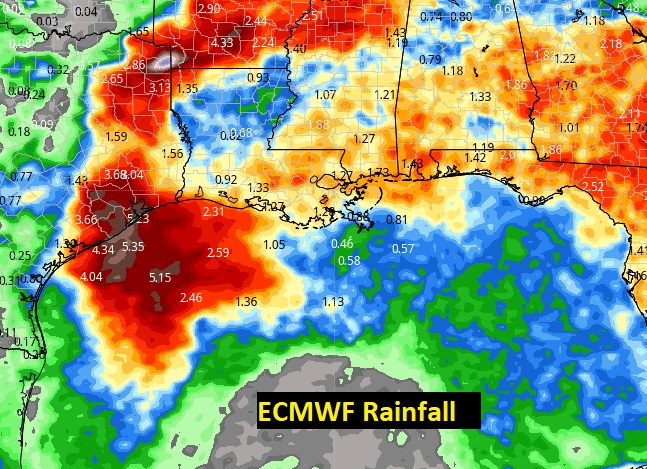
The system in the Gulf could be a big rain maker for Texas.
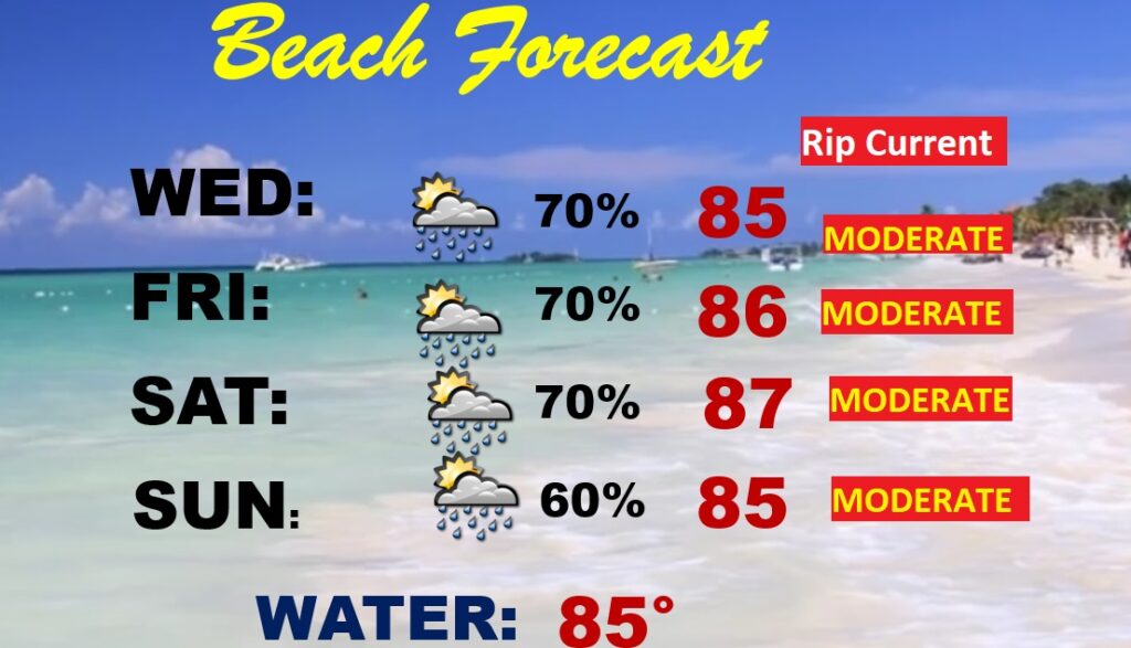
BEACH OUTLOOK: Unfortunately you may have to dodge raindrops at times this week down on the coast. The better than normal rain chance will stick around well into the 4th of July weekend. Moderate Rip Current Risk especially from Destin east to Panama City.
—
Thanks for reading this Blog this morning! This morning we are LIVE on the radio from 6 to 9 on NewsTalk 93.1. Watch us on TV on CBS 8 and ABC 32. I’ll have another update for you in the morning. Have a nice day.
–Rich