
Good Morning! Here’s my brief video forecast discussion.
TODAY: Hot & humid, again today. High near 90. Scattered Random showers & thunderstorms today, most numerous in the afternoon & evening hours. Feast or famine, again. Some towns will get no rain at all. Other towns will get very heavy rain. Low tonight 72
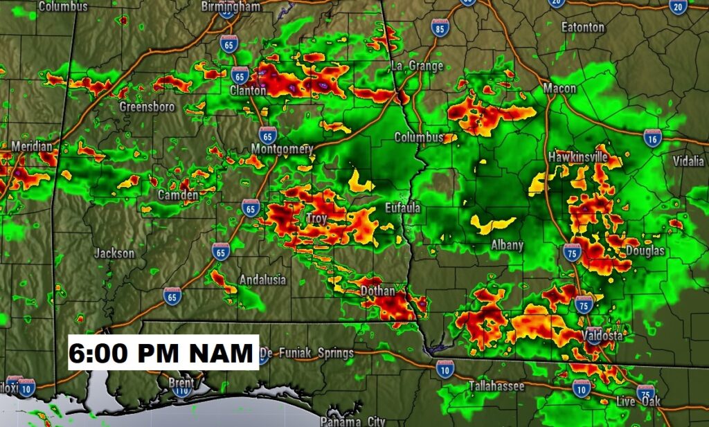
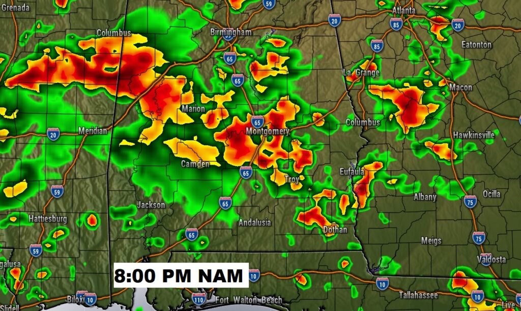
Here’s a couple of Future Radar examples this evening…just to show you potential coverage and how each models has a different take.
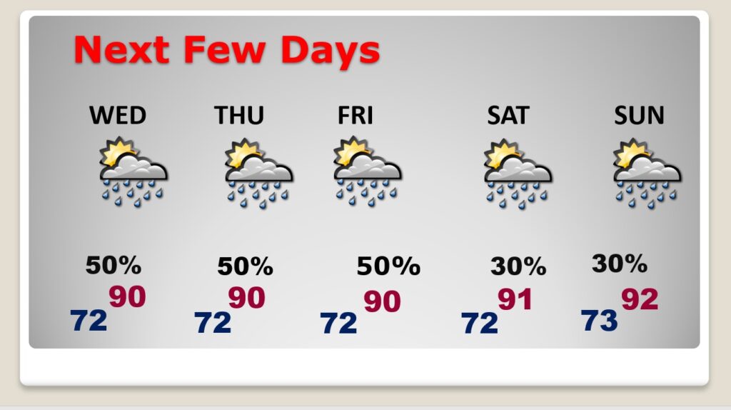
NEXT FEW DAYS: Very little day to day change. Hot & humid. Highs mostly 89-92. Better than normal rain chance. Scattered Random showers & thunderstorms, most numerous in the afternoon & evening hours. Highs 89-92. Loews at night in the low 70’s.
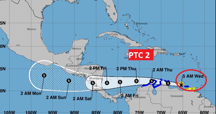
TROPICAL UPDATE: NHC is tracking two Area’s to Watch. But, the star of the show is Potential Tropical Cyclone Two. This system could become Tropical Storm Bonnie by later today. It looks like it will eventually cross central America and get a new name in the East Pacific Basin.
Invest 95-L still could become a depression before it reaches the Texas coast. It will bring massive rainfall to coastal Texas.
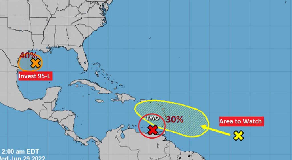
Almost every model keeps this system moving westward at a very low latitude.
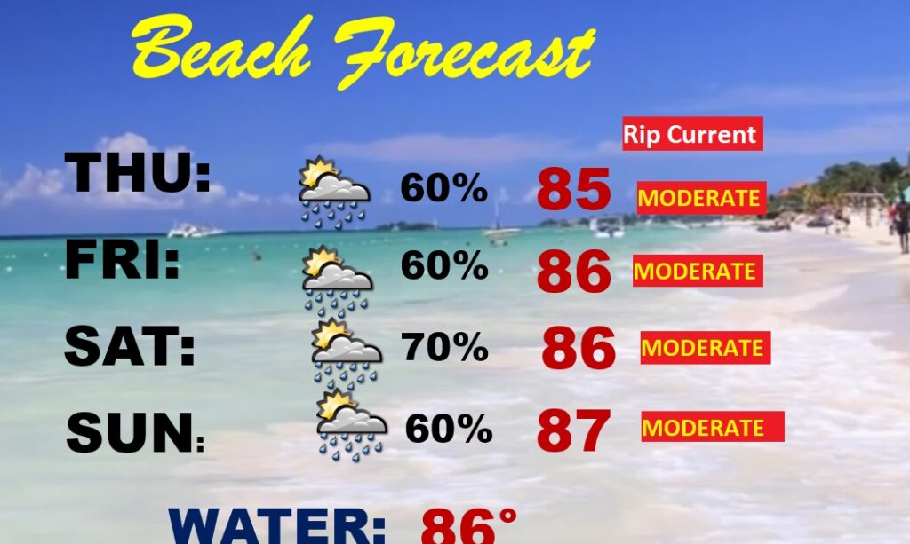
BEACH OUTLOOK: Radar will be active. It won’t rain all the time. But showers & storms will be scattered to numerous. The better than normal rain chance will stick around well into the 4th of July weekend. Moderate Rip Current Risk especially from Destin east to Panama City.
—
Thanks for reading this Blog this morning! This morning we are LIVE on the radio from 6 to 9 on NewsTalk 93.1. Watch us on TV on CBS 8 and ABC 32. I’ll have another update for you in the morning. Have a nice day.
–Rich