Good Morning! No surprises on this Fourth of July holiday. The forecast is text book routine. Yes, there will be random scattered showers and thunderstorms roaming around this afternoon and this evening. But, that’s par for the course practically every Fourth of July. Keep track of the storms on our weather app radar. Watch out for lightning. Statistically, there are more lightning deaths and injuries on the 4th of July than any other day of the year.
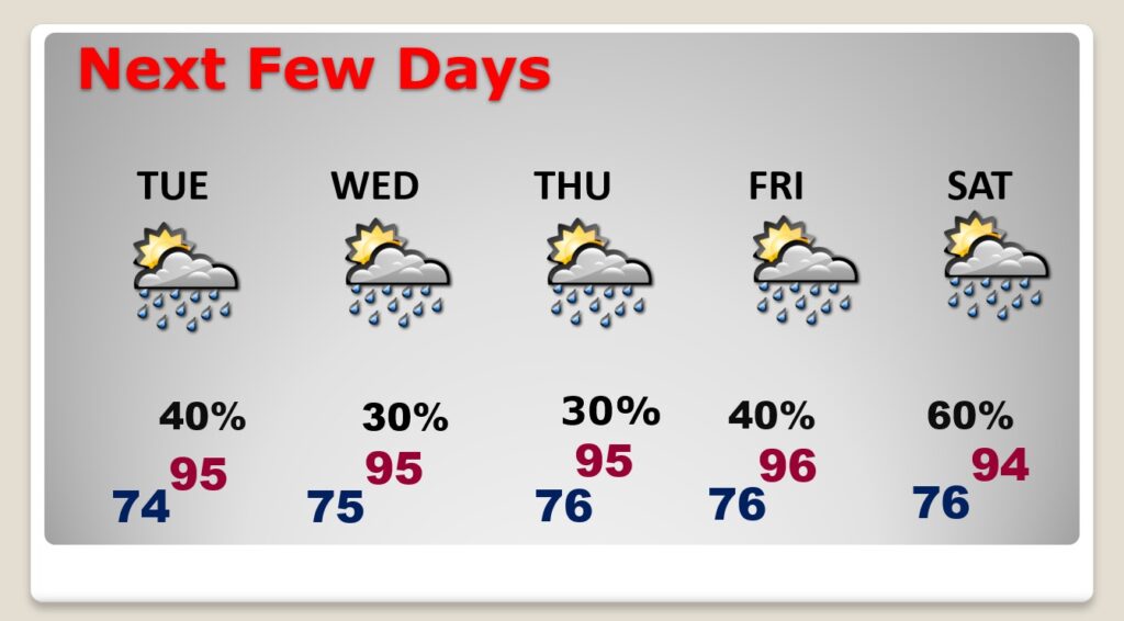
Expect hotter days Tuesday through Friday. Highs in the mid 90’s. Heat index near the 105 danger range each. There will be random storms around, but not as many storms. They will be more widely scattered in nature.
TODAY: Just a completely “regular” 4th of July Forecast. Foggy this morning. Yes, there will be random scattered showers and thunderstorms roaming around this afternoon and this evening. But, that’s par for the course, practically every Fourth of July. High today 93. Heat index in the triple digit range. Stay hydrated. Keep track of the storms on our weather app radar. Watch out for lightning. Statistically, there are more lightning deaths and injuries on the 4th of July than any other day of the year. Boaters on area lakes beware. Storms will fade out tonight. Will the storms be gone by fireworks time? Maybe. It’s just luck. Low tonight 74.
Here’s a Future Radar loop (NAM) from 10AM till 8:30 PM, just to give you a general idea of potential coverage today.
NEXT FEW DAYS: Expect hotter days Tuesday through Friday. Highs in the mid 90’s. Heat index near the 105 danger range each. There will be random storms around, but not as many storms. They will be more widely scattered in nature. Not much day to day change.

.
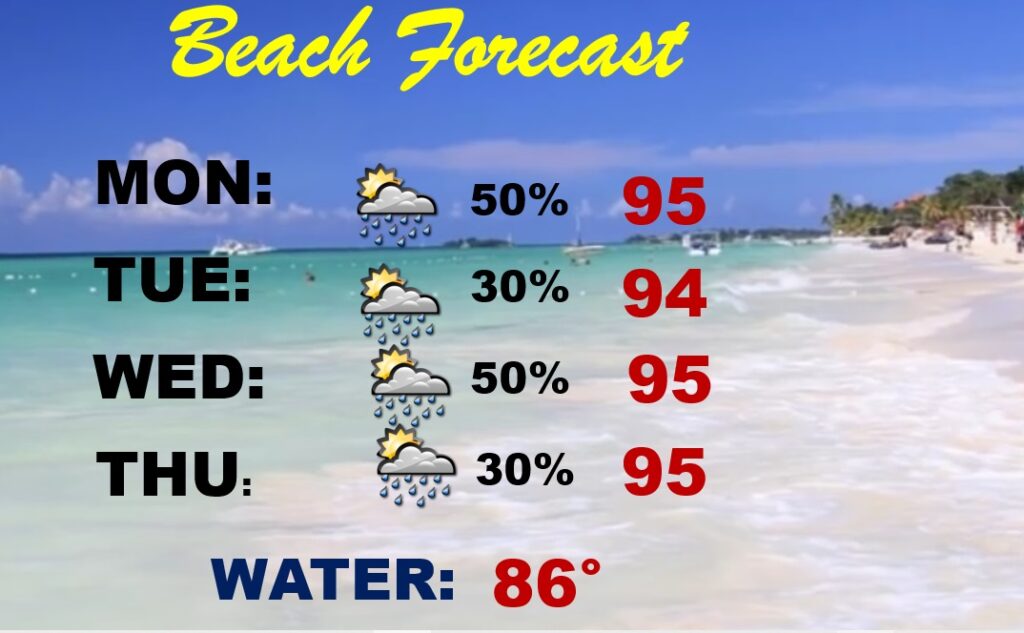
BEACH FOREAST: Elevated rain chance each day. Be prepared. Your Beach fun may be interrupted from time to time. Highs in the mid 90’s. Dangerous heat Index near or above 105. Not much day to day change.

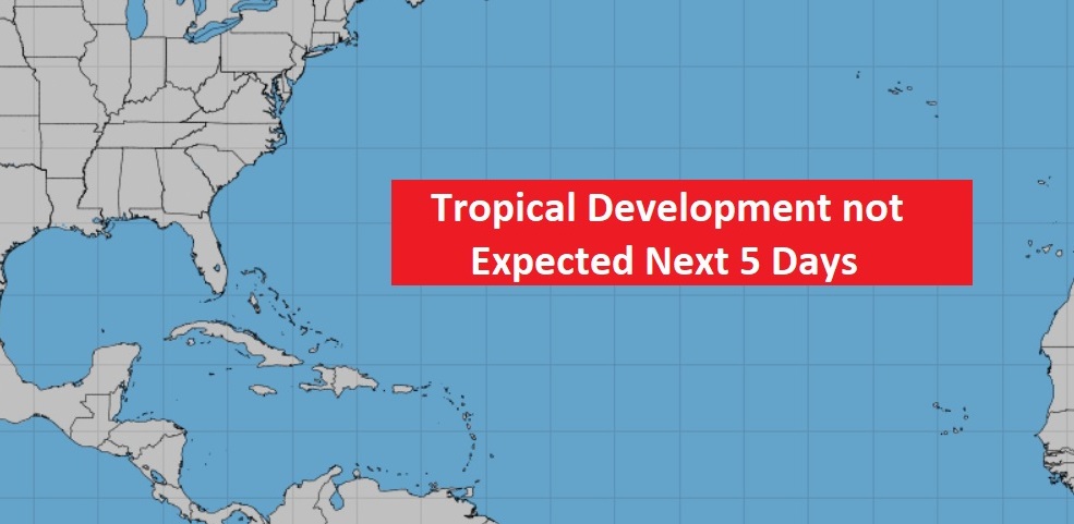
TROPICAL OUTLOOK: Well, this is good news, for now. NHC has no X’s on the map in the Atlantic basin.

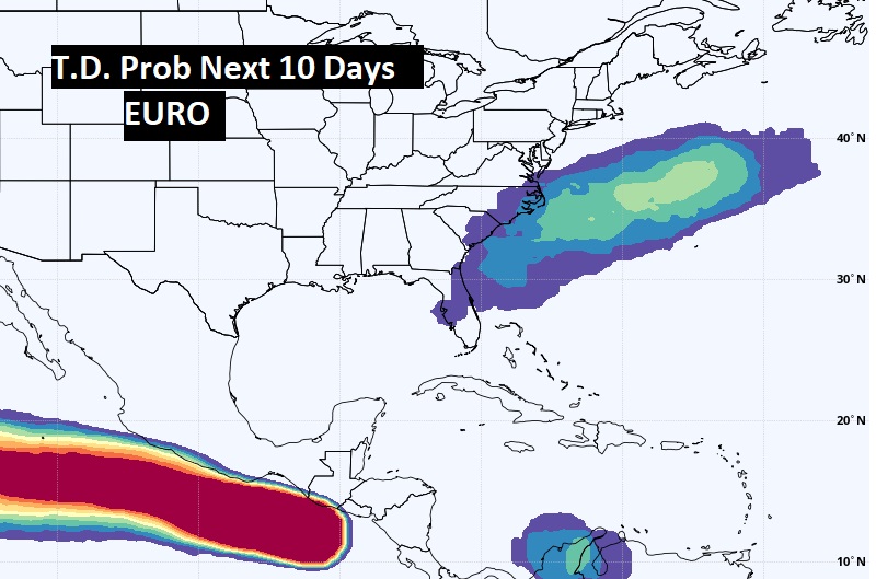
The EURO model advertises the chance of Tropical Mischief off the East coast in the next 10 days.

—
Thanks for reading this brief Blog this morning. Hey! Even though we are officially OFF today at Bluewater, Greg and I will be LIVE at the WAKA/WNCF studios in the 6th o’clock hour. We’ll get back to a video update tomorrow morning. Tomorrow everything will return to normal, including Live on the radio and Live on TV. Enjoy this 4th of July holiday.
–Rich

