
Good Morning! Here’s my brief video forecast discussion.
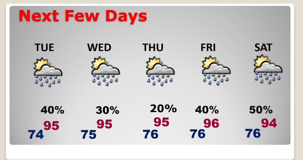
TODAY: Heat Advisory Issued for today & Wednesday. Hotter today. Today’s high mid 90’s. Heat index near or above 105. Scattered Random showers & thunderstorms, most numerous in the afternoon & evening hours. Not as many storms as the last few days. Very humid tonight. Low tonight 75.
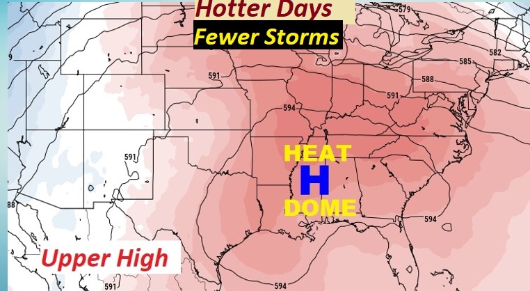
Upper Ridge of high pressure re-builds. Hotter days. Storms will be less numerous.
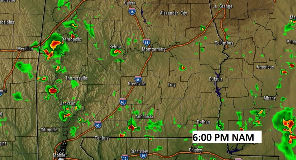
Here’s a Future Radar snapshot at 6PM. Far fewer showers & storms will be roaming around today.
NEXT FEW DAYS: Series of very hot days. Highs in the mid 90’s. Heat index near 105 danger range. Scattered Random showers & thunderstorms, most numerous in the afternoon & evening hours. Still hot at night. Low mid to upper 70’s. Storms may be a little more numerous by Saturday.
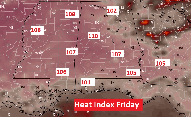
The heat will be excessive. Thursday & Friday will be the hotter day. The Heat Index will be in the danger range.
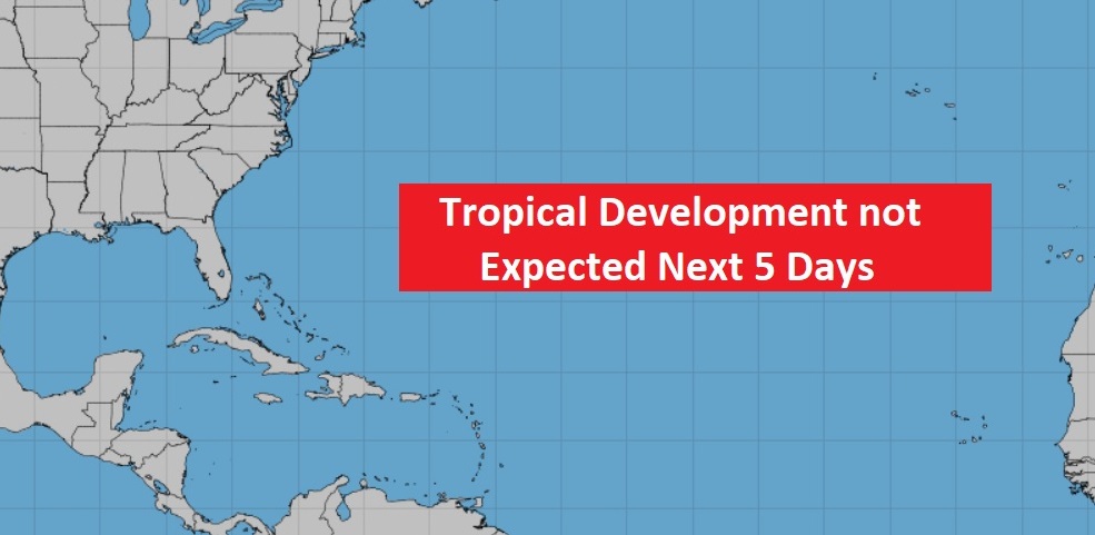
TROPICAL UPDATE: Happy to say…the Atlantic, Caribbean and Gulf of Mexico are quiet.
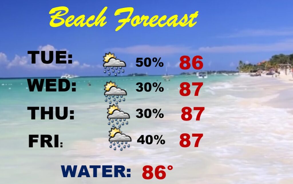
BEACH OUTLOOK: Showers & storms will be through Saturday. Mainly in the afternoon & evening hours. Hot and humid. Mid to upper 80’s Triple digit heat index. Gulf water temperature is 85. Moderate Rip Current Risk especially from Destin east to Panama City.
—
Thanks for reading this Blog this morning! This morning we are LIVE on the radio from 6 to 9 on NewsTalk 93.1. Watch us on TV on CBS 8 and ABC 32. I’ll have another update for you in the morning. Have a nice day.
–Rich