
Good Morning! Here’s my brief video forecast discussion.
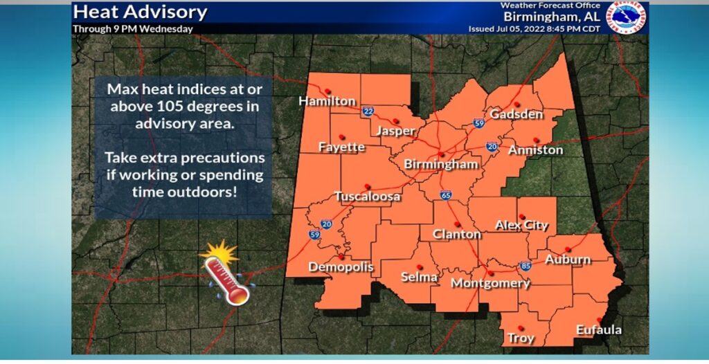
TODAY: Heat Advisory continues in effect. Today’s high mid 90’s. Heat index 105+. Danger range. Random showers & thunderstorms will be few and far between, most numerous in the afternoon & evening hours. Most towns will stay dry. Very humid tonight. Low tonight 76.
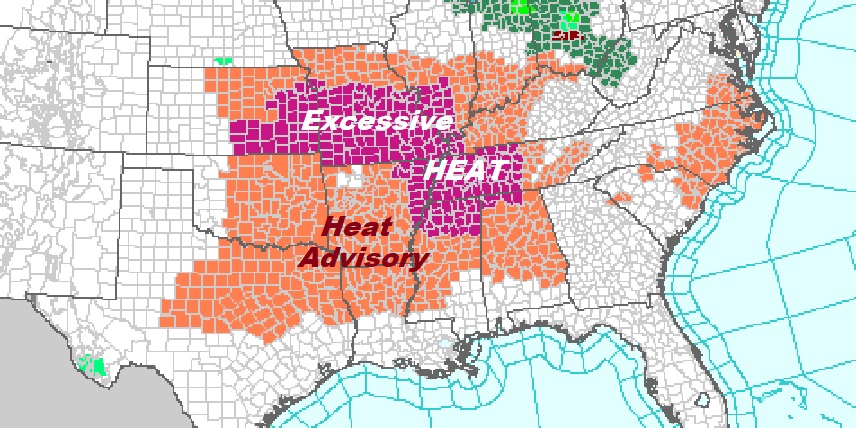
Heat Advisory continues in effect. In fact, the Heat Advisory covers a multi-state area. Some areas are under a Excessive heat Warning.
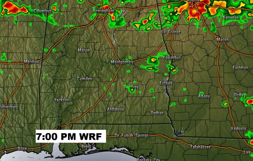
Most showers and storms in the state today will be along and north of I-20/I-59.
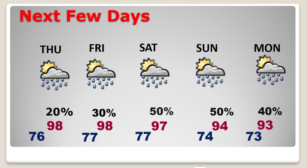
NEXT FEW DAYS: Series of very hot days. Highs in the mid to upper 90’s. Heat index 105-110 danger range. Widely Scattered Random showers & thunderstorms, most numerous in the afternoon & evening hours. Still hot at night. Low mid to upper 70’s. Storms may be a little more numerous by Saturday & Sunday..
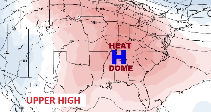
A massive ridge of high pressure in the upper atmosphere remains King.
TROPICAL UPDATE: Happy to say…the Atlantic, Caribbean and Gulf of Mexico are quiet.
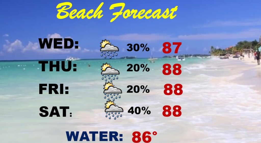
BEACH OUTLOOK: Widely scatteredShowers & storms will be through Saturday. Mainly in the afternoon & evening hours. Hot and humid. Highs in the upper 80’s Triple digit heat index. Gulf water temperature is 86.
DOG DAYS OF SUMMER: This week begins the so called Dog Days of Summer, and of course it has nothing to do with dogs. It goes back to ancient times. The Dog Star Sirius is prominent in the sky in the constellation Canis Major during this part of the summer. The dog days run from about July 3 to August 11.


—
Thanks for reading this Blog this morning! This morning we are LIVE on the radio from 6 to 9 on NewsTalk 93.1. Watch us on TV on CBS 8 and ABC 32. I’ll have another update for you in the morning. Have a nice day.
–Rich