
Good Morning! Here’s my brief video forecast discussion.
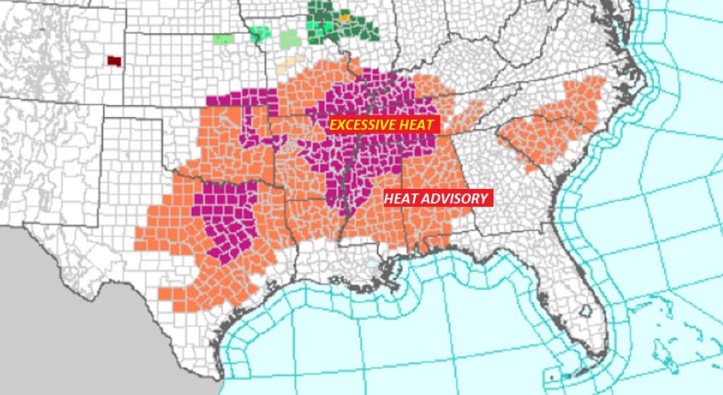
TODAY: Heat Advisory continues in effect. Today’s high mid to upper 90’s. Heat index 105 to 110. Random showers & thunderstorms will more numerous today , especially in the afternoon & evening hours. Very humid tonight. Low tonight 77..
Scattered Strong Storms today. Radar will be active. BIG heat can produce BIG storms.
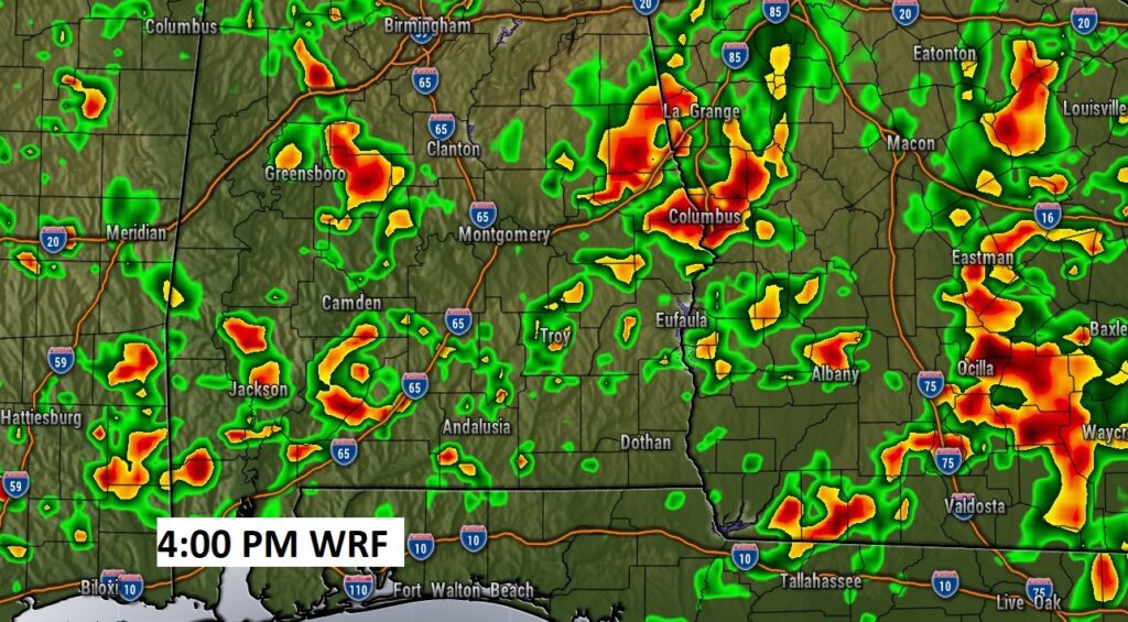
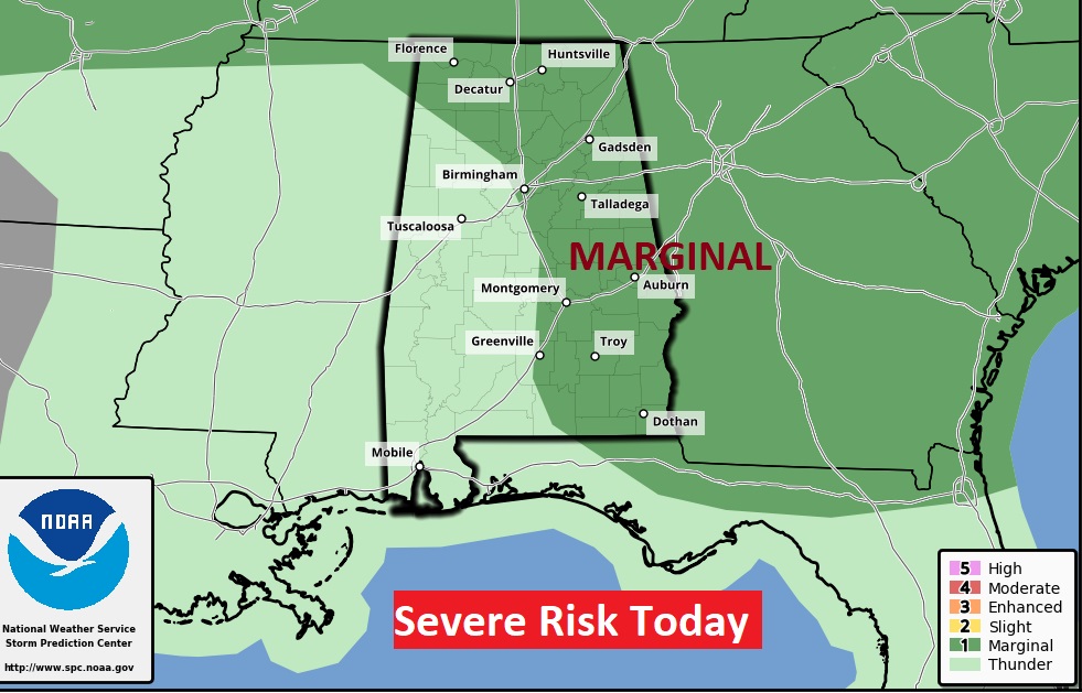
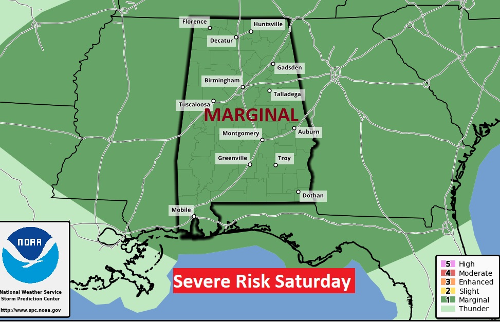
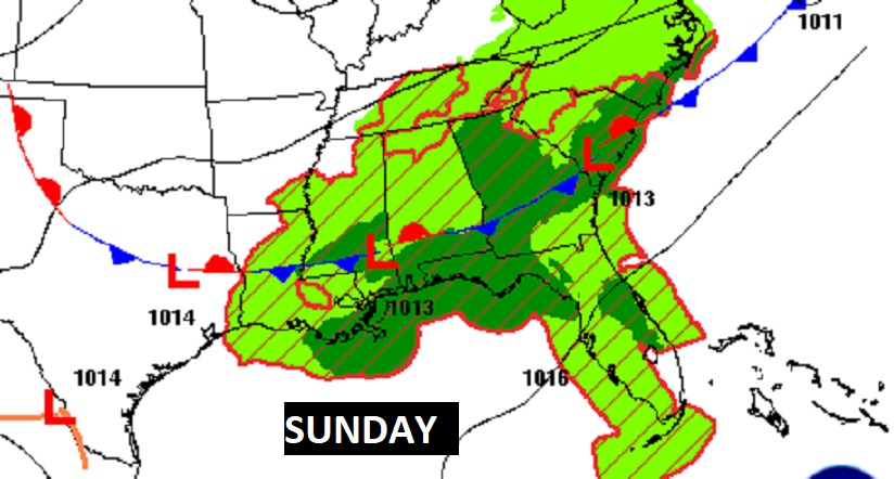
Marginal Severe Risk for much of the eastern half of the state today, and through all of the area on Saturday.
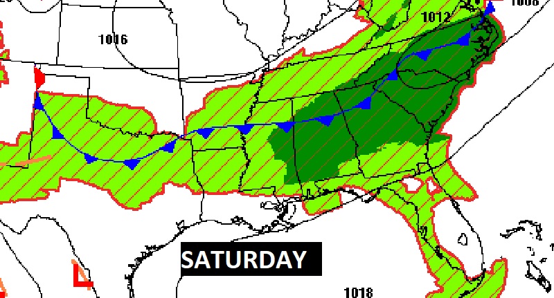
A southward moving front will be responsible for the increased storms over the weekend.
The Heat Advisory has expanded all the way down to the coast. Excessive Heat Warning now covers NW Alabama.
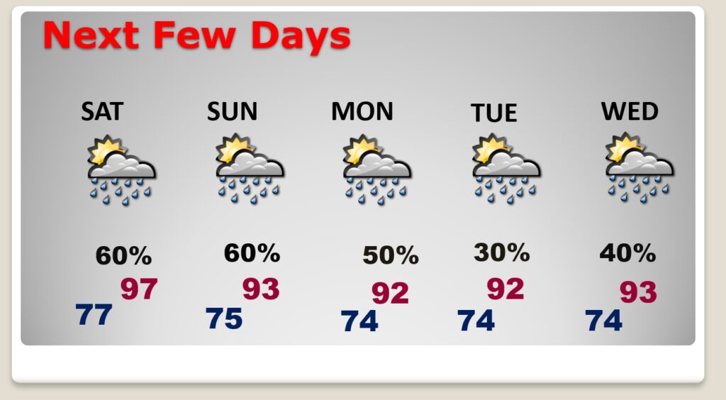
NEXT FEW DAYS: Heat Advisory through Saturday. Highs in the mid to upper 90’s. A southward moving front will be responsible for the increased storms over the weekend. Scattered to numerous showers & thunderstorms, most numerous in the afternoon & evening hours. Some storms will be strong to severe. Vefry warm & humid at night. Low mid to upper 70’s. Scattered storms Monday & Tuesday, but not as hot.
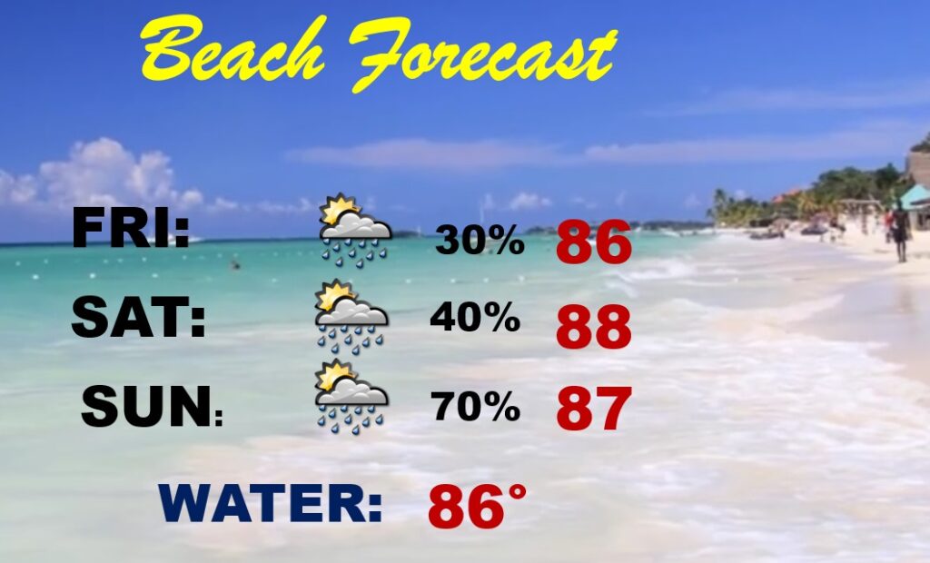
BEACH OUTLOOK: ScatteredShowers & storms will be through the weekend. Mainly in the afternoon & evening hours. Best chance on Sunday. Hot and humid. Highs in the upper 80’s Triple digit heat index. Gulf water temperature is 86.
—
Thanks for reading this Blog this morning! This morning we are LIVE on the radio from 6 to 9 on NewsTalk 93.1. Watch us on TV on CBS 8 and ABC 32. I’ll have another update for you in the morning. Have a nice day.
–Rich