
Good Morning! We are into a “typical” July pattern. Hot & humid. Low to mid 90’s. Triple digit heat indices. Not many storms. Storms will be few and far between through Wednesday.
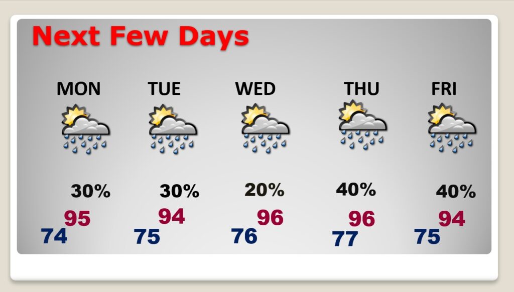
Gradually temperatures are getting hotter. We should be in the middle 90’s most days this week. Lows at night will also increase to the middle 70’s. Somewhat better rain chances by Thursday and Friday. Otherwise, no big surprises. And, for now, the tropics are shut-down.
CLIMATE DATA: Saturday’s High was 93 – Heat Index 101. Morning low 70. Normal hi/lo 94 and 72. Record high for today 100 from 1887…record low 62 from 2014. Sunrise 5:51 AM. Sunset 7:53 PM.
TODAY: Hot & Humid. High 93. Heat index 100 to 105. Any random storms today will be few and far between by this afternoon and this evening. Low tonight 73.
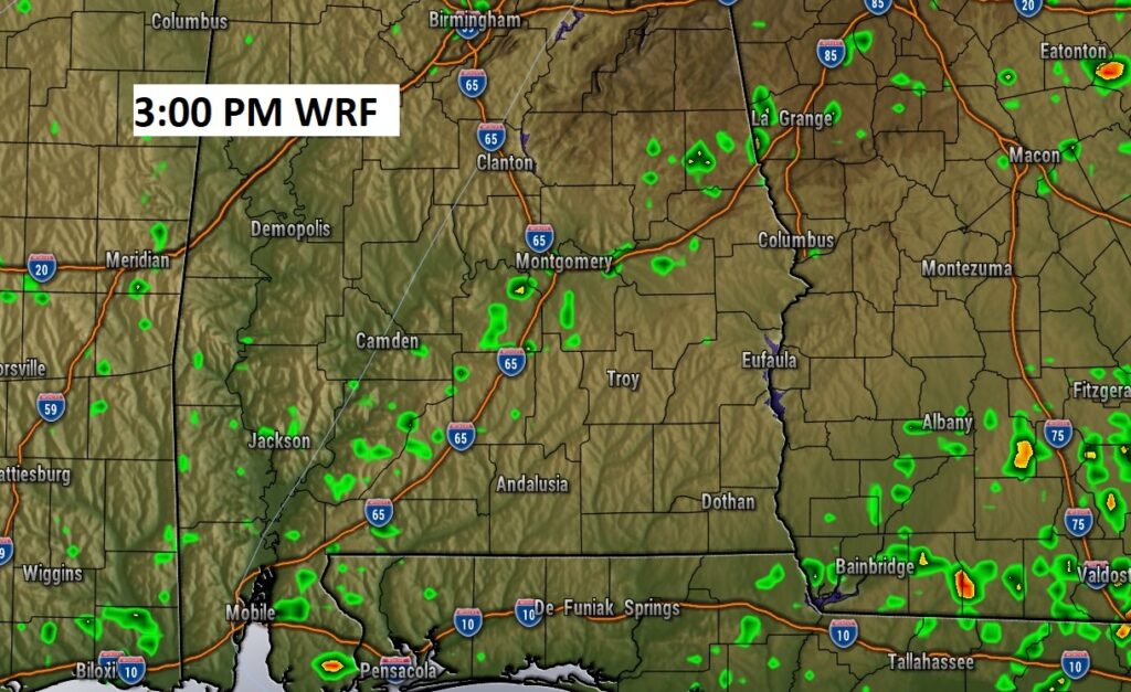
Here’s a Future Radar example this afternoon. Showers and storms will be rather rare.
NEXT FEW DAYS: Getting hotter. Highs in the mid 90’s. Triple digit heat index. Lows at night edging toward the mid 70’s. Scattered to numerous afternoon and evening showers & storms each day. Little day to day change. Rain chances a little better toward Thursday & Friday.
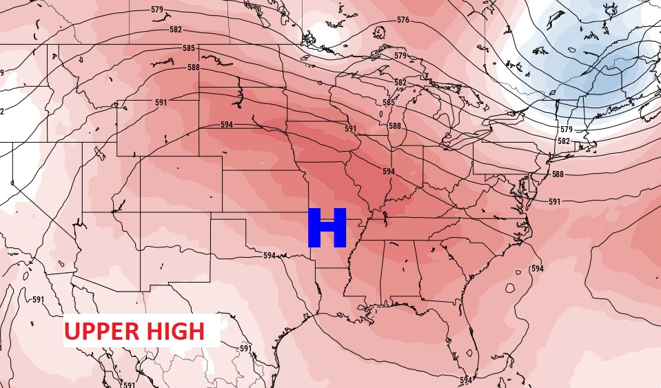
This week Upper High pressure builds eastward across the Gulf states. That spells hit weather and not many storms.
.
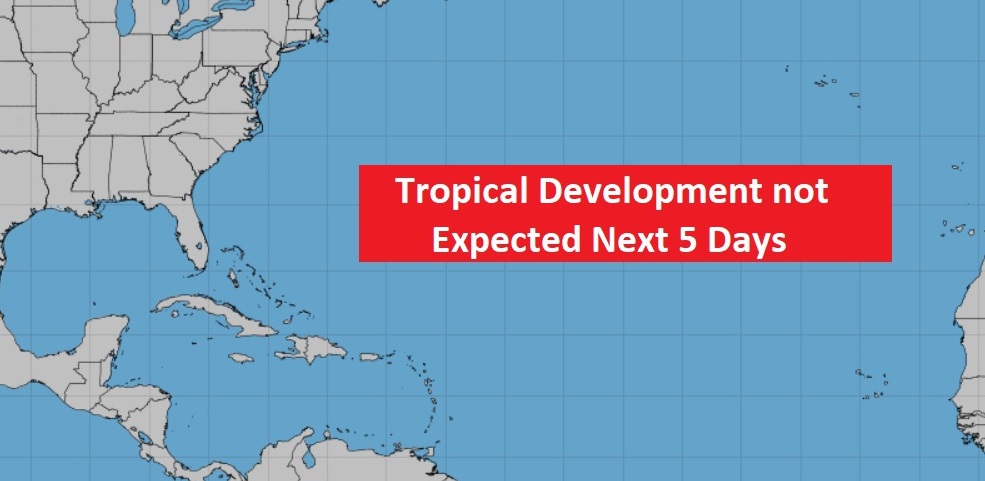
TROPICS: Thankfully, the tropics are quiet for now.
.
I’ll have another update for you in the morning. Have a nice Sunday!
–Rich