
Good Morning! Here’s my brief video forecast discussion.
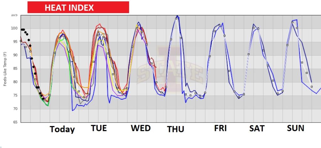
TODAY: Good bit of sun sunshine. High in the mid 90’s. Heat index 100+ Scattered random showers & thunderstorms, not just in the afternoon and well into the evening hours. Risk of Showers and storms will continue tonight. Low tonight 75.
RADAR TRENDS TODAY: Much of the day will be routine. Here’s a Future radar snapshot this afternoon.
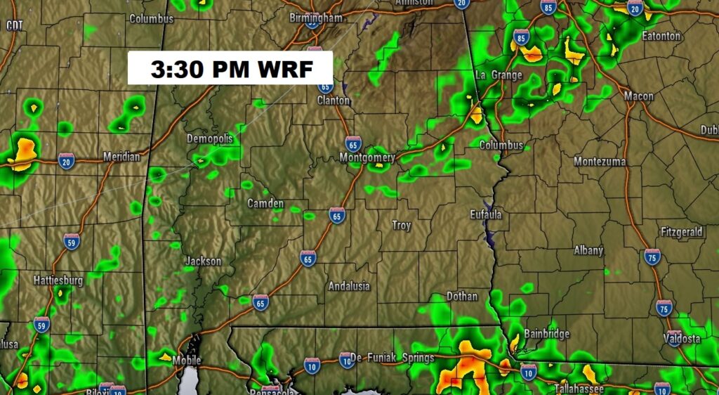
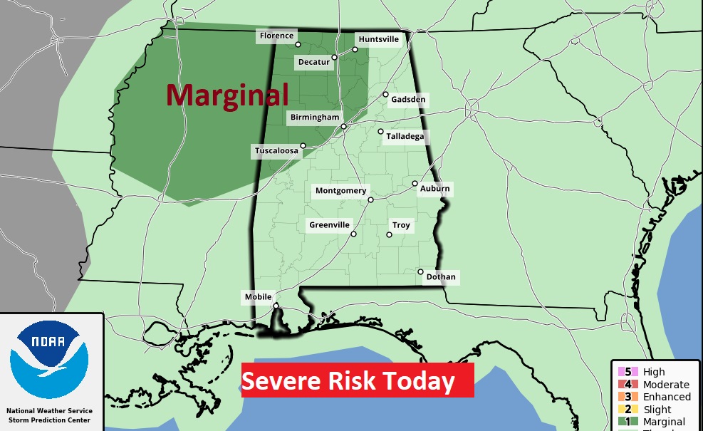
There’s a frontal system approaching north Alabama. It will fall short. However, a complex of storms MCS will enter NW Alabama this afternoon and head southward this evening and tonight. We’ll have to monitor the progress of this storm complex.
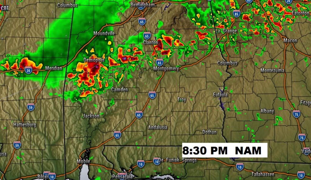
Some storms across NW Alabama could reach severe limits. Damaging wind gusts in the main threat.
TROPICAL OUTLOOK : The tropics are quiet for now.
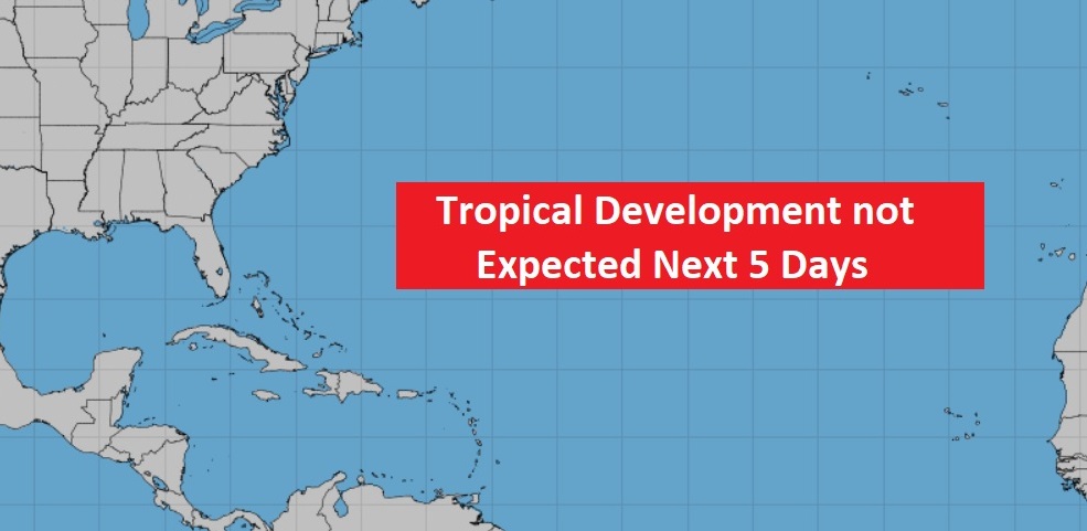
However the Tropical Atlantic is starting to get more active.

NEXT FEW DAYS: Scattered showers & thunderstorms, each day, most numerous in the afternoon & evening hours. Highs mostly mid 90’s. Low at night mid 70’s. Little day to day change.
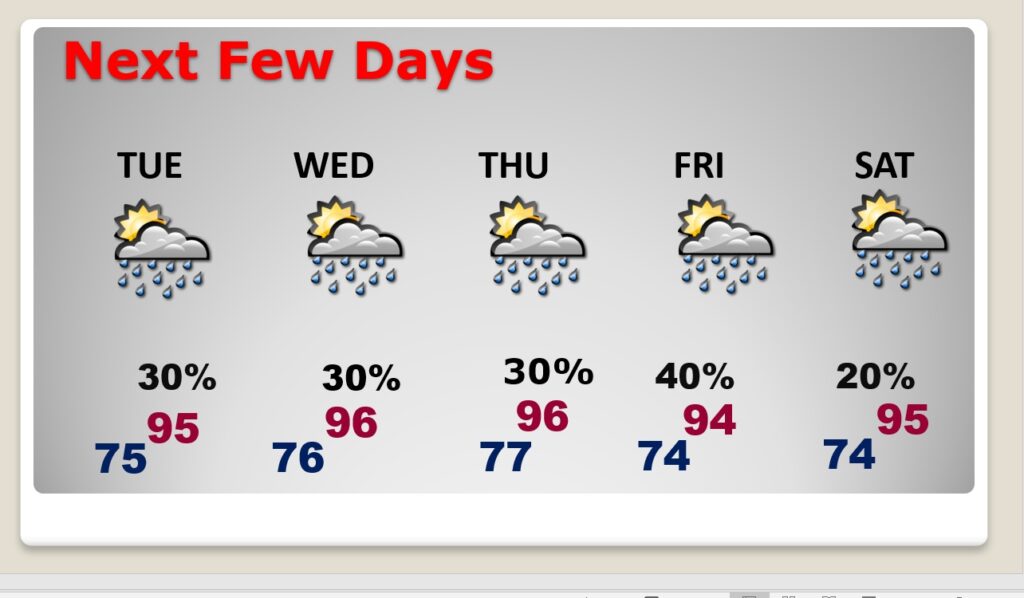
Triple digit heat indices each day.
—
Thanks for reading this Blog this morning! There will be another update for you tomorrow morning. Have a nice day.
–Rich