
Good Morning! Our weather pattern is settling down to a “typical” July pattern. Still Hot & humid, nut more bearable than last week. Low 90’s. But, storms will not be plentiful. More of a widely scattered, widely separated array of afternoon & evening showers and thunderstorms. There’s no big surprises over the next few days. Little day to day change. No big ticket weather. The next significant uptick in our rain chances will be next Friday as a trough approaches. The Tropics are quiet for now.
Yesterday’s high was only 90. What a big improvement from 98 on Wednesday & Thursday. The airport rainfall was .25″
TODAY: A good bit of sunshine. Hot & humid. High 94. Heat index near 100. Widely scattered afternoon & evening showers and thunderstorms. Low tonight 74.
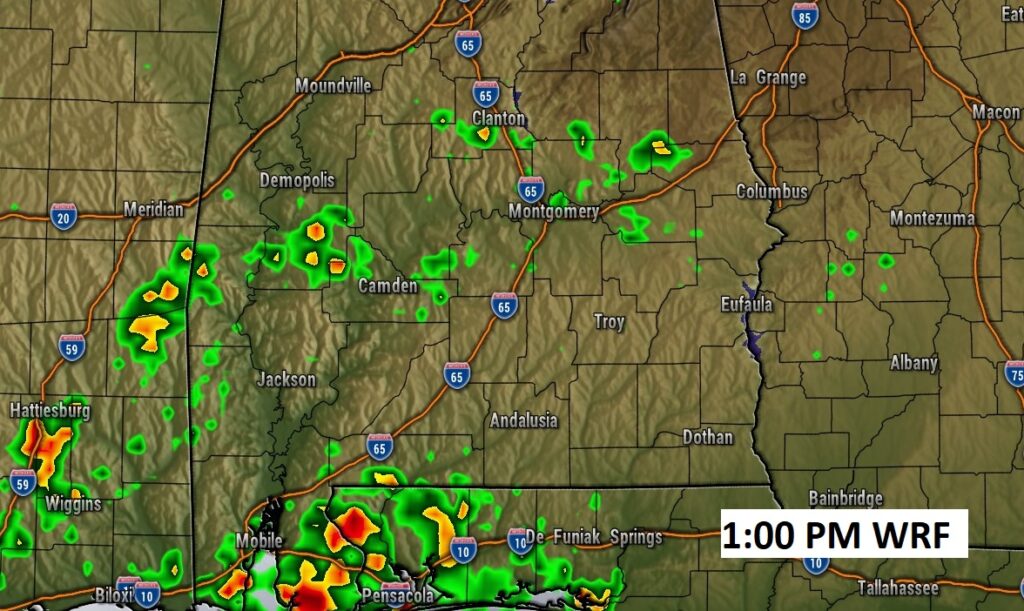
Future radar (WRF) suggests any storms today will be few and far between.
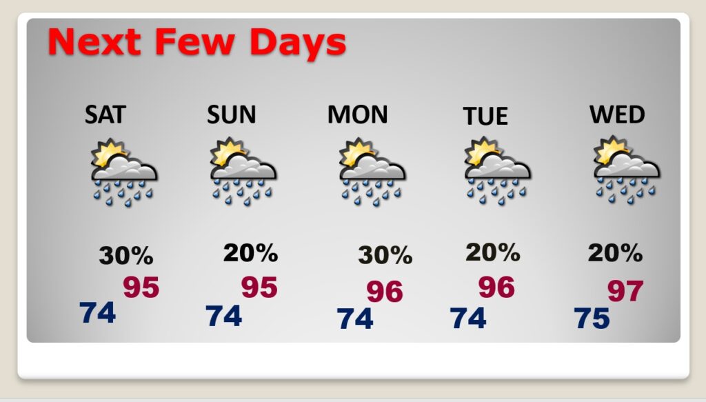
NEXT FEW DAYS: Not much day to day change. Very typical for July. Generally mid 90’s each day. Scattered Random storms every day. Daily rain chance in the 20-30% range.
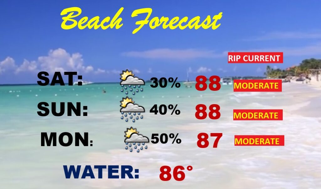
BEACH FORECAST: Finally, the chance of daily storms will start to come down a bit today through Monday. Scattered storms. Watch out for lightning. Highs in the 80’s. Gulf water temp is 86. Moderate Rip Current Risk especially from Destin eastward.
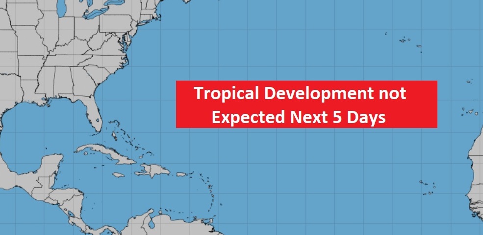
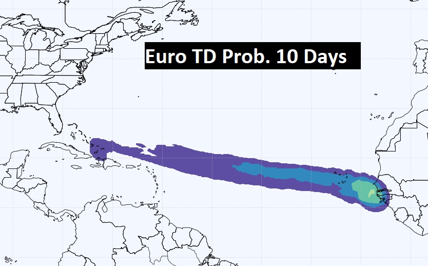
TROPICAL OUTLOOK: NHC is not expecting any tropical development in the next 5 days.
The EURO model is hinting that we need to keep an eye on the Tropical Atlantic next 10 days..
—
.
I’ll have another Blog update in the morning. Have a nice weekend!
–Rich