
Good Morning! Here’s my brief video forecast discussion.
CLIMATE DATA: Yesterday’s high in Montgomery was 95, with a Heat Index as high as 105. Morning low 72. Normal High/Low 94 and 72. Rainfall: 1.09”.
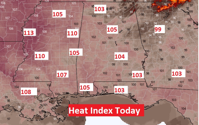
TODAY: Sun/Cloud Mix. Very Hot & Humid. Today’s High near 95. Heat index 103 to 105. Widely Scattered random showers & thunderstorms mainly in the afternoon & evening. Low tonight 74.
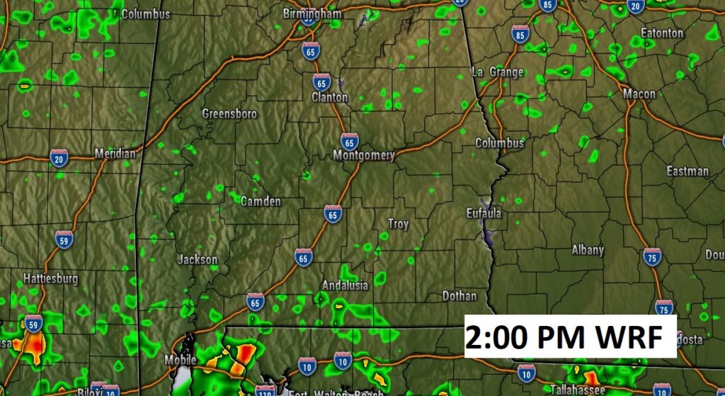
Future Radar (WRF) suggests there won’t be much activity today. Showers and storms will be few and far between.
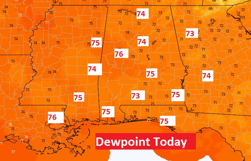
Excessive Heat Indices across the Gulf South today. High Dewpoints will lead to oppressive Heat Indices.
.
.
NEXT FEW DAYS: Good bit of sun. High in the mid to upper 90’s. Heat index close to the 105 danger level. Low at night mid 70’s. Not much day to day change through Thursday. Scattered random afternoon & evening storms. Rain chances improves by Friday & Saturday.
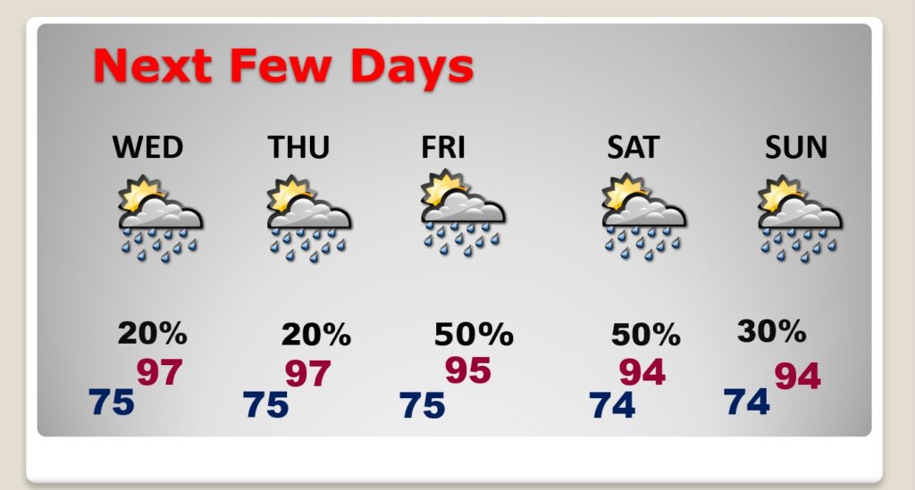
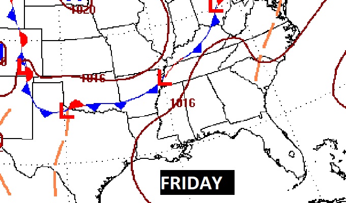
An approaching frontal system should enhance the rain chances by Friday & Saturday. More scattered storms on Sunday.
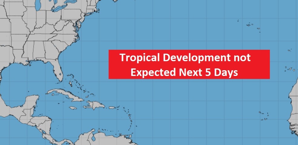
TROPICAL OUTLOOK : The tropics continue quiet for now.
—
As daddy builds graphics and writes the Blog, Chase patiently waits for his morning walk.

Thanks for reading this Blog this morning! This morning we are LIVE on the radio from 6 to 9 on NewsTalk 93.1. Watch us on TV on CBS 8 and ABC 32. I’ll have another update for you in the morning. Have a nice day.
–Rich