
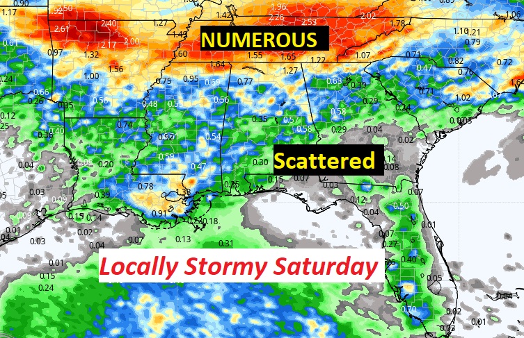
Good Morning! The atmosphere is primed for action today. Rain chances are better. Radar is likely to be bright and colorful. Scattered to numerous afternoon & evening showers and thunderstorms. Best rain chance of the week. Still storms will be random. Not every town will get wet, but many will. Watch out for intense lightning.
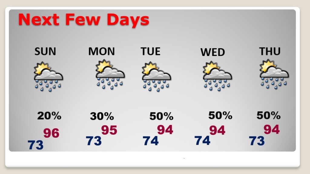
Tomorrow and Monday, the storms will start to “thin out” again. Fewer storms. Widely scattered. Expect another “uptick” in the number of storms Tuesday through Thursday. Meanwhile the hot days will continue as July ends and August begins.
CLIMATE DATA: Yesterday’s high in Montgomery was 94, with a Heat Index as high as 105. Morning low 74. Normal High/Low 94 and 72. Rainfall: Trace. Sunrise at 6:00 AM
TODAY: Limited sunshine. Hot & humid. High 94. Heat index near or above 100. Scattered to numerous afternoon & evening showers and thunderstorms. Best rain chance of the week. Low tonight 73.
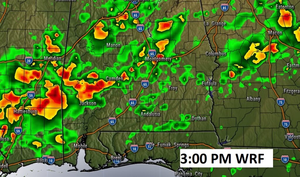
Here’s a Future Radar example (WRF model) at 3:00PM. Scattered to numerous storms.
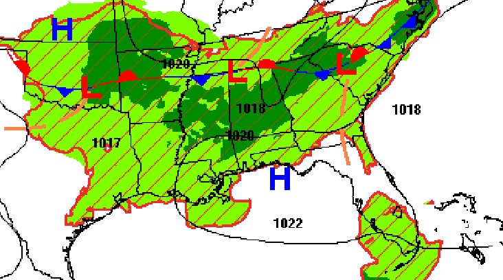
Potentially, some of the heaviest rainfall totals will be closer to the front it self near the Tennessee border.
NEXT FEW DAYS: Not much day to day change. Tomorrow and Monday, the storms will start to “thin out” again. Fewer storms. Widely scattered. Expect another “uptick” in the number of storms Tuesday through Thursday. Generally mid 90’s each day. Lows in the low to mid 70’s.
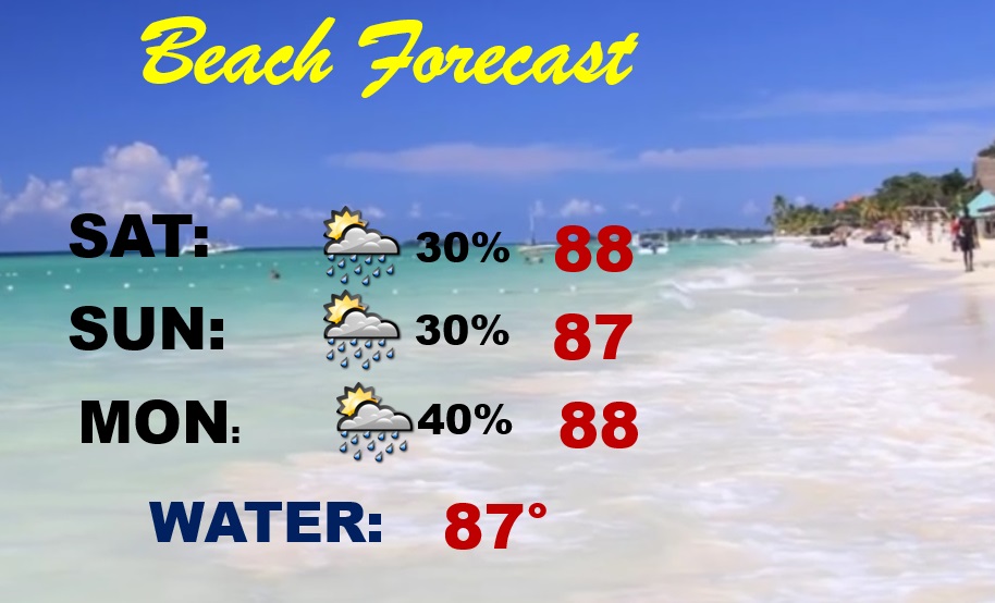
BEACH FORECAST: Fairly routine forecast this weekend. Scattered storms. Watch out for lightning. Highs in the upper 80’s. Gulf water temp is 87. High Rip Current Risk especially from Destin eastward.
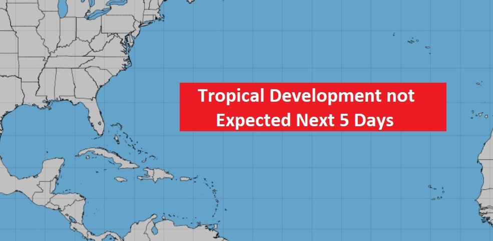
TROPICS: This will change, but the Atlantic Basin is still as quiet as a mouse. Look for a big uptick in activity, probably by the middle of August.
I’ll have another Blog update in the morning. Have a nice weekend!
–Rich