
Good Morning! Yesterday the biggest story was heat & humidity. Montgomery got to 97, heat Index 106. Did you get rain? Radar was more active. There were some nice downpours. My buddy Ryan near Atlanta highway and Bell Road has .85”. Today, scattered afternoon & evening showers and thunderstorms, will be more numerous than yesterday. Still storms will be random. Not every town will get wet. Many will.
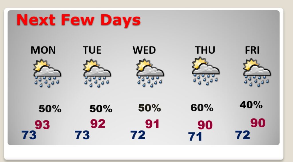
Monday through Thursday, storms will become more numerous. Closer to 50-60% coverage every day. Locally heavy downpours. Temperatures next week will be down just a notch. Lower 90’s daytime, lower 70’s at night.
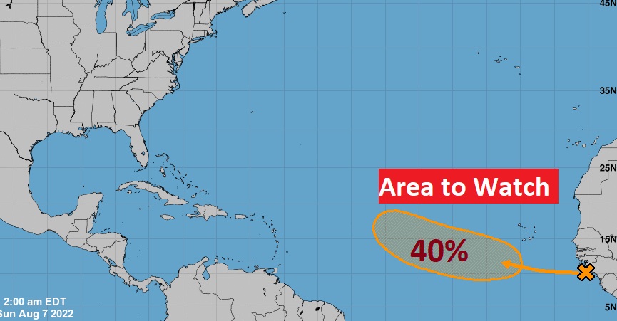
There is now an Area to watch in the Tropical Atlantic.
CLIMATE DATA: Yesterday’s high in Montgomery was 97, with a Heat Index as high as 106. Morning low 74. Normal High/Low 94 and 72. Rainfall: 0.52. Sunrise at 6:07 AM, Sunset 7:37. (My rainfall in East Montgomery was .6$”
TODAY: Sun/cloud mix. Hot & humid. High mid 90’s. Heat index above 100. Random scattered afternoon & evening showers and thunderstorms. Generous coverage…perhaps 50%. Storms fade out tonight. Low tonight 73.
Lots of “boundaries” will be the focus for scattered to numerous showers and storms across the Gulf south today.
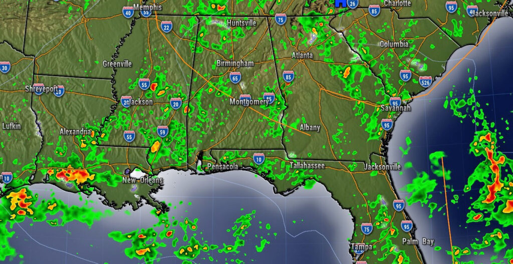
Here’s the NAM Model Future Radar Loop through the day today and into the early evening tonight.
NEXT FEW DAYS: Not much day to day change. Better than normal coverage of the daily Hit or Miss storms Monday through Thursday. Temperatures will be down just a notch. Generally Lower 90’s. Lows in the low 70’s.
TROPICS: NHC is indicating a “Area to Watch” in the tropical Atlantic, with a medium 40% chance of development in the next 5 days.
—
.
I’ll have another Blog update in the morning. Have a nice Sunday!
–Rich