
Good Morning! A southward moving front has delivered some better weather news for most of us in central Alabama, bot not so much in extreme South Alabama. Today, the rain chances will be small in central Alabama Isolated storms perhaps. Humidity, behind the front, will be ‘SLIGHTLY’ lower. Noticeable. All in all, it should be a nice weekend treat for many. Slight summer relief. The forecast will return to an August normal Monday through Wednesday with scattered random storms.
CLIMATE DATA: Yesterday’s high in Montgomery was 90. Morning low 74. Normal High/Low 94 and 72. Rainfall: Trace. Sunrise at 6:09 AM. Sunset 7:31 PM.
TODAY: Mostly sunny. Not as humid. High 91 Best rain chance near the coast Low tonight 73. Only isolated storms in central Alabama. Widely scattered.
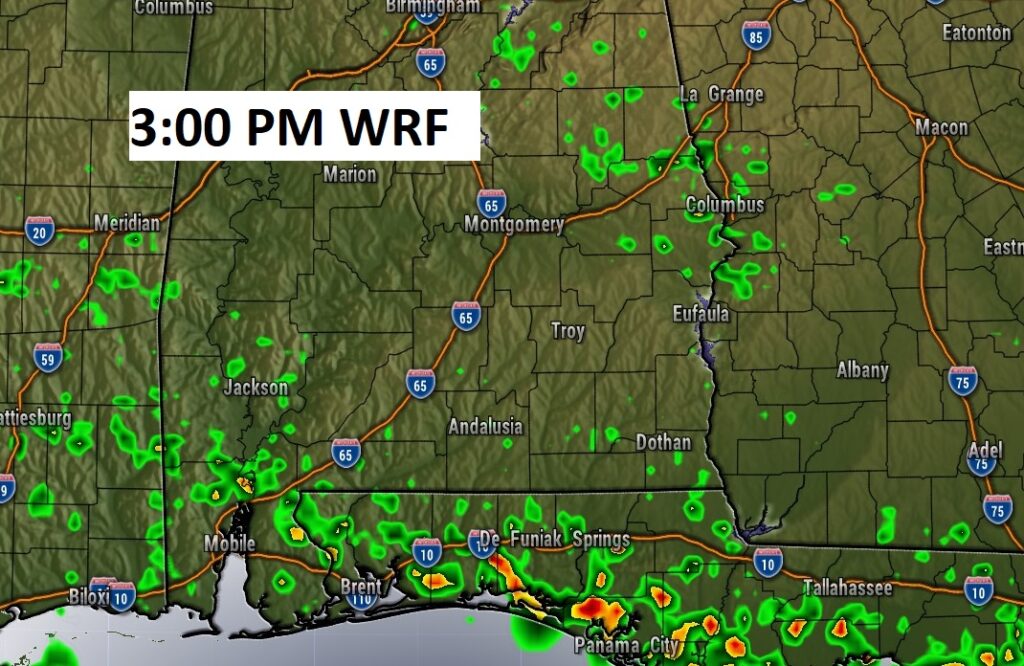
Here’s Future radar. An afternoon snapshot. Most of the storms will be south of the front near the coast.
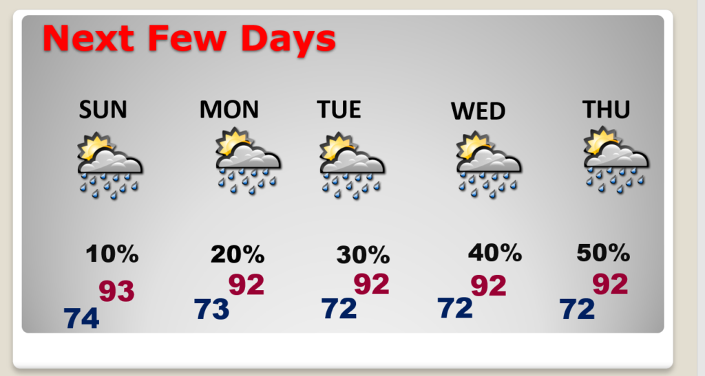
NEXT FEW DAYS: Very small rain chance through Monday. Scattered storms Tuesday & Wednesday. Generally low to mid 90’s each day. Lows in the low 70’s.
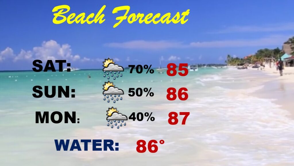
BEACH FORECAST: High rain chance today. Not as many storms Sunday & Monday. Scattered storms. Watch out for lightning. Highs in the mid 80’s. Gulf water temp is 86. High Rip Current Risk especially from Destin eastward. Today.
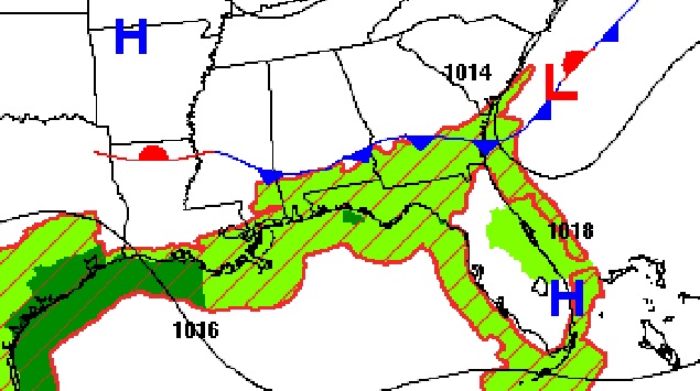
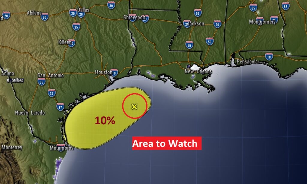
TROPICS: NHC is still monitoring an Area to Watch in the far western Gulf. Low 10% chance of development. The rest of the tropics are quiet.
.
I’ll have another Blog update in the morning. Have a nice weekend!
–Rich