Good Morning! Here’s my brief video forecast discussion.
CLIMATE DATA: Yesterday’s high in Montgomery was 94, Morning low 72. Normal High/Low 94 and 72. Rainfall: 0.00. Sunrise at 6:10 AM. Sunset 7:30
TODAY: Today will be more routine, after a great weekend. Lots of sunshine. The risk for scattered storms return, in the afternoon & evening. In fact, a cluster of storms will track into central Alabama during the evening hours. Expect a hotter day. High in the Middle 90’s. Low tonight 74.
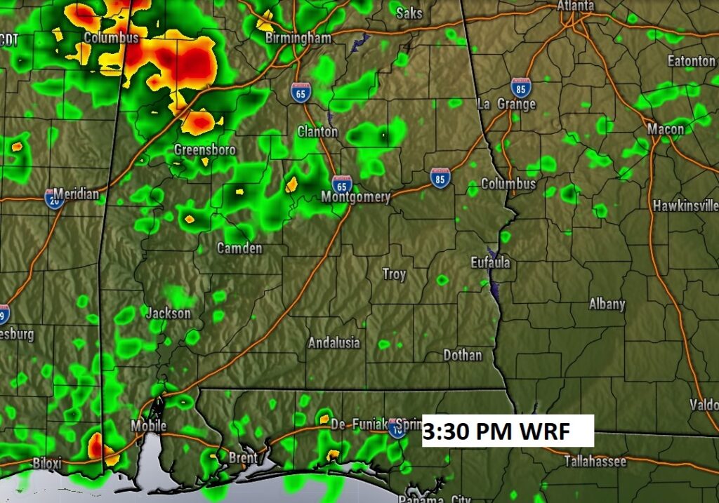
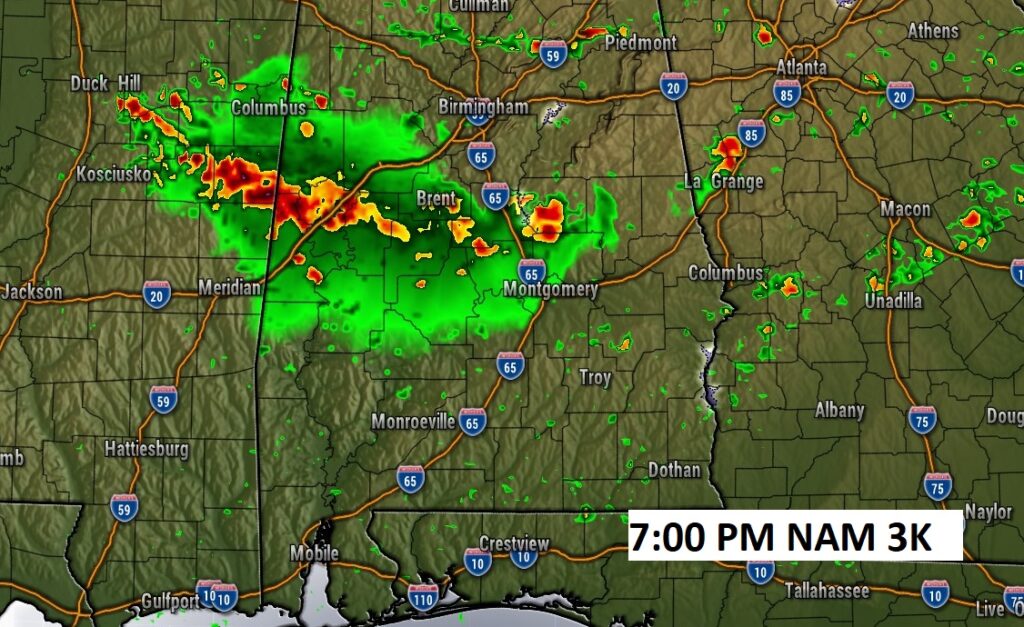
Hi-res Future Radar examples shows a southward moving cluster of storms moving into central Alabama. A few stronger storms are possible.
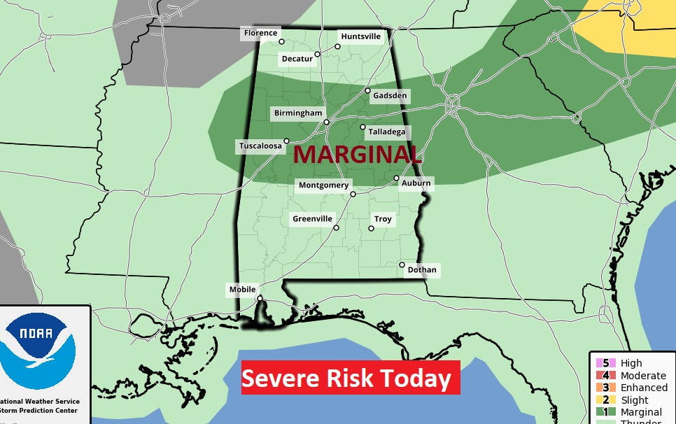
The Storm Prediction Center has included much of north central Alabama in a Marginal Severe Risk. Damaging wind gusts are possible.
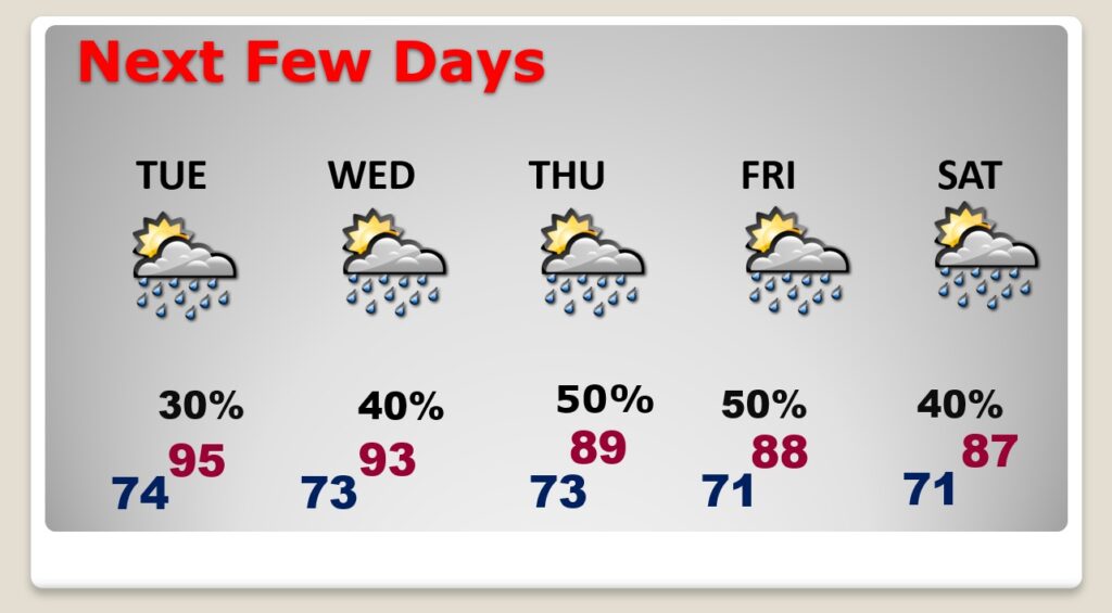
NEXT FEW DAYS: Widely scattered storms Tuesday. Hot. High in the mid 90’s. Storms become little more numerous Wednesday. Scattered to numerous storms Thursday through Saturday. High temperatures will be down a notch by Thursday through Saturday, with increased showers & storms. Lows at night in the low 70’s.
On Wednesday, SPC has included much of central and South Alabama in a Marginal Severe Risk. Damaging wind gusts are possible in a few of the stronger storms.

.
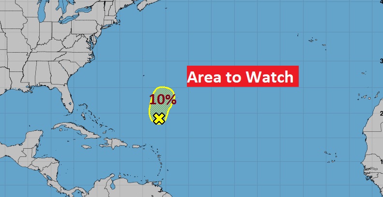
TROPICAL OUTLOOK: In the Atlantic basin there is only one small Area to Watch in the Atlantic with a low 10% chance of development in the next 5 days.
Elsewhere, there are NO named Tropical Cyclones anywhere in the world. Very rare.

.
Thanks for reading this Blog this morning! This morning we are LIVE on the radio from 6 to 9 on NewsTalk 93.1. Watch us on TV on CBS 8 and ABC 32. I’ll have another update for you in the morning. Have a nice day.
–Rich