
Good Morning! Here’s my brief video forecast discussion.
CLIMATE DATA: Yesterday’s high in Montgomery was 96, Morning low 71. Normal High/Low 94 and 72. Rainfall: 0.00. Sunrise at 6:10 AM. Sunset 7:29
TODAY: Another hot day today. Lots of sunshine. I have the rain chance under 20%. Most places stay dry. High in the Middle 90’s. Low tonight 73.
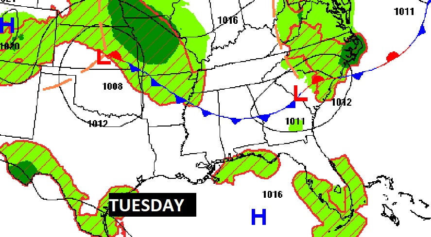
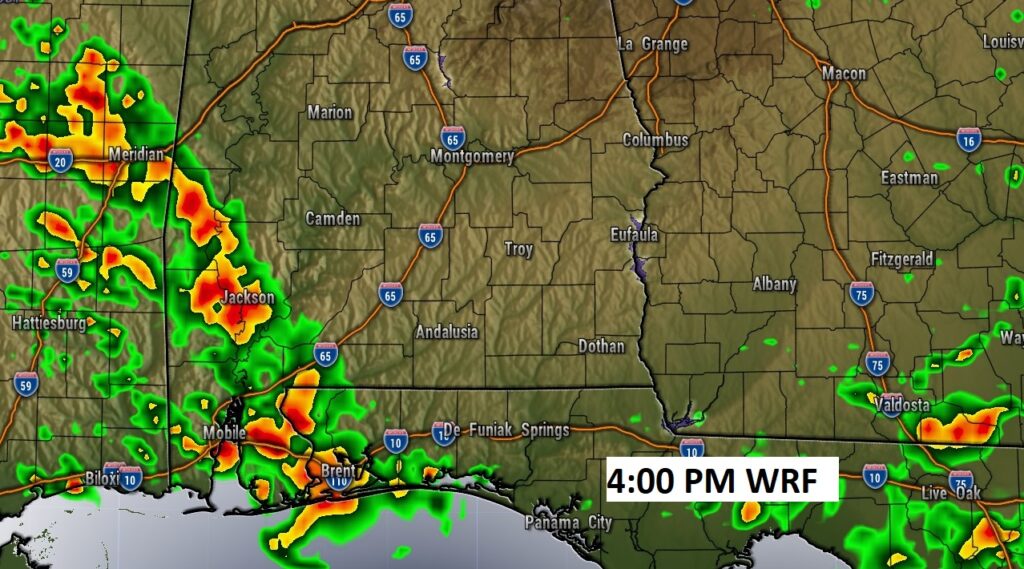
A frontal system is stretched across central Alabama. Hi-res Future Radar examples shows an active cluster of storms affecting mainly SW Alabama today. Many of us should stay dry. A few stronger storms are possible.
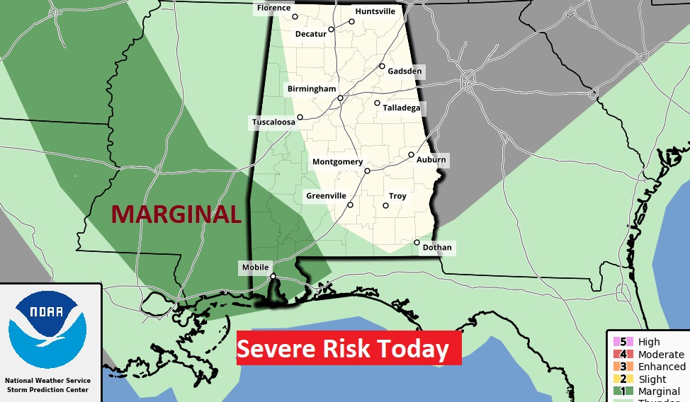
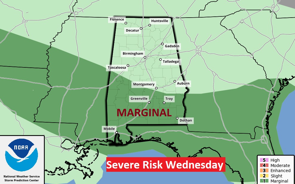
The Storm Prediction Center has included much of SW Alabama in a Marginal Severe Risk. Damaging wind gusts are possible.
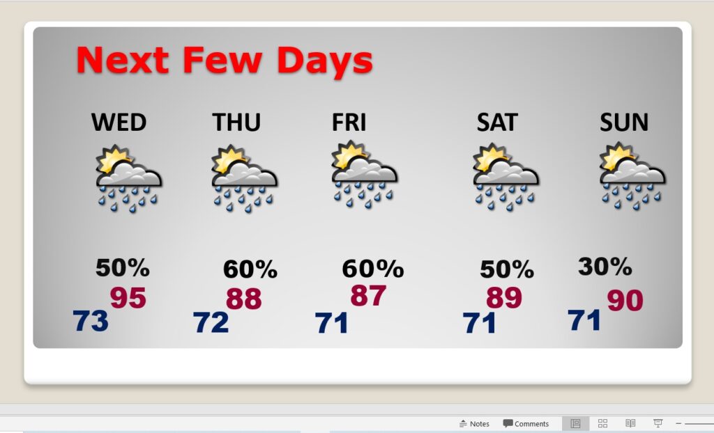
NEXT FEW DAYS: Storms become little more numerous again tomorrow. Scattered to numerous storms Thursday through Saturday. High temperatures will be down a notch by Thursday through Saturday, with increased showers & storms. Mid 90’s Wednesday. Upper 80’s Thursday through Saturday. Lows at night in the low 70’s. Fewer storms Sunday.
On Wednesday, SPC has included much of South Alabama in a Marginal Severe Risk. Damaging wind gusts are possible in a few of the stronger storms.
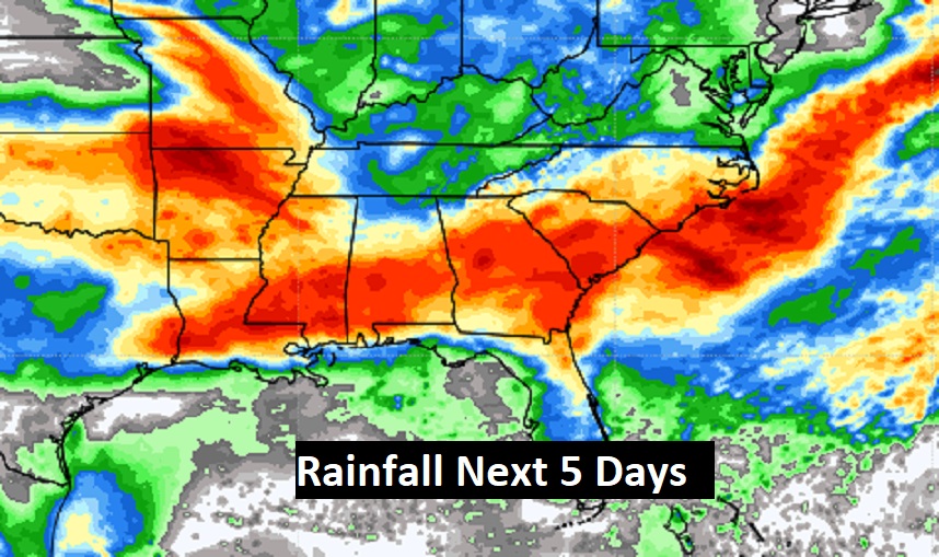
Potentially wet times across the Gulf South next 5 days.
.
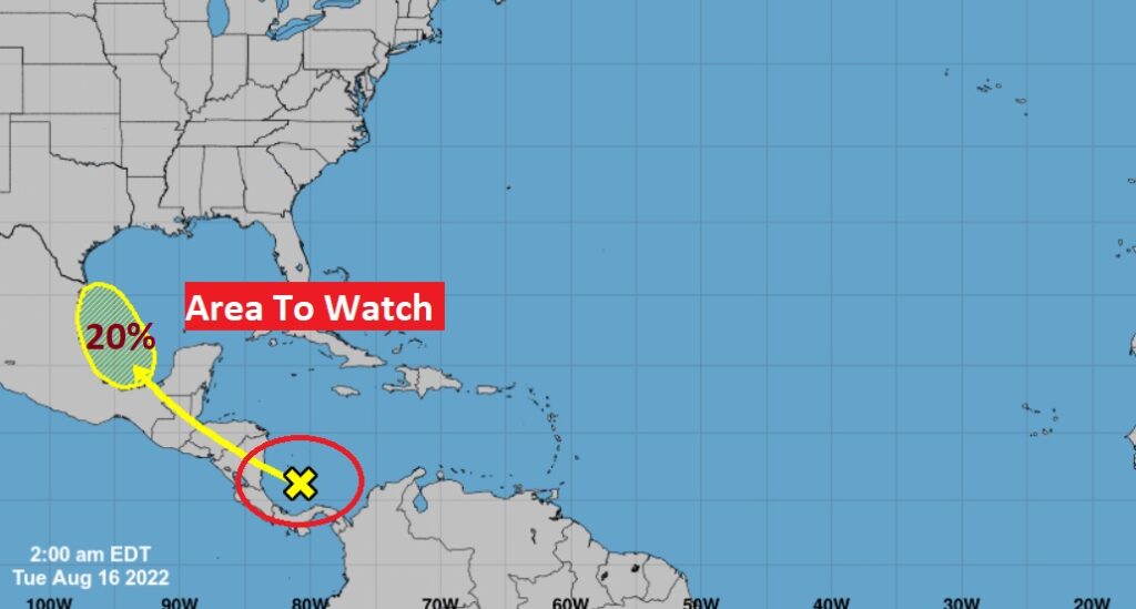
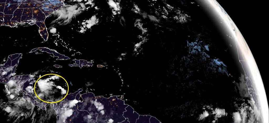
TROPICAL OUTLOOK: NHC is monitoring a disturbed area in the west Caribbean. They have outlined an area in the western Gulf with a 20% chance of development in the next 5 days. The rest of the Atlantic Basin is quiet as a mouse.
Thanks for reading this Blog this morning! This morning we are LIVE on the radio from 6 to 9 on NewsTalk 93.1. Watch us on TV on CBS 8 and ABC 32. I’ll have another update for you in the morning. Have a nice day.
–Rich