
Good Morning! Here’s my brief video forecast discussion.
CLIMATE DATA: Yesterday’s high in Montgomery was 96, Morning low 72. Normal High/Low 94 and 72. Rainfall: 0.00. Sunrise at 6:12 AM. Sunset 7:29
TODAY: Radar will be much more active today. Partial sunshine. Scattered to numerous showers & storms. A few stronger storms area possible. High in the lower 90’s. Low tonight 73.
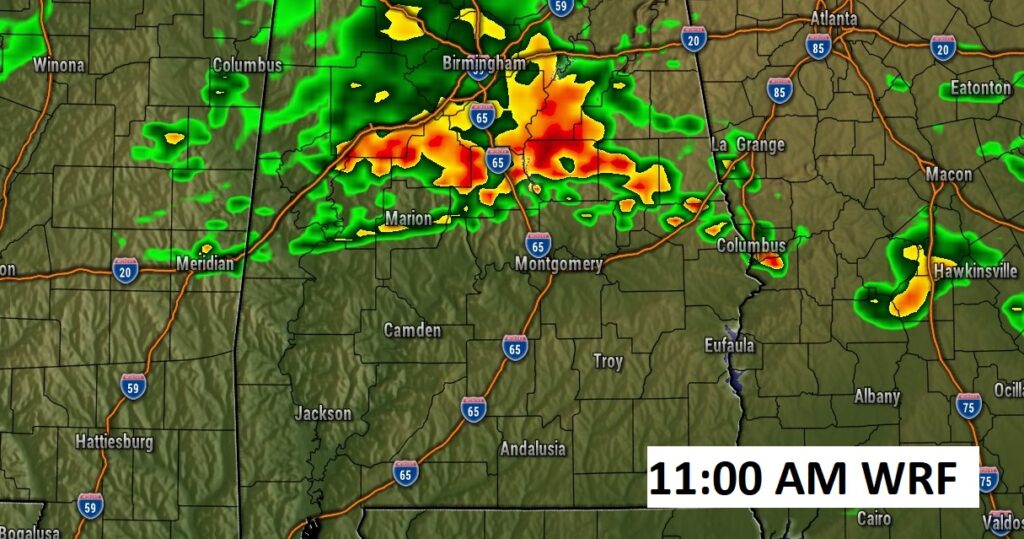
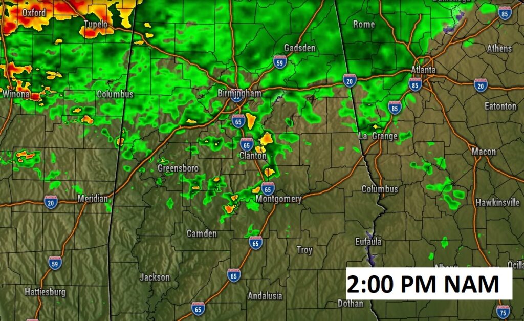
Here’s a few Future Radar Examples. ANY hour of the day is fair game today. The action could begin late morning. A few stronger storms are possible.
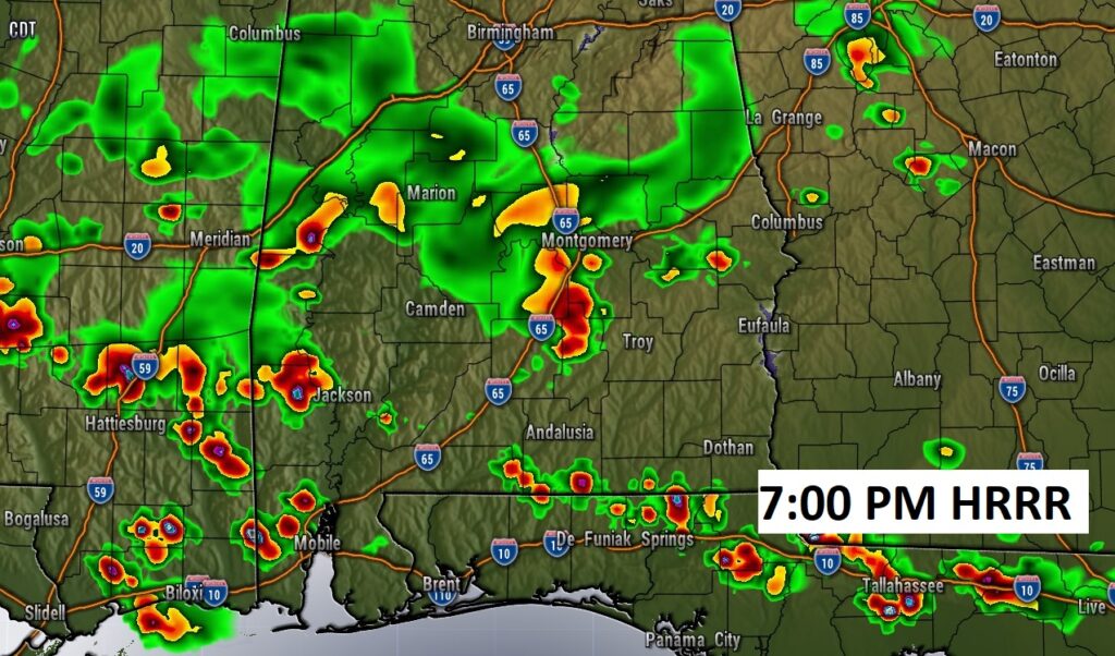
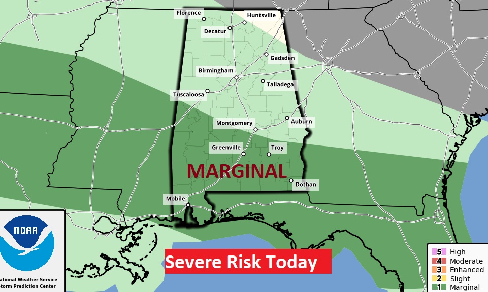
The Storm Prediction Center has included much of south Alabama in a Marginal Severe Risk. Damaging wind gusts are possible.
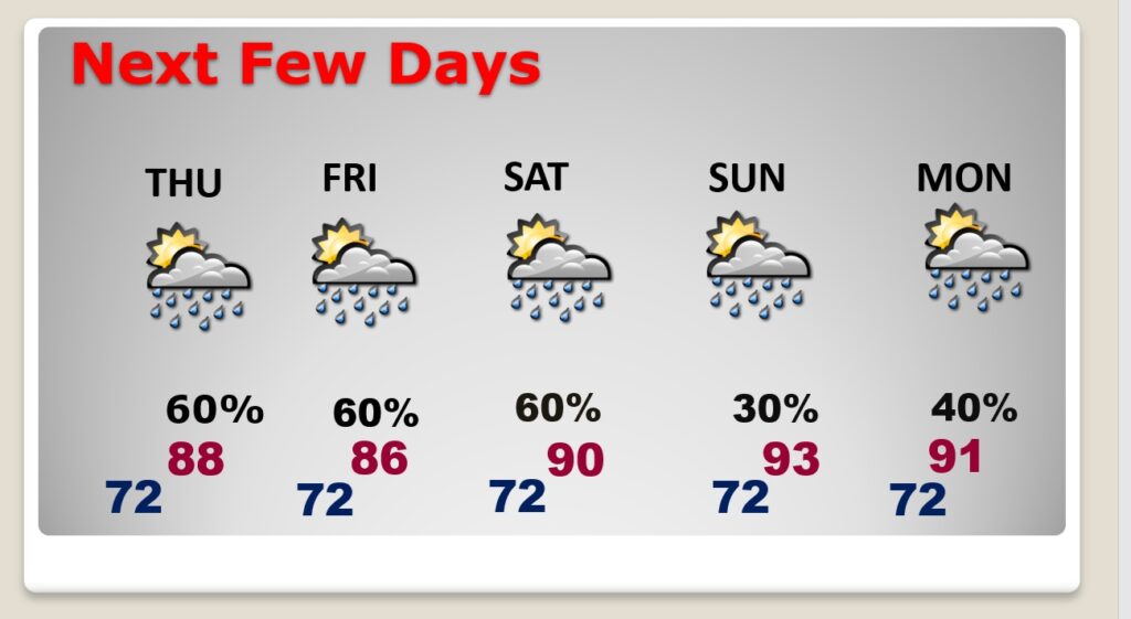
NEXT FEW DAYS: Scattered to numerous showers and storms will continue at least through Saturday. High temperatures will be down a notch by Thursday through Saturday, with increased showers & storms. Mid to Upper 80’s Thursday through Saturday. Lows at night in the low 70’s. Fewer storms Sunday.
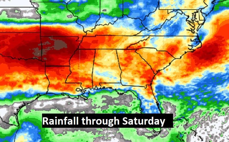
Potentially wet times across the Gulf South next few days.
.
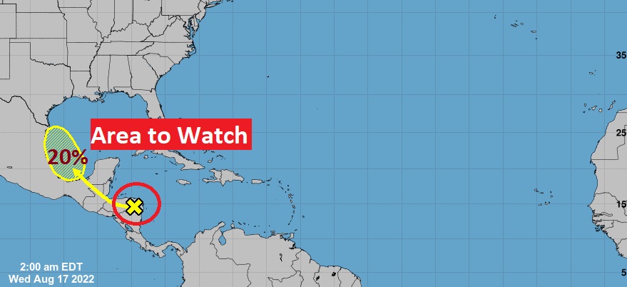
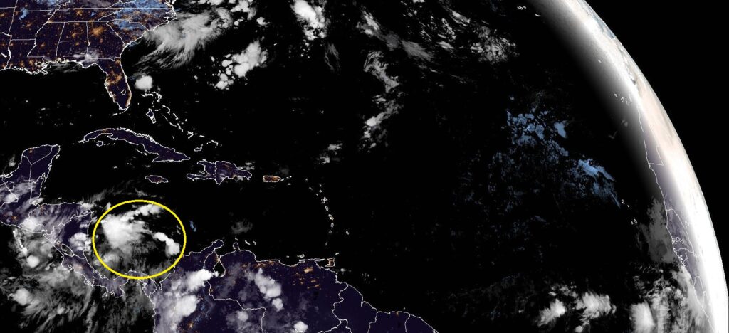
TROPICAL OUTLOOK: NHC is monitoring a disturbed area in the west Caribbean. They have outlined an area in the western Gulf with a 20% chance of development in the next 5 days. The rest of the Atlantic Basin is still quiet.
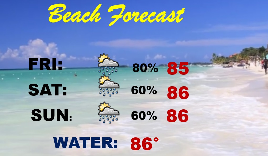
BEACH FORECAST: Once again this weekend, the rain chances are quite high. Scattered to numerous storms. Highs in the middle 80’s.
Thanks for reading this Blog this morning! This morning we are LIVE on the radio from 6 to 9 on NewsTalk 93.1. Watch us on TV on CBS 8 and ABC 32. I’ll have another update for you in the morning. Have a nice day.
–Rich