
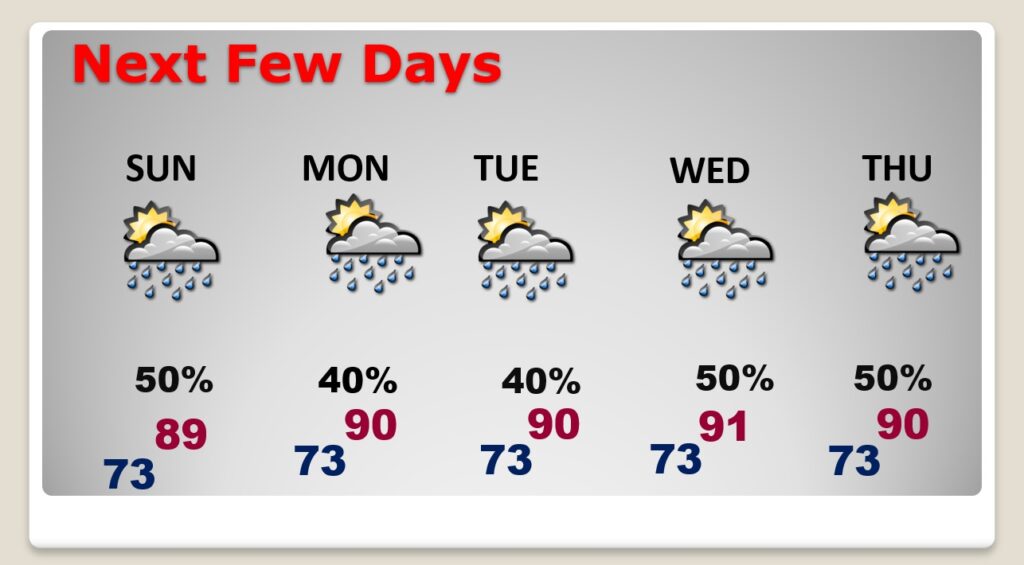
Good Morning! I don’t have to tell you. It’s been a wet week and an extremely wet August. Random showers and storms will continue in the forecast each of the next several days, but the probability of rain is coming down just a bit. Not as many storms on the radar. With fewer storms, temperatures will be a little warmer, but still a little below normal for August.
Meanwhile the tropics are starting to come alive.
CLIMATE DATA: Yesterday’s high in Montgomery was 90. Morning low 73. Normal High/Low 93 and 71. Rainfall: 0.00″. Sunrise at 6:18 AM. Sunset 7:15 PM.
TODAY: Partial sunshine High in the upper 80’s Random showers and storms will be most numerous in the afternoon & evening hours. Low tonight 72.
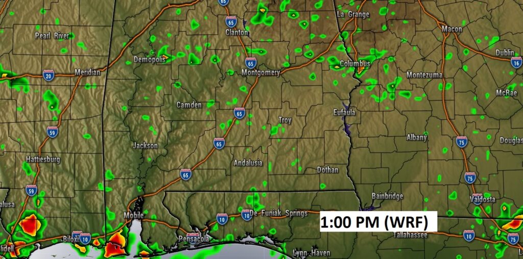
Not nearly as many storms on radar today. Here’s a Future Radar example from the WRF model.
NEXT FEW DAYS: Random showers and storms will continue in the forecast each of the next several days. Daytime highs in the upper 80’s to near 90.. Lows in the low 70’s.
.
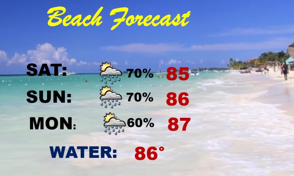
BEACH FORECAST: High rain chance again today. More storms Sunday & Monday. Scattered to numerous storms. Watch out for lightning. Highs in the mid to upper 80’s. Gulf water temp is 86. Moderate Rip Current Risk especially from Destin eastward this weekend.
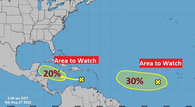
TROPICS: NHC is still monitoring two Area’s to Watch. One in the Tropical Atlantic with a 30% chance of development. The other one is in the Caribbean with a low 20% chance of development in the next 5 days.
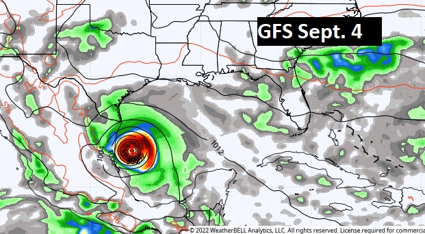
The rest of the tropics are quiet. However, the GFS continues to suggest we need to monitor the western Gulf of Mexico over the next 8 days or so.
—
.
I’ll have another Blog update in the morning from here in Pittsburgh at the National Weather Association Conference. Have a nice weekend!
–Rich