
Good Morning! Here’s my brief video forecast discussion.
CLIMATE DATA: Montgomery had a high of 93 yesterday, after a morning low of 74. Heat index peaked at 102. Normal Hi/Lo: 93 and 70. Airport rainfall: 0.00 The Montgomery Airport has now had 10.08” of rain in the month of August. Sunrise: 6:19, Sunset 7:12.
TODAY: Get ready for another hot day today. Yesterday radar was VERY quiet. Today, expect random scattered showers & storms, especially in the afternoon & evening. High in the lower 90’s. Low tonight 73.
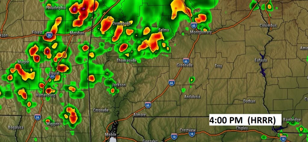
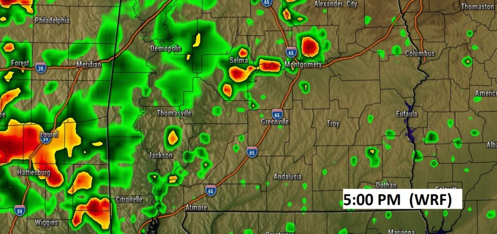
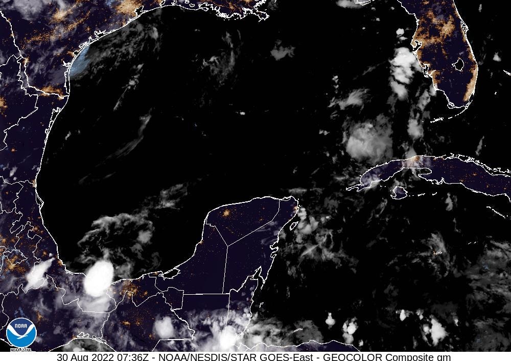
Radar was as quiet as a mouse yesterday. Scattered random storms return today. Here’s a couple of Future Radar model examples this afternoon.
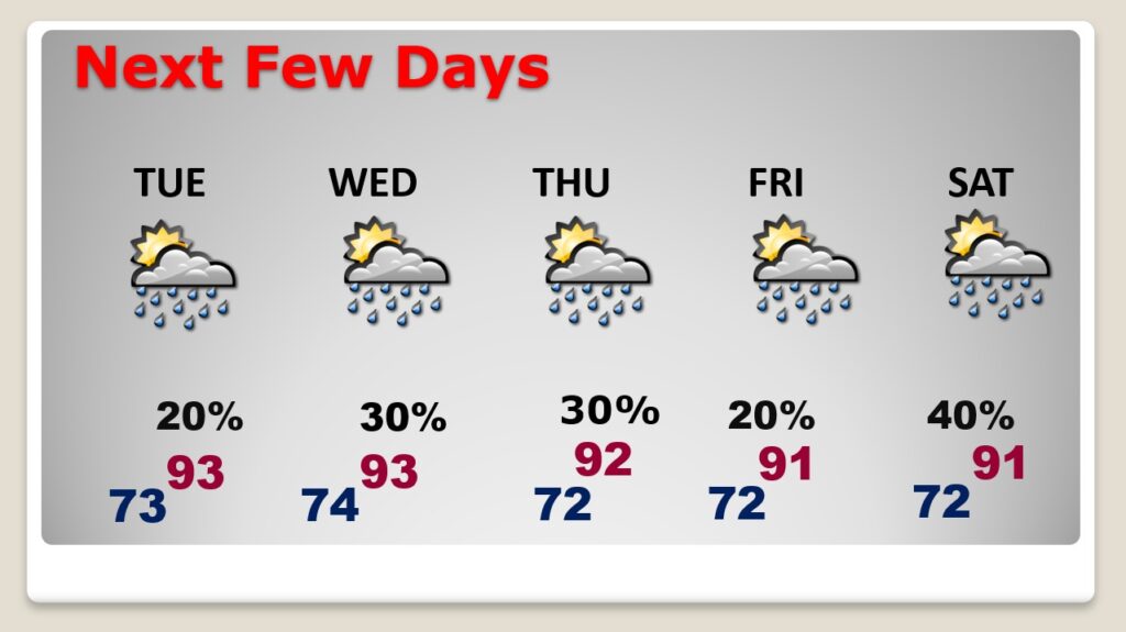
NEXT FEW DAYS: Routine forecast for the rest of the week as August ends and September begins. More scattered random storms will continue each. Little day to day change. Highs mainly in the lower 90’s. Lows at night in the low 70’s. Rain coverage gets a little better, as we get closer to Labor Day weekend. Better rain chance Friday, Saturday & Sunday
.
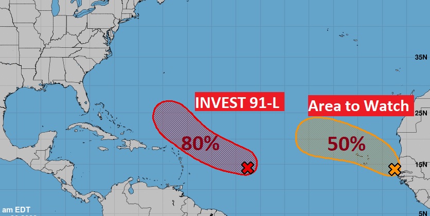
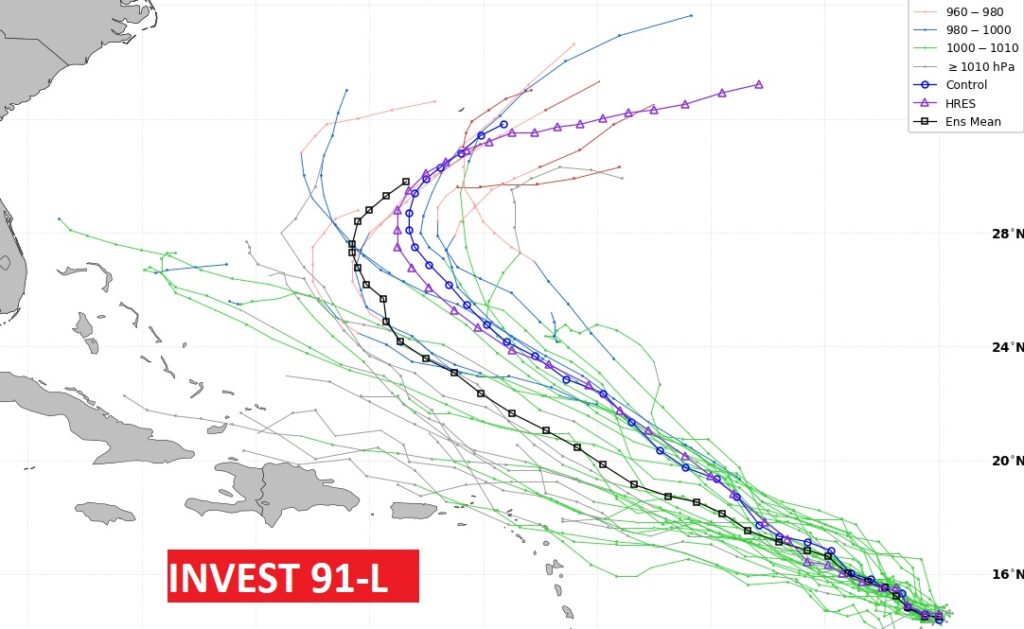
TROPICAL OUTLOOK: The map from NHC today shows TWO features. The star of the show is Invest 91-L. It has an 80% chance of development in the next 5 days. It is very likely this system will get the name Danielle. The other wave coming off Africa will very likely eventually become a tropical cyclone. Perhaps Earl. It will probably curve into the east Atlantic.
Most models curve Invest 91-L into the Atlantic. Here’s the GFS Ensemble tracks.
Here’s the Euro Tropical Depression Probabilities over the next 10 days.
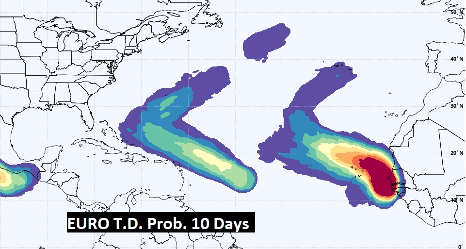
I think we still need to monitor that disturbed area over central America for possible future Gulf of Mexico implications.
Thanks for reading this Blog this morning! This morning we are LIVE on the radio from 6 to 9 on NewsTalk 93.1. Watch us on TV on CBS 8 and ABC 32. I’ll have another update for you in the morning. Have a great day!
–Rich