
Good Morning! Here’s my brief video forecast discussion.
YESTERDAY’s High was 94, after a morning low 68. Heat Index reached 101. Normal: 88/65. Sunrise 6:34. Sunset 6:42.
TODAY: Fall officially Begins at 8:04PM tonight. Mostly Sunny Hot & humid. High in the upper 90’s. (The record is 99 in 1925) Heat index near or above 100 this afternoon. Rain chance 10 to 20%. Wind becomes northwest 5 to 10 mph in the afternoon. Mainly Clear tonight. Low 66.
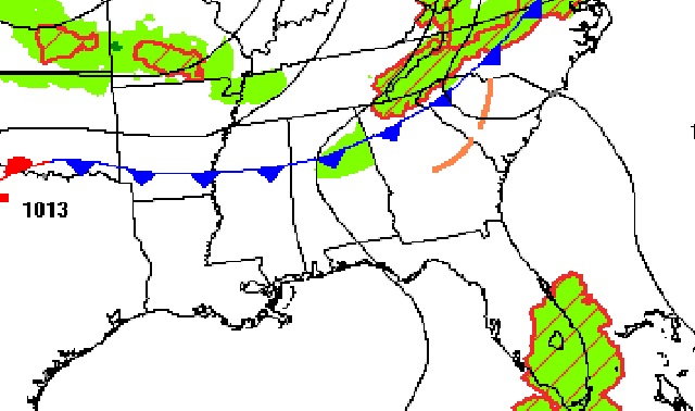
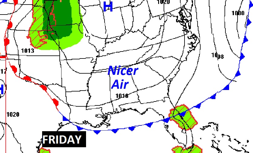
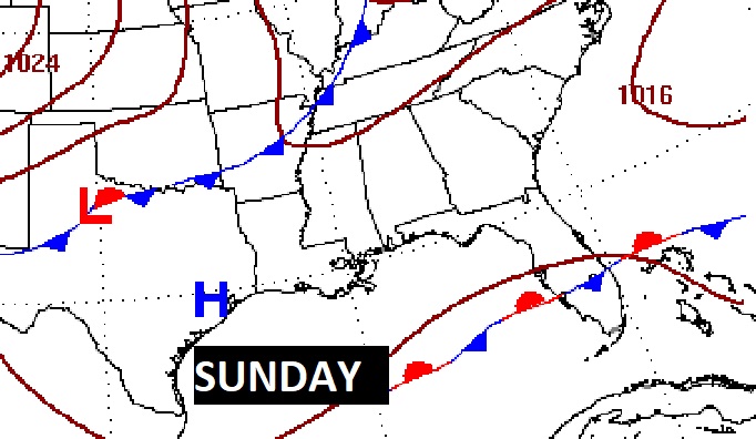
Forecast Map at 1PM, shows a southward moving front, which will reach the coast by morning. Friday will feel much nicer. Not as hot. Less humid.
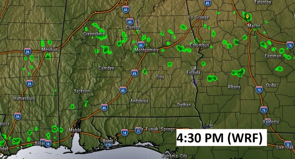
Could there be a stray shower along the front today? The chances are small. 10 to 20% at best.
NEXT FEW DAYS: A weak front will drift southward through the state this afternoon. Behind the front, the high temperature Friday will be about 8-9 days cooler. Lower humidity. Saturday should be dry & warm. Spotty showers are possible Sunday ahead of the next weak front. Behind it, Monday will be much more comfortable.
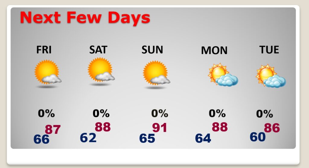
Another front will bring a small rain chance Sunday, followed by nice relief Monday.
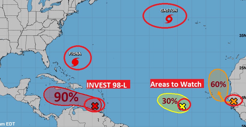
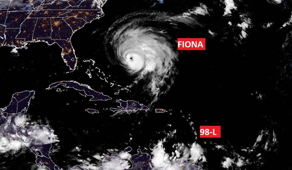
TROPICAL OUTLOOK: There are FIVE features being tracked by NHC, including Major Hurricane Fiona, Tropical Storm Gaston, and two Areas to Watch. But, we are focusing only on Invest 98-L in the Tropical Atlantic. The future Hermine. It has a 90% chance of becoming a Tropical Depression or Tropical Storm. Another Air Force RECON flight will investigate this system this morning.
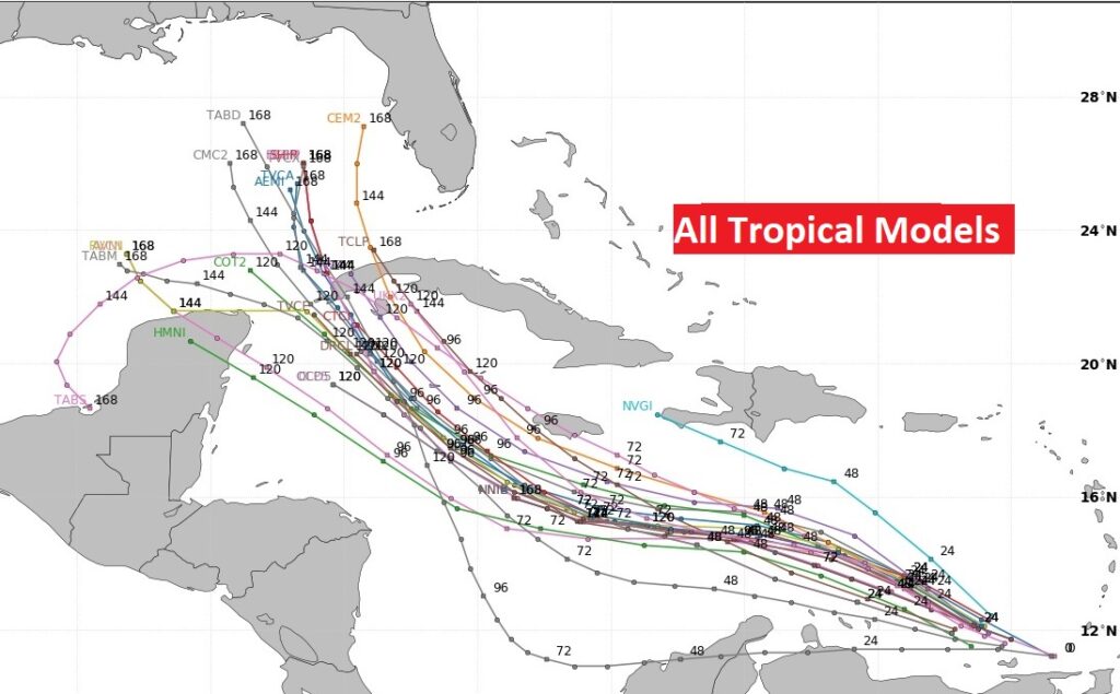
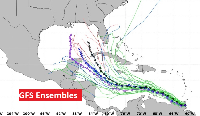
This system needs to be closely monitored. There is a very good chance this system is destined to be a problem in the Gulf of Mexico next week. Let’s check some of the Tropical Model plots, pointing toward the Gulf. It’s likely we will be dealing with a Hurricane in the Gulf. Where could it make landfall….and when?
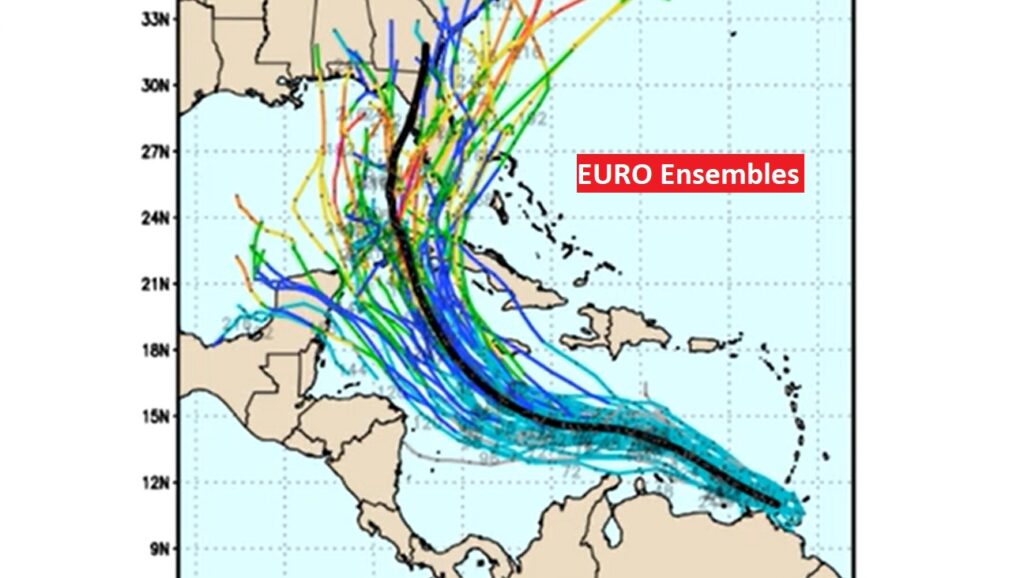
The EURO model also favors the Idea of 98-L reaching the Gulf. Here’s a look at potential EURO Ensemble Tracks. Many tracks seem to favor Florida.
Now here’s the GFS Ensemble tracks. The GFS is farther west with it’s tracks. Stay tuned as we continue to track future Hermine.
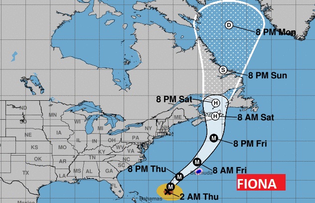
Monster, Cat 4 Hurricane Fiona will be a historic hurricane for the Canadian Maritime provinces.
Thanks for reading this Blog this morning! This morning we are LIVE on the radio from 6 to 9 on NewsTalk 93.1. Watch us on TV on CBS 8 and ABC 32. I’ll have another update for you in the morning. Have a great day!
–Rich