
Good Morning! Here’s my brief video forecast discussion.
YESTERDAY’s High was 97 (Heat Index 104), after a morning low 66. Normal: 88/65. Sunrise 6:34. Sunset 6:41.
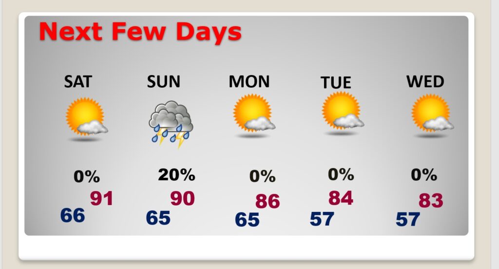
TODAY: On this first Full Day of Fall…MUCH nicer air. Mostly Sunny. Less humid. Not as hot. High in the middle 80’s. Rain chance 10 to 20%. Nice northeast breeze at 6 to 12 mph. Mainly Clear tonight. Pleasantly cool. Low 62.
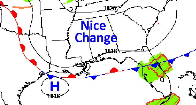
The Cool Front that brought a few showers yesterday, has made it down to the northern Gulf. You can already feel a nice difference this morning.
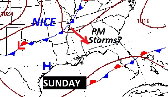
NEXT FEW DAYS: Saturday looks nice. Highs in the 80’s. Low humidity. Another front approaches Sunday. Spotty thundershowers are possible. Behind it, Monday will be much more comfortable. In fact, much of next week looks great. Low humidity. Sunshine. Cool nights. Highs in the 80’s. Upper 50’s at night. Nearly perfect.
TROPICAL OUTLOOK:
LATE BREAKING: AFTER I published the BLOG this morning NHC promoted Invest 98-L to Tropical Depression Nine. The Corner points towards Florida and the Eastern Gulf of Mexico. Stay tuned. The next two names available are Hermine and Ian.
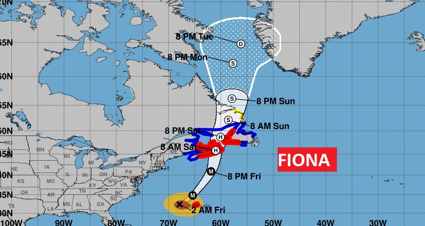
There are FIVE features being tracked by NHC, including Major Hurricane Fiona, Tropical Storm Gaston, and two new Invests. But, we are still focusing on the future of Invest 98-L. It has a 90% chance of becoming a Tropical Depression or Tropical Storm. Another Air Force RECON flight will investigate this system today.
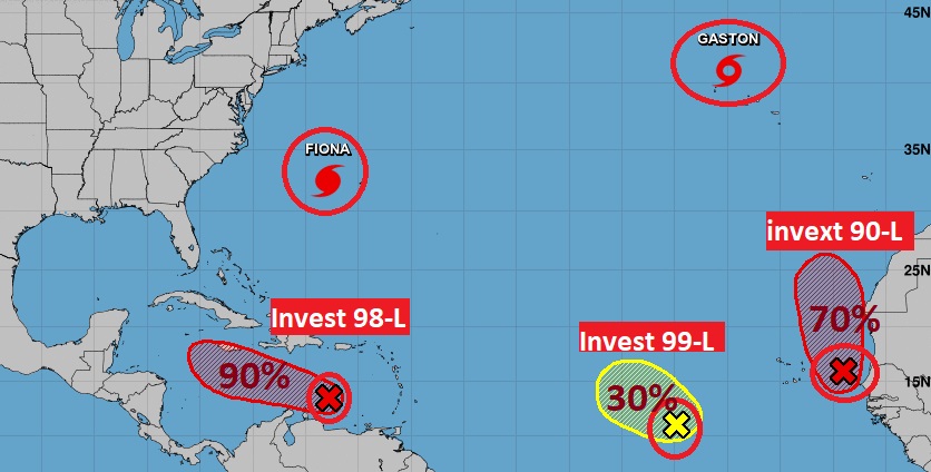
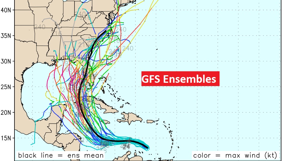
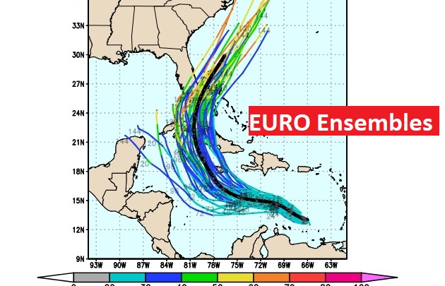
We are starting to see a little more model consistency today on the potential future track of this system. There’s a very good chance 98-L will become a Tropical Storm by Saturday PM, and perhaps a Hurricane by Sunday night or Monday. Right now, the global models (EURO and GFS seem to be favoring a Florida landfall. But, yesterday the models were all over the place. The next two available names on the list are Hermine and Ian. Stay tuned.
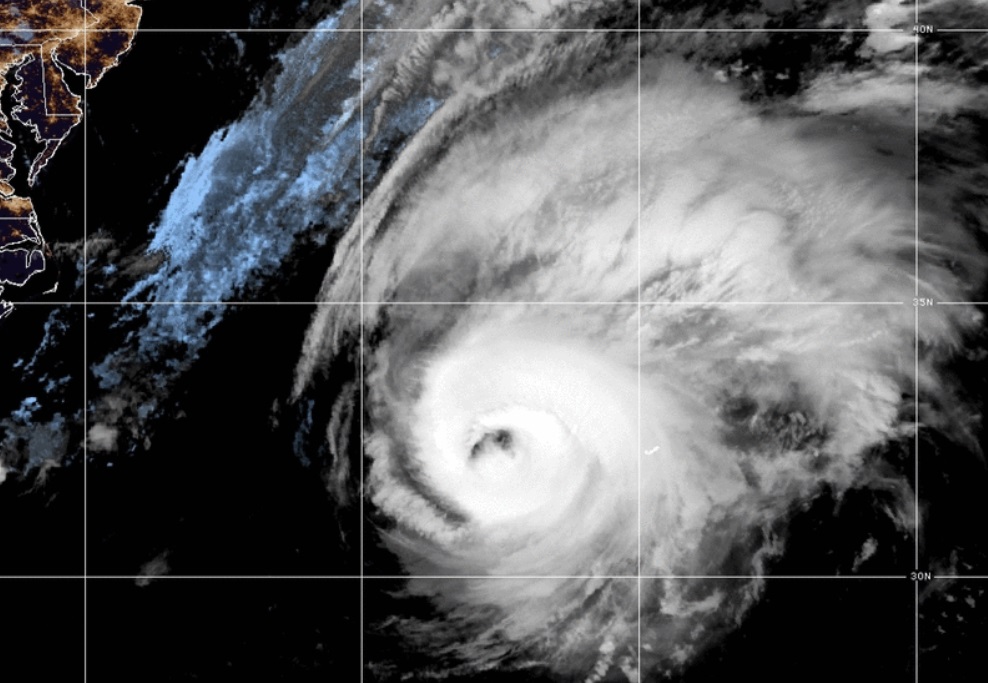
Spectacular text book, historic major Hurricane Fiona is destined for a devastating strike on the Canadian Maritime providences. Perhaps their worst hurricane in recorded history. Not only that. It’s perhaps the first time EVER, the Cone of Uncertainty includes part of Greenland. Incredible.
Thanks for reading this Blog this morning! This morning we are LIVE on the radio from 6 to 9 on NewsTalk 93.1. Watch us on TV on CBS 8 and ABC 32. I’ll have another update for you in the morning. Have a great day!
–Rich