
Good Morning! Our weather news continues good, with little or no effects from Ian. Here’s my brief video forecast discussion.
TODAY: Our day to day forecast is going to be very similar for the week ahead and beyond. Abundant Sunshine. Breezy again, but not as breezy as the last few days. Comfortable. Low humidity. High in the lower 80’s. NW wind 10 to 15 mph. Clear and pleasantly cool again tonight. Low 55.
NEXT FEW DAYS: Our great fall Weather continues through for the next several days. We should stay dry and sunny through the weekend and all of next week. Not as breezy. storm-free pattern for us will continue through next week. Highs will be in the lower 80’s. Nights will be pleasantly cool, mainly in the 50’s.
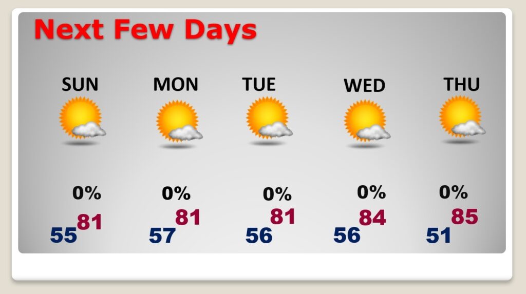
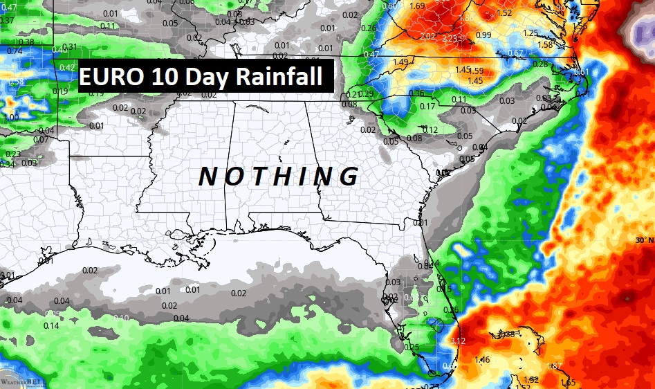
Don’t expect any rain. We should be dry for several more days.
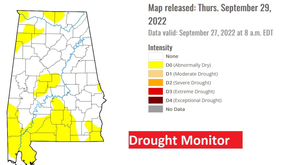
The latest Drought Monitor map shows scattered “yellow” areas. Stage one. Abnormally dry. This map comes out every Thursday.
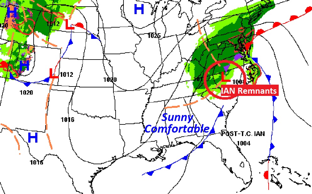
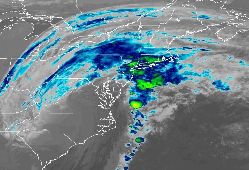
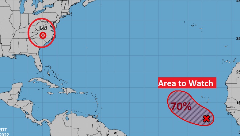
TROPICAL OUTLOOK: Ian is now a post-topical remnant Low over the Carolinas. It will continue to bring locally heavy rain for much of the eastern states over the weekend.
Elsewhere in the Tropics, there is an Area to Watch in the far eastern Atlantic. It has a 70% chance of development in the next 5 days. The rest of the tropical Atlantic is very quiet for now.
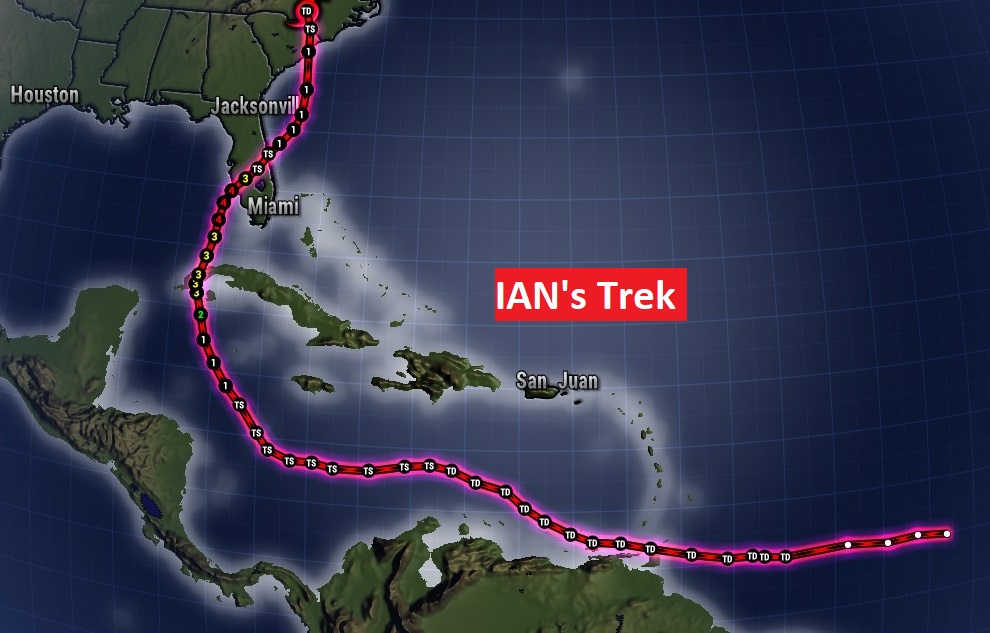
Here’s the amazing Trek of historic and deadly Ian over the last several days.
Thanks for reading this Blog this morning! I’ll have another update for you in the morning. Have a nice day!
–Rich