
Good Morning! Our beautiful Fall weather continues. Here’s my brief forecast discussion.
CLIMATE DATA: Yesterday’s high was 80, after a chilly morning low of 54. Normal: 85/69. Rainfall: 0.00”. Three years ago today: Record High 102. 27 years ago today: Hurricane Opal. (more on Opal below) Sunrise 6:42, sunset 6:28.
TODAY: Warm & Dry again today. Sunshine. Low humidity. High 83.. East wind 6 to 11 mph. Clear and pleasantly cool again tonight. Low 55.
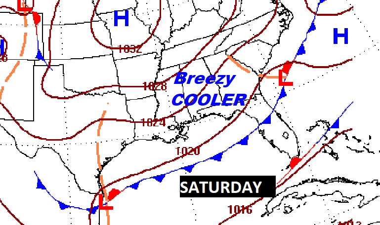
NEXT FEW DAYS: Our long string of dry, storm-free days continues. We should stay dry and sunny through Friday High mostly in the mid 80’s Tuesday & Wednesday. Warmest days Thursday & Friday. Upper 80’s. Nights will continue pleasantly cool, mainly in the 50’s. Late week, a Cold front will bring in a batch of cooler air by Saturday.
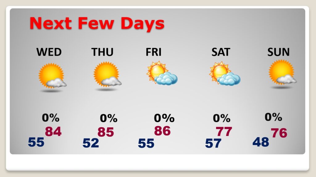
Late week cool front will deliver much cooler air. Breezy & Cool Saturday.
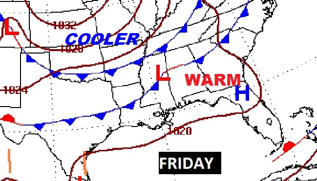
We should be dry for several more days. Here’s the Euro model through next Monday.
TROPICAL OUTLOOK: In the Tropical Atlantic. It has a low 30% chance of development over the next 5 days, as it treks through the Caribbean.
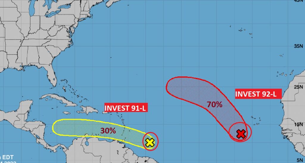
This system will probably be more of a threat to central America, rather than North America.
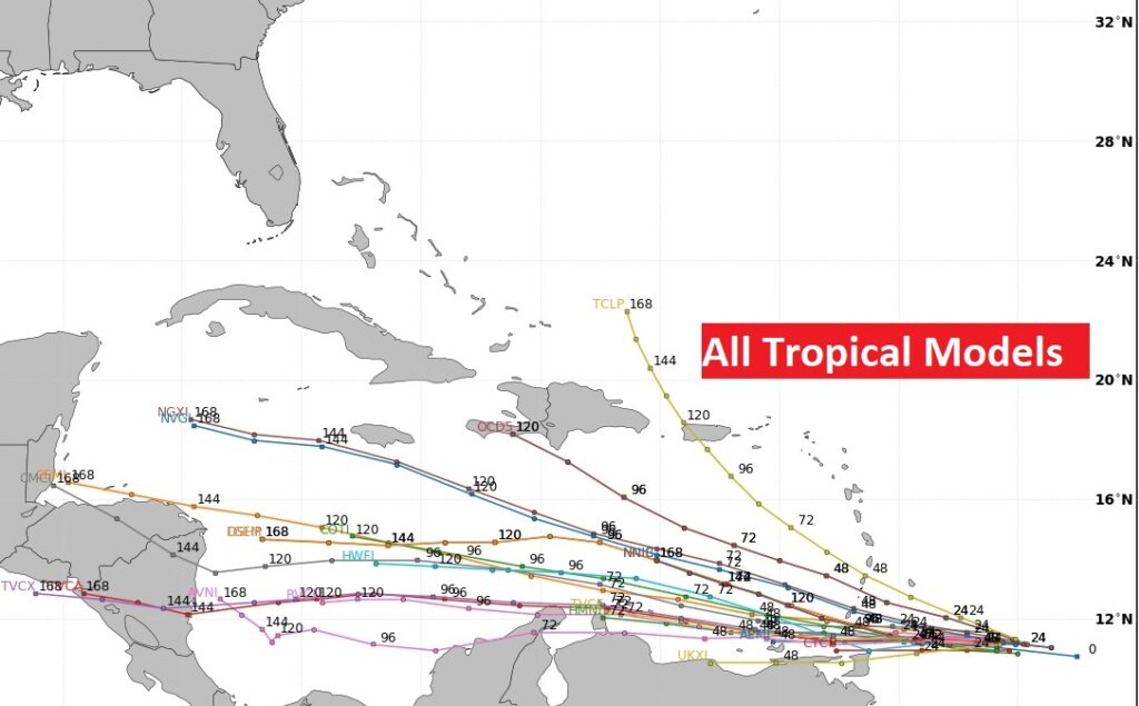
Elsewhere in the Tropics, there is Invest 92-L in the far eastern Atlantic. It has a 70% chance of development in the next 5 days. The rest of the tropical Atlantic is very quiet for now.
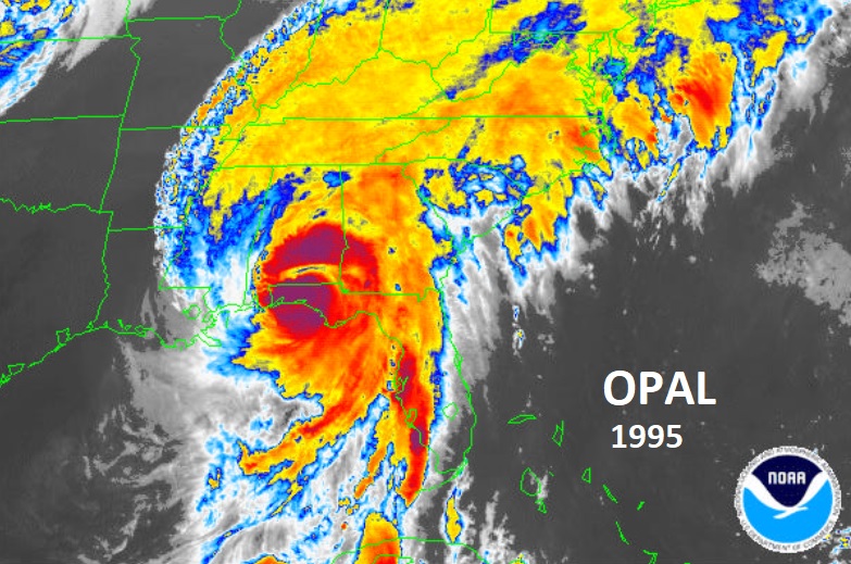
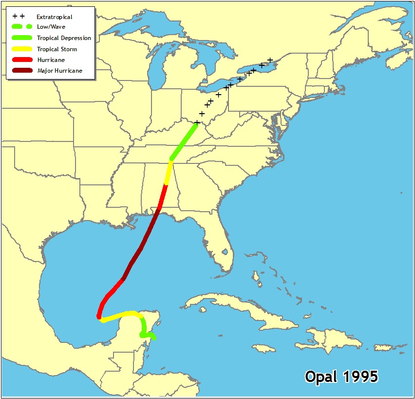
HURRICANE OPAL ANNIVERSARY:
On this date in 1995…Cat 3 Hurricane Opal came shore on the Gulf coast around Destin, 115 mph winds around 4pm. It was a Wednesday. Opal moved straight north into Alabama. It was still a Full Fledge Hurricane when it came straight up through and over Montgomery. NHC listed to top sustained winds at 75, but wind gusts to over 90 mph recorded at Dannely field and Maxwell.
Thanks for reading this Blog this morning! I’ll have another update for you in the morning. Have a nice day!
–Rich