
Good Morning! Our beautiful Fall weather continues. Here’s my brief forecast discussion.
CLIMATE DATA: Yesterday’s high was 80, after a chilly morning low of 53. Normal: 84/60. Rainfall: 0.00”. Sunrise 6:43, sunset 6:24.
TODAY: Warm & Dry again today. Sunshine. Low humidity. High 84. East wind 6 to 11 mph. Clear and cool again tonight. Jacket weather. Low 51.
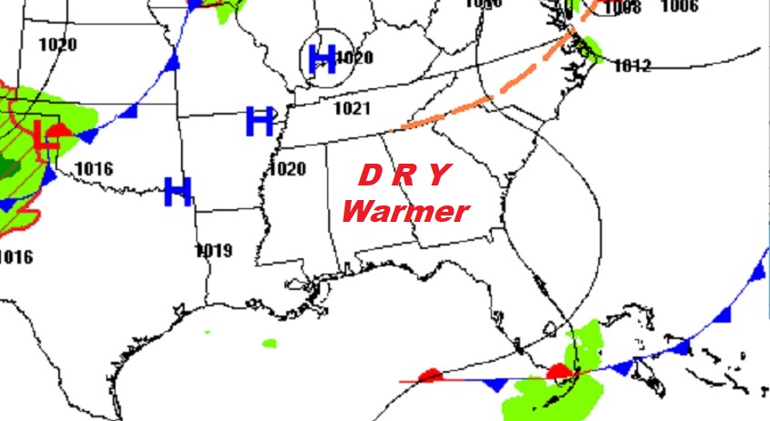
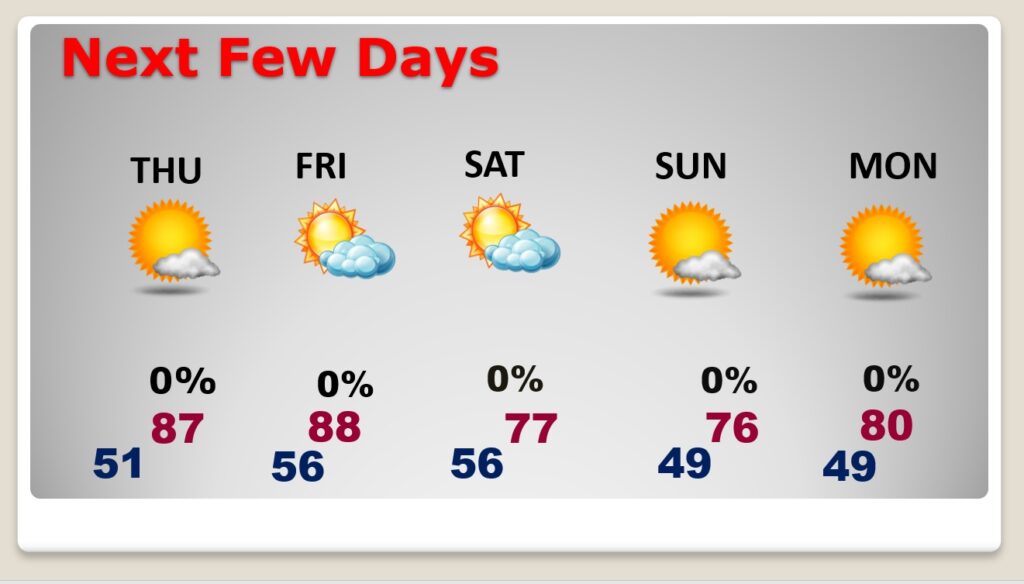
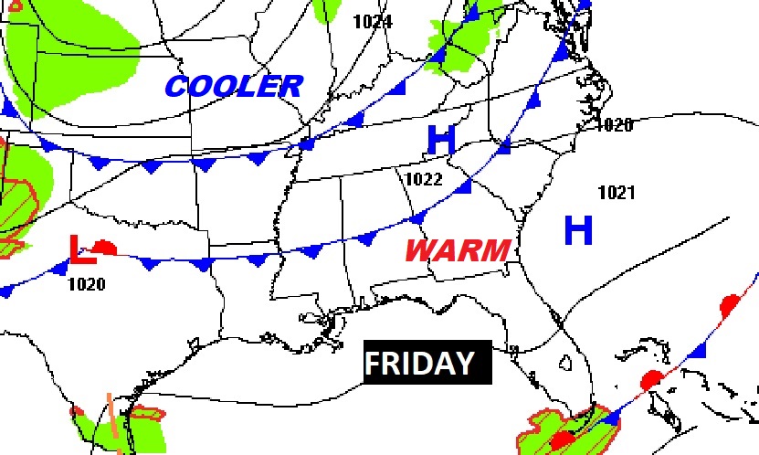
NEXT FEW DAYS: Our long string of dry, storm-free days continues. We should stay dry and sunny through Friday. Warmest days Thursday & Friday with Upper 80’s. Nights will continue pleasantly cool, mainly in the 50’s. Late week, a Cold front will bring in a batch of cooler air by Saturday.
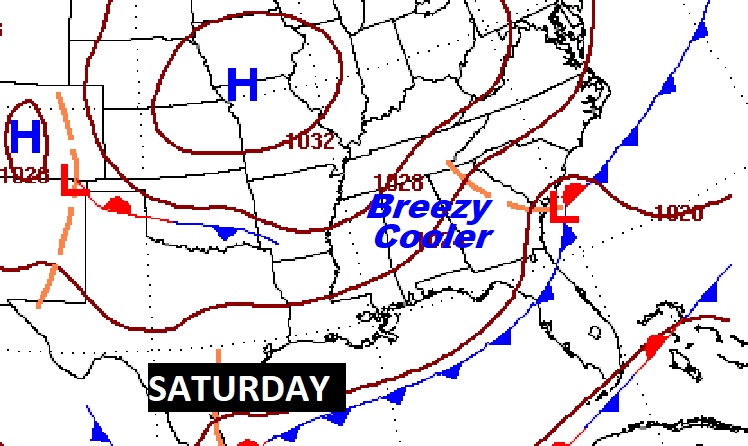
Late week cool front will deliver much cooler air. Breezy & Cool Saturday. Nice Fall air all weekend. Chilly 40’s at night.
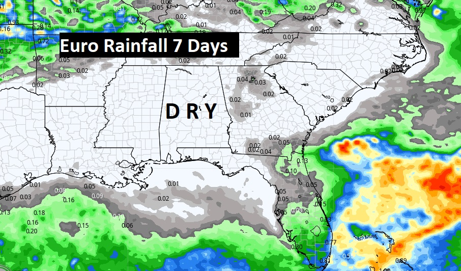
We should be dry for at least the next seven days, if not longer. This is day 16 without rain. Here’s the Euro model through next Wednesday.
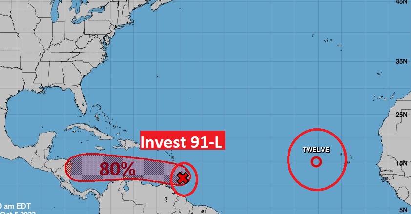
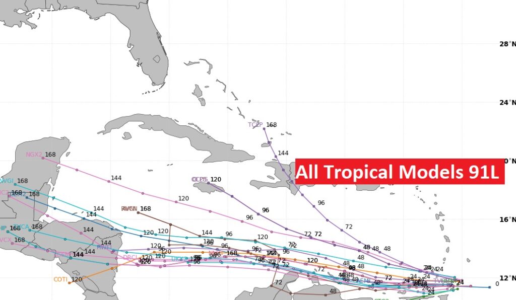
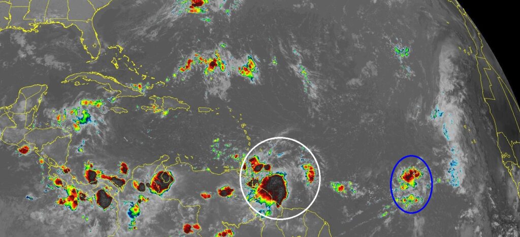
TROPICAL OUTLOOK: In the Tropical Atlantic, NHC is tracking Invest 91-L. It has a high 70% chance of development over the next 5 days, as it treks through the Caribbean.
This system will probably be more of a threat to central America, rather than North America.
Elsewhere in the Tropics, there Tropical Depression 12 in the far eastern Atlantic. It has a 70% chance of development in the next 5 days. It could become Tropical Storm Julia. It should stay in the Far East Atlantic.
The rest of the tropical Atlantic is very quiet for now.
Thanks for reading this Blog this morning! I’ll have another update for you in the morning. Have a nice day!
–Rich