
Good Morning! Our storm-free, dry pattern continues. Here’s my brief forecast discussion.
CLIMATE DATA: Yesterday’s high was 83, after a chilly morning low of 51. Normal: 84/60. Rainfall: 0.00”. Sunrise 6:43, sunset 6:24.
TODAY: Warm & Dry again today. Sunshine. Low humidity. High 86. East wind 6 to 11 mph. Clear and cool again tonight. Jacket weather again. Low 55.
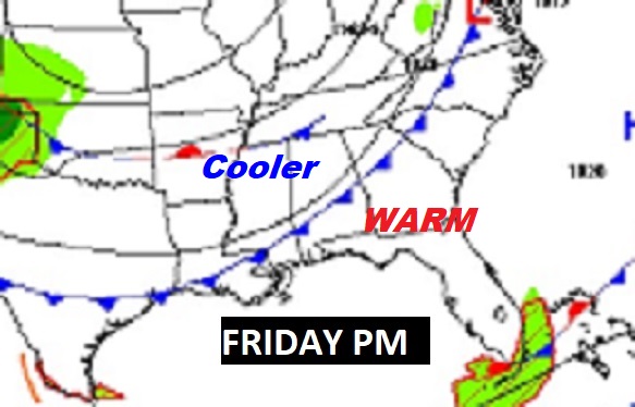
NEXT FEW DAYS: Our long string of dry, storm-free days continues. We should stay dry and sunny through tomorrow. Warmest day this week qill be Friday with Upper 80’s. Nights will continue pleasantly cool, mainly in the 50’s. A Cold front will swings across the state Friday evening.
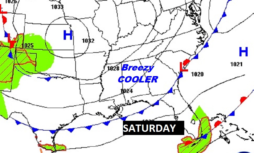
It will be noticeably cooler this weekend behind the front. Breezy & Cool. Highs in the 70’s. Chilly 40’s at night. Still dry for several more days.
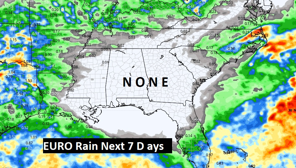
We should be dry for at least the next seven days. This is day 17 without rain. Here’s the Euro model through next Wednesday.
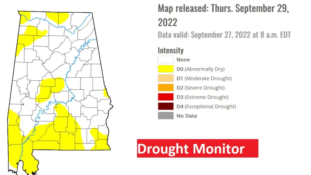
A new drought monitor map will come out today. The map from last Thursday showed patchy Abnormally Dry areas. You can bet on an escalation on today’s map.
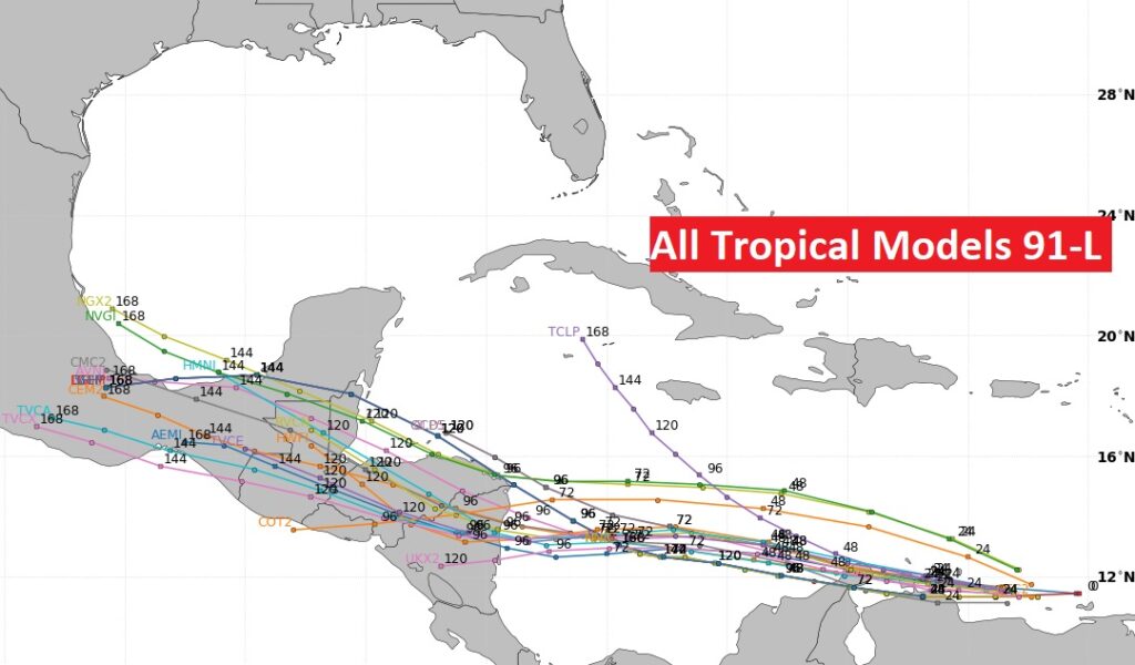
TROPICAL OUTLOOK: In the Tropical Atlantic, NHC is tracking Invest 91-L. It has a high 90% chance of development over the next 5 days, as it treks through the Caribbean.
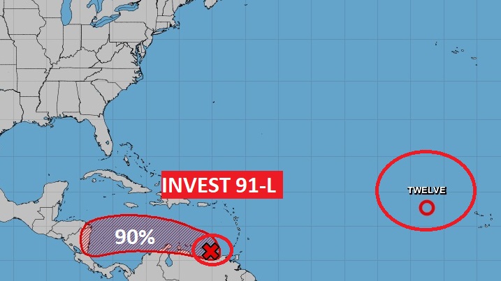
This system will probably be more of a threat to central America, rather than North America.
The rest of the tropical Atlantic is very quiet for now.
Thanks for reading this Blog this morning! I’ll have another update for you in the morning. Have a nice day!
–Rich